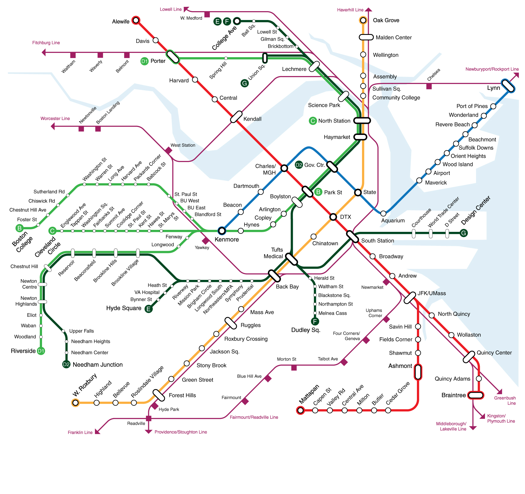
I know there have been various discussions of running the commuter rail on an RE/S-bahn type service pattern, especially if NSRL ever happens. Having paid a relatively recent visit to Germany I've been thinking of how this might look. I present the following for your consideration:
(Built off
this map originally created by
The Port of Authority)
Some notes/assumptions:
*I have things set up with only S-bahn (~inside 128) type services running through the NSRL, but you could definitely pull some of the CR lines into their opposite terminals as well (e.g. Providence <-> North Station).
*I'm assuming that Needham gets cannibalized by OL/GL extensions. I'm keeping the lower western route as an S line, but this could also get sucked up by an OL extension. Likewise, West Lynn/Riverworks could be cannibalized by a BLX.
*I didn't include all CR extension proposals (RI infills/expansion, Nashua/Manchester, Plaistow, etc). I did include SCR as it was already on the base map.
*I'm somewhat ignorant of what north/south pairings make the most sense, so the S destination pairs are pretty arbitrary. I also kept the current structure of branches vs. lines (all of the OC lines are branches, Lowell/Haverhill are distinct lines), but maybe every terminal should have its own number.
*Some station changes: More infills on the inner Worcester Line, Hastings + Kendal Green get eaten by a 128 superstation, Mishawum gets switched to a Montvale station, West Lynn + Revere infill on the Rockburyport. North Wilmington gets lost by running the Haverhill trains on the Wildcat; might be worth reopening the closed station at Salem Street as compensation.