Crazy Transit Pitches

The last page says we should consider a dedicated bike/pedestrian tunnel from East Boston to downtown, and... I'm not even going to criticize that. It sounds awesome and we should do it.
 
Battery Wharf to LoPresti Park would be about 1,800 feet; you could get a bit closer to Maverick for a few hundred extra feet. That's not unreasonable - Woolwich foot tunnel near London is about the same length. (Unlike the Woolwich tunnel, though, you'd want to allow biking.) Security would of course be an issue, though the North End and the Eastie waterfront should be decently populated.

In the meantime, a pilot program of all-night ferry service or bus service would be a great idea. Not only would it be extremely useful, but it would be a good test of demand.
 
Boston Planning & Development Agency planners, as seems to be their wont (sorry, folks - if the shoe fits...) threw a bunch of wild-eyed, long-term transit visioning into the latest East Boston rezoning study, including this crayon of alternatives for extending the Blue Line:

View attachment 42553

FYI: If you see the map in context (page 87 of the PDF, 169-170 of the printed doc: https://www.bostonplans.org/getattachment/64e6e176-1936-46e7-abb2-bf131fdca6fe), it's clear that crayon is options, not a vision for an octopus-like line.

Other notable ideas and/or intent expressed about use of streets in the area:
  • advocating for using the 1A corridor as some kind of additional bus highway and adding Revere<>Eastie<>Chelsea bus service (PDF pages 80-83)
  • Redrawing Day Square to put the SL3 and T104 on dedicated surface lanes (PDF pages 51-53)**
  • Fairly lengthy bus lanes up Meridian (PDF pages 45-50)
  • A whole mess of cycling improvements (scattered throughout, PDF page 34 and onwards)
**Wouldn't that run afoul of the vehicular access detailed in the 355 Bennington St. project presentations from last year? https://www.bostonplans.org/projects/development-projects/355-bennington-street
Is this the first time that BLX-beyond-Charles appeared in any documents other than crayon maps?
 
As an East Boston (Jeffries Point) resident for over 2 years, this is all refreshing! Some of the worst air quality is here, there's a severe lack of green space and trees, my street is a long block 4 story streetwall that feels like a concrete jungle. The parks do make it nice but are much needed given the density.

Things of note I enjoyed reading:

1. Increasing height in many areas, including ones lkke near Maverick which are stuck at 3 stories right now! That's 1 mile from Downtown and right near a T stop...

2. Day Sq stop (seems tricky and not planned out fully)

3. Extending the Greenway to Winthrop and Orient Heights. Once you bike to Constitution Beach, it basically ends.

4. Making the Maverick Square bus stop pedestrian friendly and adding trees.

5. Increasing height in Maverick

6. Bike lanes

7. Increasing ground level businesses and spurring new businesses and growth

8. Eliminating Orient Heights Sq roundabout and turning into a turn, adding green space as a result.

9. The pedestrian tunnel. Yes. Crazy? Yes. But yes.

...I've had a long idea as a 20 something young person in Eastie - the trains stop at Bout 1am at Aquarium and it's quite unfortunate to have to worry about going home on transit at a reasonable hour. Why not pilot late night service on the blue line? Even if it was a shuttle from State to Airport. I think it would also help people going to the airport early, service workers too.
 
Is this the first time that BLX-beyond-Charles appeared in any documents other than crayon maps?

BPDA likely did this by themselves - anything the BPDA does with regard to transit expansion planning is purely hypothetical - the MBTA may have had a say in reviewing it (if the BPDA reached out, and the T decided to respond), but this isn't any kind of indication or commitment from the MBTA that this is a potential plan down the road.
 
In a similar vein, I'd be really curious to know how deep the consultation was with BTD below senior levels. Does this reflect their institutional input and priorities regarding bike networks, in particular, beyond what the head (who was generally well-known in transit and bike circles before his appointment but is definitely not "of" the department) thinks is cool?
 
The last page says we should consider a dedicated bike/pedestrian tunnel from East Boston to downtown, and... I'm not even going to criticize that. It sounds awesome and we should do it.
Although I think this would be amazing, and there definitely are examples of such tunnels elsewhere, a really good interim solution would be expanded ferry service. At a minimum, it shouldn't be seasonal, but better frequency would also be great. The ferry transformed my commute to East Boston over this past year, and the only real issue is that I have to be sure I arrive before it leaves, because missing it means waiting 30 minutes for the next boat. In practice, that adds 10-15 minutes to my commute, because I'm not willing to risk missing it.

Order of awesomeness:
  1. Tunnel
  2. year round 15 minute ferry headways
  3. year round 30 minute ferry headways
 
Is this the first time that BLX-beyond-Charles appeared in any documents other than crayon maps?
I believe a blue line extension was officially considered as an alternative in the early stages of planing for the project that ultimately became the GLX.
 
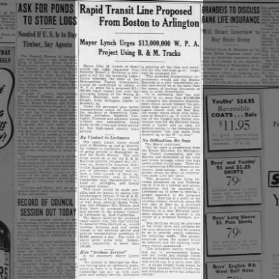
There was a 1924 city study for an extension to Charles in conjunction with the construction of that station, and a 1926 proposal (part of the region's first comprehensive plan) to connect it to the Tremont Street Subway at Park Street and run through out Comm Ave. There was also a 1938 proposal by the Somerville mayor to extend the line to Arlington via Lechmere and North Cambridge:

Connecting to Park shows up again in a 1974 state plan. From the 1978 Program for Mass Transportation onward, Charles/MGH has generally been the proposed terminus. The exception, as Scalziland noted, was the 2003 Program for Mass Transportation, which looked at both Blue Line and Green Line extensions to West Medford. The Blue Line extension had twice the projected cost of the Green Line, primarily because of the cost of a new Charles River tunnel. (That's not to say a Blue Line extension via Kendall is a bad idea - it may well be worth the tunneling cost - merely that it wasn't the right choice for the GLX corridor.)
 
There was a 1924 city study for an extension to Charles in conjunction with the construction of that station, and a 1926 proposal (part of the region's first comprehensive plan) to connect it to the Tremont Street Subway at Park Street and run through out Comm Ave. There was also a 1938 proposal by the Somerville mayor to extend the line to Arlington via Lechmere and North Cambridge:
This captured my imagination since I hadn't seen it before, so I sketched it out (using a stylus, so it's a little wobbly in places).

1694708567930.png


A reminder -- as ever -- that probably something like 80% of Crazy Transit Pitches -- past and present -- are just a matter of connecting together the 19th-century ROWs in novel combinations.
 
This captured my imagination

Same! Looking at the 1938 Bromley map, I'd guess this is how they'd do it -- I *think* there's just enough distance between Levrett Circle and Nashua Street to get underground, if you use the Canal Street Incline as a template -- they might have been tempted to do an Brattle Loop-style, set of single-direction tunnels. Two-track tunnel goes under Nashua to Staniford before splitting into single-track tunnels at the Staniford/Green Street junction and meeting back at the existing Bowdoin station (filled in below). That's one less station to (re)build, even if you're still burdened with a 90 degree turn on the route.

1694731928513.png
 
A follow-up. I looked more closely at the Staniford/Green Street junction and there's no two ways about it: You have to eminent domain at least the north-east corner building owned by an "M. & E. Kern" to make this work, if not the next-door "Boston S.D. & Tr. Ca."-owned building. I wonder if that would open up the option of rebuilding Bowdoin into a normal platform with parallel tracks and running a two-track tunnel the whole way? Or would other takings you'd need to make to enable a Bowdoin rebuild be too much? The article notes the mayor specifically sells his plan as something that wouldn't require any takings.

1694732495862.png
 
^ Awesome stuff. I commend you for taking on the task I was too chicken to attempt! (I don’t even think the PMT tried to figure out the Bowdoin-Lechmere route?)

Ironically, I’d bet you’ve now given more thought to this particular question than anyone did at the time.
 
This captured my imagination since I hadn't seen it before, so I sketched it out (using a stylus, so it's a little wobbly in places).

View attachment 42690

A reminder -- as ever -- that probably something like 80% of Crazy Transit Pitches -- past and present -- are just a matter of connecting together the 19th-century ROWs in novel combinations.
Looks accurate, except the BL probably would have crossed Fresh Pond Parkway to the north of the Route 2/16 intersection. using a RR ROW that used to connect to the Lexington Branch:
1694744294171.png
 

MassDOT has begun the process of planning a replacement for the 73-year-old Tobin Bridge, one of the largest bridges in New England and a major regional connection for the greater Boston region.

"Repairs are not a permanent solution, that's why we are releasing the (request for proposals)," said Tibbits-Nutt.

Looks like it's time to revive our earlier discussion of just what you could do with a project like this...
 
Ignoring the fact that the design process has already started and any major additions to the design requirements are unlikely to be added: What kind of transit could we even expect to add to such a new structure? Bus lanes for a Silver Line/BRT addition are obvious, but do the grades of the structure even vaguely support any sort of rail transit? I've often toyed with the idea of an Orange Line branch over a NuTobin ala the Ben Franklin Bridge, but that thing is so high I don't know that you can do much with it.
 
Ideally, Tobin Bridge would have been a perfect corridor for a new heavy rail (or at least grade-separated light rail) line to Chelsea, then to either Everett or Revere, and beyond.

This is probably one of the most desperately needed rapid transit corridors, outside of the downtown core and Fairmount Line conversions. It's one of the few densely populated regions within 128 without any HRT or LRT lines, any radial commuter rail lines (the Newburyport ROW is less than ideal), nor any official plans to build one at the moment.

Several crayon proposals have been made, such as my God-mode proposal (where I also discussed other "missing" HRT corridors in greater detail). This would also have been a perfect fit for F-Line's "Red X" proposal.
 
Some super-quick math (~250 feet tall, ~3500 feet of travel from first channel to underground segment of the roadway) shows a grade steeper than any on the MBTA system: 7% versus about 6.5% on the Causeway Street Tunnel up to the Lechmere viaduct. That doesn't bode well for anything other than BRT.
 
Some super-quick math (~250 feet tall, ~3500 feet of travel from first channel to underground segment of the roadway) shows a grade steeper than any on the MBTA system: 7% versus about 6.5% on the Causeway Street Tunnel up to the Lechmere viaduct. That doesn't bode well for anything other than BRT.
Go under not over the channel.
 

Back
Top