Fantasy T maps

I'm assuming that, at the end of the day, fully grade separated RER through-running onto NSRL is an equivalent alternative to OL service. So the options are:
  • Start a long construction process, end up with an OL extension with amazing after 5-10 years.
  • Electrify the line with overhead catenary now, end up with a line with great service much quicker, and then spend the next 5-10 years slowly eliminating grade crossings to elevate the service to amazing. Yes, this works out more expensive in the long run, but it yields much more immediate returns compared to the OL alternative. It's not letting "best" get in the way of "better." (And as a nice bonus the RER approach gets you express service along the current OL corridor without sacrificing service to Sullivan, Assembly, Rivers Edge, etc.)
Although I realize that potentially the biggest problem here is that there is a very significant temporal element not really present elsewhere that isn't really easy to convey with a static map.
The problem is that the exact same point applies to places like Waltham -- in fact, it's easier to bring RER to Waltham than to Reading, due to lack of concerns of single tracking. And I see no timeline in which a BLX with long tunnels (partially TBM) is higher on the priority list than simply converting an existing regional rail line to (mostly) surface rapid transit -- or, in other words, no timeline in which the state of the system would be as depicted on the map.

(It's not even getting to F-Line's point that grade-separating the "okay" service to Reading requires more construction hurdles than "great" OLX would.)
Fair enough. The last open question then is express service. What stations are okay to skip, if any? What proportion of trains should be express? Should all trains run to Reading or should some terminate at Oak Grove? If the answers to any of these questions is greater than 0, then at least some OL stops will see a reduction in service compared to OL to Oak Grove/RER to Reading. If the answer to the questions is zero, then trip times could potentially increase compared to the current CR service.
 
ExtensionOn-mode new riders (rank)Total new transit riders (rank)
BLX Wonderland-Lynn21,000 (1)7,900 (2)
BLX Lynn-Salem15,500 (2)8,900 (1)
OLX Forest Hills-Needham/12811,300 (3)600 (7*)
OLX Oak Grove-Reading9,400 (4)5,400 (3)
RLX Braintree-South Weymouth
6,700 (T5)2,900 (4)
RLX Alewife-Hanscom/128
6,700 (T5)2,000 (T5)
OLX Forest Hills-Westwood/1284,700 (7)2,000 (T5)
*large weighting to bus diversions/consolidations
I realize there is the asterisk for Needham Line conversion, but it's a bit frustrating to see that this approach essentially disregards trip efficiency.
 
Re Reading OLX: huh. I'm in the odd position of largely agreeing (I think) with @TheRatmeister's ultimate conclusions, but disagreeing with the underlying methodology.
I'm assuming that, at the end of the day, fully grade separated RER through-running onto NSRL is an equivalent alternative to OL service.
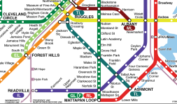
Well, so, big disagree on this one. At the end of the day, a hypothetical version of the Orange Line could shovel 20 tph up to Reading (e.g. an entire tunnel's worth of trains); the only way NSRL gets to that level is if fully half of the trains in a 4-track tunnel run to Reading, and I'm deeply skeptical that Reading exceeds Waltham and Lynn in demand.

That being said, Reading getting a quarter of the NSRL's ~40 tph, yielding 6-minute headways, is somewhat more plausible (though unlikely). Which I think is your general point -- at this distance, the Orange Line probably doesn't need full frequencies, so a "low rapid transit" frequency might overlap with a "high Regional Rail" frequency. And generally I think that's true in principle.

In practice, I think that RER would probably provide Reading with 15 or 20 minute frequencies, which is definitely not equivalent to the Orange Line. I'm not qualified to have a strong opinion on this, but it certainly seems to me that the more branches a system has, the lower effective capacity of the core section, given the greater complexity of scheduling interlining. Keeping Reading on the Regional Rail network makes everything more complicated for everyone, from Lynn to Brockton, Waltham to Providence. An OLX narrows the scope of the complexity.

So the options are:
  • Start a long construction process, end up with an OL extension with amazing after 5-10 years.
  • Electrify the line with overhead catenary now, end up with a line with great service much quicker, and then spend the next 5-10 years slowly eliminating grade crossings to elevate the service to amazing. Yes, this works out more expensive in the long run, but it yields much more immediate returns compared to the OL alternative. It's not letting "best" get in the way of "better." (And as a nice bonus the RER approach gets you express service along the current OL corridor without sacrificing service to Sullivan, Assembly, Rivers Edge, etc.)
Although I realize that potentially the biggest problem here is that there is a very significant temporal element not really present elsewhere that isn't really easy to convey with a static map.
This used to be my thinking as well, but I no longer think it's worth the trouble. From what I can tell, the current in situ conditions could probably yield 30 min headways wth diesel equipment. With some minor to moderate track adjustments south of Oak Grove, maybe that could even drop to 20 min.

In either option you describe, Melrose, Wakefield, and Reading will need to contend with 5-10 years of construction and disruption to service. (Are we really going to be able to do grade separations while thru-running trains?) So, those communities will have a choice: are 5-10 min frequencies really that much better than 20-30 min that it's worth a long term disruption?

If the answer is "yes", then just go ahead and build the Orange Line Extension. And if the answer is no, then continue on with the status quo, but without Indigo Line branding.

So I guess that's where I disagree a bit: I'm less enthusiastic about a Reading OLX, but I also don't particularly see good reason to try to turn the Reading Line into a northern Indigo Line.
 
If the answers to any of these questions is greater than 0, then at least some OL stops will see a reduction in service compared to OL to Oak Grove/RER to Reading.
If OLX happens, then the existing CR tracks could be converted to express tracks, with at least one peak express track always available. (And I think the ROW is 4 tracks wide for much of the way to Malden Center, meaning you could probably create bidirectional express tracks as well.) I think it could be done such that current stations do not see a reduction in frequency. By consolidating all tracks on to a shared mode, you can increase flexibility and capacity at all points on the route.
 
If OLX happens, then the existing CR tracks could be converted to express tracks, with at least one peak express track always available. I think it could be done such that current stations do not see a reduction in frequency.
You can't keep that going into downtown though. If the target is (eventually) 3 minute headways on the OL then not all stops north of North Station will get those headways, those 20 TPH will need to be split into Local/Express trains and the express ones will by definition need to skip some stops. And picking stops to bypass isn't easy. (Except Assembly, sorry Assembly.) Sullvian, Wellington, and Oak Grove are all pretty high ridership stations and Community College is well situated for a new UR/GJ/RER megastation.
 
You can't keep that going into downtown though. If the target is (eventually) 3 minute headways on the OL then not all stops north of North Station will get those headways, those 20 TPH will need to be split into Local/Express trains and the express ones will by definition need to skip some stops. And picking stops to bypass isn't easy. (Except Assembly, sorry Assembly.) Sullvian, Wellington, and Oak Grove are all pretty high ridership stations and Community College is well situated for a new UR/GJ/RER megastation.
Oh, I see what you're saying, yeah fair enough.

But this raises a bigger question that I've been wondering about for years: is there any particular reason that Reading OLX needs to have express trains? Reading is just under 11.5 miles from Post Office Square, which is only slightly further than most "128 stations", including Braintree and Riverside, and is comparable to a number of other destinations, none of which we ever are particularly concerned about providing express service to, including South Salem, Lexington/Burlington, Weston/128, Needham Junction, and University Park/128 itself. (Though, yes, that last one does get de facto express service, I grant that.)

Of all of those, the Reading Corridor seems most similar to the Riverside Corridor, and I don't think anyone particularly feels express service is needed there?

~~~

On a broader note: another reason to favor OLX over Indigo Line for Reading is that Reading is one of the very few corridors that can be wholesale removed from the Regional Rail network via a rapid transit extension. Compare to the Eastern Route: even with a BLX to Salem (or Danvers or even Beverly), you're still gonna need to maintain the mainline tracks to handle trains from Rockport and Newburyport (where rapid transit will never reach). The same is true on the Main Line to Woburn, the Fitchburg Line to Waltham (ish), the B&A, the Franklin Line, the NEC, and the Old Colony branches. Even Fairmount itself probably needs to stay on the mainline network in order to absorb some Franklin/Foxboro trains.

The only other (extant) corridor that this can be done for is, of course, the Needham Line. (The Lexington Branch would also qualify, and way back when, the Saugus Branch might have as well.)

"Indigo-ification" should, in my opinion, be reserved for corridors which must remain connected to the mainline network. In the case of Reading and Needham (and Lexington), a transformational increase in frequency should be borne by rapid transit, rather than continuing to burden the mainline network where it would compete with other services that have no rapid transit alternative.
 
including Braintree and Riverside, and is comparable to a number of other destinations, none of which we ever are particularly concerned about providing express service to, including South Salem, Lexington/Burlington, Weston/128, Needham Junction, and University Park/128 itself
Braintree, South Salem, and Weston (And University Park of course) all get express service (In this magical fantasy world) via parallel CR though. Although this does get me wondering if maybe doing peak-direction express to/from Needham is possible. It seems like there are some places you could triple-track the Highland Branch.
 
Last edited:
Illustrator_Fantasy_Map v3.0.jpg

Okay space is starting to become a real constraint now. Getting the Mass Ave line (Called the Maroon Line because colors are beginning to run low) to fit and not look bad was quite difficult and required a couple deviations from the style. I also redid a good chunk of the GL while I was at it for good measure. I had also hoped to make the Teal Line nice and straight but I could not get Jackson Sq, Roxbury Crossing, and Ruggles to work unfortunately, so that 90 degree angle is still there, mocking me.
 
Looking great! Yes, space is definitely tight, so it may be that you are approaching the limits of this particular approach. But it still looks cool!
Getting the Mass Ave line (Called the Maroon Line because colors are beginning to run low) to fit and not look bad was quite difficult and required a couple deviations from the style
Mass Ave -- whether mapping the 1 or adding a new rapid transit route -- is always a pain because it puts two axes in tension: the Red Line and Mass Ave itself. Geographically, Mass Ave is darn close to a straight shot (the biggest bend is just south of MIT and it's not severe); this makes it very alluring as a diagrammatic axis for a map, where you're always looking for places to make straight lines. On the other hand, system-wise, the Red Line makes for an extremely strong east-west (northwest-southeast) axis; creating a straight-shot from Harvard to South Station is very tempting. Unfortunately, you can't have both at once.

You've come up with an interesting way to square this circle by using an extended transfer barbell at Central, allowing you to keep the convergence point at Harvard itself while also keeping Red and Maroon straight. I don't think it's the approach I myself would take, but I think it's innovative!
I had also hoped to make the Teal Line nice and straight but I could not get Jackson Sq, Roxbury Crossing, and Ruggles to work unfortunately, so that 90 degree angle is still there, mocking me.
For similar reasons, I think it'll be hard to achieve that while also keeping the Orange Line fully straight. That being said, if you kept the line running diagonally northwest of Franklin Park, you might be able to get it to intersect the vertical line at Jackson Square, giving you a 135-degree angle instead of 90. (Though I think you will need to shift the Franklin Park <> Ashmont segment downward a bit, which in turn would mean adjusting the Red, the F, and maybe the Indigo as well.

What's your objection to right angles?

Community College Superstation: this has been a cornerstone of this and previous maps of yours, and I am definitely intrigued. Do you have any additional detail on how you envision this?
 
What's your objection to right angles?
It's just the aesthetic I'm aiming for, really. I think the 45º angles give it a nice flow-y look whereas 90º angles feel more harsh and abrupt.
Community College Superstation: this has been a cornerstone of this and previous maps of yours, and I am definitely intrigued. Do you have any additional detail on how you envision this?
Currently there's 12 tracks around Community College that get narrowed down to 4 to cross the Charles as well as some currently unused space along the highway ramps. Move the split point up much closer to the yard and expand the site, keeping 8 tracks: 2 for the GJ Light Rail (Pink Line), 2 for the Indigo Line, and 4 for the Commuter Rail. If there's space for 2 more tracks the Yellow Line can also go above ground, otherwise it can just go underground. An elevated walkway would come up from the surface tracks to connect to the OL station.
 
For similar reasons, I think it'll be hard to achieve that while also keeping the Orange Line fully straight. That being said, if you kept the line running diagonally northwest of Franklin Park, you might be able to get it to intersect the vertical line at Jackson Square, giving you a 135-degree angle instead of 90. (Though I think you will need to shift the Franklin Park <> Ashmont segment downward a bit, which in turn would mean adjusting the Red, the F, and maybe the Indigo as well.
I did sort of get this to work, but the compromise I needed to make was that now the F branch stop spacing isn't consistent. I think I prefer this version but I'm not totally sure. You were right about adjusting basically everything else in the area but luckily because Illustrator it didn't take long.
1716852158951.png
 

Attachments

  • 1716852162364.png
    1716852162364.png
    230 KB · Views: 14
Looks great!
but the compromise I needed to make was that now the F branch stop spacing isn't consistent.
I actually think there are benefits to this. IMO, the different label spacing north vs south of Franklin Park creates a stronger visual differentiation, serving to break up what is otherwise a pretty large "wall of text" effect on the F Line.
 

Back
Top