Fantasy T maps

I appreciate someone trying to solve that BU bridge riddle, but I'm not sure if all of those routings work. We've had a couple debates on this forum about how to do it in the past.

RE: A branch bike lanes, obviously we care about trains more than bikes. Not sure why this is a question.
 
RE: A branch bike lanes, obviously we care about trains more than bikes. Not sure why this is a question.

How is the car dependency in Allston-Brighton going to be solved if the neighborhood is starved of the fastest east-west cycling connection?

JP has the SW Corridor for cyclists and the Orange Line for rapid transit. Allston-Brighton has literally nothing except for painted bike gutters and a crappy slow bus that only comes every 11 - 13 minutes peak and every 17 - 20 minutes off peak.

Allston-Brighton already has a corridor that can be used for rapid rail transit. It's along the Boston & Albany right of way (ROW) along the I-90 Mass Pike.

The streetcars are going to have to be street running if there's no room for a dedicated median for faster operating speeds, so they're going to be subject to the same 18 MPH (30 KMH) speed limit as everyone else. So at some point the 57 corridor is going to have even slower operation than today once the citywide speed limits are reduced from 25 MPH (40 KMH) to 18 MPH (30 KMH). Plus the fact that the Green Line central subway is going to be hooked with the Needham Branch if push comes to shove for the Needham CR to rapid transit and adding a 5 branch into the central subway.


1720555210617.png
 
Correct me if I'm wrong, but I'm not seeing anywhere on the old A-line route with less than 80' of RoW until it becomes Washington Street where it drops to 70'. There's no concerns on this segment about having green line, grade separated bike lanes, sidewalks, and travel lanes in each direction.

Once you reach Washington Street, cut one of the travel lanes. Make it east bound only (to preserve access to St. Elizabeth). Divert westbound drivers onto Sparhawk/Arlington/Faneuil. That frees up space to maintain green line as well as bike lanes in both directions and sidewalks.

We can in fact have our cake and eat it too.
 
I'd be VERY interested in an updated version of this map, and hopefully we get something like it with the upcoming GoBoston 2030 update. Bluebikes has so much more reach than Hubway did a decade ago, and with Turo and GetAround coming on the scene I don't think there is an inch of Boston that isn't within a 10 minute walk of carshare.
 
I'd be VERY interested in an updated version of this map, and hopefully we get something like it with the upcoming GoBoston 2030 update. Bluebikes has so much more reach than Hubway did a decade ago, and with Turo and GetAround coming on the scene I don't think there is an inch of Boston that isn't within a 10 minute walk of carshare.
It's kind of limiting that there isn't an updated version of the map.

The transit coverage would be smaller for the KBRs since some of the KBRs currently fail to meet KBR standards. (requirements for KBR is 10 minute headways rush hour and 20 minutes off peak). The 57 is only running 11 - 13 minutes at rush hour and the 39 runs every 23 minutes on Saturdays, failing the KBR standards.

I'd also be interested to see the map covering the entire BERy service area + Lynn/Quincy/Waltham. I'd imagine Medford/Malden/Everett would appear as one giant desert except for Malden Center.
 
Last edited:
Hey everyone,

I've been lurking for a while and got around to making my own fantasy T map. I call it Giga MBTA and it’s inspired by a lot of the helpful info on this forum along with a few ideas that I like. I tried to not make it entirely crazy by looping in projects that are being proposed in one form or another. I’m planning on working back from this toward a more reasonable pitch that doesn’t require as many MEGA-projects and is a little nicer to those who like street parking.

gigaMBTA.jpg


View attachment gigaMBTA.jpg

I made this to showcase this map to scale as well
Sorry I didn't get a chance to reply sooner, but first of all, excellent work, this looks so cool! Lots of excellent stuff all around.

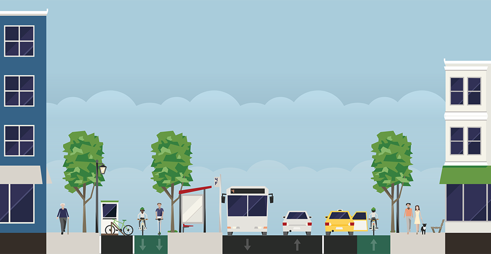
Some random examples of things I liked include your studious attention to indicating walking transfers (nicely including time estimates) as well as your "light touch" for indicating bus corridors. Bus corridors in particular can be very hard because it's easy to try to do "too much" with them (such as by explicitly marking all relevant routes, see for example my monstrosity of an attempt to redesign the T's system diagram), and I like that your map is much more sparing in its detail. Enough to illustrate that there is important transit infrastructure there, but not so much that it overwhelms.

(I also am a big fan of Indigo-via-Tobin, even though there are substantial engineering challenges to overcome.)

I might offer more comments later, but to briefly respond to a couple of things:

Blue Line on Storrow
I think a surface running line is a massive upgrade on the noise and pollution of Storrow drive which is already such a barrier between the residential and the espanade. Surely replacing a few Storrow lanes wirh a mostly straight electric rail line would be quieter, cleaner, and more aesthetically pleasing than what is there now?
I think it's worth clarifying a little bit what F-Line is describing by a "capped cut". Basically, steal a number of lanes of Storrow (as you describe), sink them down a little bit (gonna make up a number here, but let's say 6 feet), and then build a relatively thin "cover" over the top and down the side. (Using the existing barrier wall to form the other side.) That cover could then, for example, get grass/greenery put down and bring Back Bay all the closer to the river, offsetting the impact of Storrow Drive even further. So, basically the same as what you're proposing, but with a roof and walls to make the environment even more pleasant.

Back Bay Subway
I haven't been able to find how this second subway would interface with Back Bay to get towards Bay VIllage/ Tufts, could someone help me out?
I may have a more detailed diagram lying around (been meaning to collate those, but alas), but I have a brief description here.

Ah, okay, here's a very rough sketch:

1720556910020.png

Basically the tunnel gets threaded very carefully from the Exeter/Huntington/Stuart intersection under Stuart Street/the plaza outside Copley Place, into a new light rail station under the plot currently occupied by the Clarendon Street Garage. From there, the subway would run in a cut-and-cover along the Mass Pike until it reaches Bay Village.
Needham Line
  • I opted for a lower-frequency connector line between Millenium Park and Newton Highlands to maintain some service to Needham. As others have proposed, it could function similarly to the Mattapan heritage trolley line today but I know the PCC cars are being replaced soon anyway.
As the person who most recently suggested something like this, I do want to clarify that I think the only way it could make sense to run heritage trolleys/a shuttle service in Needham is if you have at least one full-time rapid transit service terminating within town limits (e.g. at Needham Heights). My suggestion was actually to bring rapid transit to three out of Needham's four stations, leaving Needham Center the only one relegated to a two-seat ride. Because yes, otherwise it's too severe a degredation of service.
Haven’t seen anyone else propose connecting this GL branch to porter along with the popular Union Square to Porter GL D extension. A loop here doesn’t seem impossible to me if you take 2 lanes from Mass Ave for a LRT/bus lane. Does another ring make sense?
It occurred to me about a year ago that something like this could give you a Sullivan <> Harvard connection that stays within existing rail ROWs/corridors, which is intriguing on paper. In practice, I agree that the number of intersections you'd need to blow through at-grade makes it prohibitively slow, and building a second tunnel is an expensive investment for something that (IMO) is not a pressing need.

That being said, if you want to do some fun outer loop stuff, you could play around with a service going Sullivan <> Porter <> Watertown Branch, hooking into your Aqua Line.

Like I said, really cool map! You've got some great ideas here, and the map itself also looks great!
 
Where is there enough room to fit dedicated bike lanes and the restored A branch? There's not enough room to fit it all.
When I lived out that way, I usually rode on Faneuil/Arlington/Sparhawk, rather than Washington St. But when my daughter lived there, she rode on Washington, mainly because it has bike lanes. In my opinion, the route I used is still perfectly viable, especially with some infrastructure upgrades. Make that the main bike corridor, and Washington the main transit corridor. Yes, ideally you'd have both on Washington, as that is the commercial street, but space constraints may require compromise.
 
You can do a lot with some creative lane management. Getting to St Elizabeths is no problem, Brighton Ave/Cambridge St are already wide enough, although a lot of street parking will need to be sacrificed on Cambridge St. From there you could terminate the line by looping it around the BPD station. From there we have two options, either lean into using Sparhawk/Arlington/Fanueil as a bike corridor and Washington as a transit corridor, or get pretty crazy on Washington. For the latter, it would require first running outbound trains on Henshaw St, then single tracking to Oak Sq with double tracked stations at Foster St and Langley Rd.
 
You can do a lot with some creative lane management. Getting to St Elizabeths is no problem, Brighton Ave/Cambridge St are already wide enough, although a lot of street parking will need to be sacrificed on Cambridge St. From there you could terminate the line by looping it around the BPD station. From there we have two options, either lean into using Sparhawk/Arlington/Fanueil as a bike corridor and Washington as a transit corridor, or get pretty crazy on Washington. For the latter, it would require first running outbound trains on Henshaw St, then single tracking to Oak Sq with double tracked stations at Foster St and Langley Rd.
I would be very curious how @F-Line to Dudley would handle trying to bring the A branch down westwards from Brighton Center along Washington Street, if bi-directional dedicated bike lanes on Brighton, Cambridge & Washington Sts were a mandatory requirement as part of the build, regardless if the A branch is brought back or not.

The original proposal to restore the A branch was before bike lanes became more prevalant like they are today.

Single tracking west of Brighton Center is an interesting idea, but in that case, keeping the loop at the police station is probably preferable for short turns in case of reliability issues, or for increased headways east of Brighton Center. Still, there's going to be the issue of where to shove station platforms/waiting areas in between the streetcar tracks, travel lanes, dedicated bike lanes, and sidewalks. The inbound/outbound stops definitely going to have to be offset quite a bit from each other.
 
Co-mingled on wider Brighton + Cambridge, then Sparhawk/Arlington/Fanueil alternate bike corridor all the way. I don't see any problem with that.


Sorry, Delvin...it's not going to thrill you, but the capacity of a loaded Type 10 trolley running every 6-12 minutes absolutely dwarfs the hourly usage of the Washington bike lanes even at peak utilization. This isn't a contest the bikes are going to win. But they don't have to lose it, either...that alt. corridor does exist.
In having these types of conversation online, it is shockingly frequent to see bicyclists defending their "turf" over bus and/or rail expansion. I had someone heap scorn on the idea of the red line to Arlington heights because of potential loss of or narrowing of the minuteman even though its utility as a rail corridor would vastly dwarf its utility as a bike commuter highway. In a way I get that losing something that feels exponentially safer than unprotected bike lanes is a difficult prospect, but there is a limit.
 
shockingly

Idk if it's really shocking that people want to defend the thing that they use in their day-to-day life. It's the same impulse as defending street parking in your neighborhood, if with significantly fewer societal externalities. Most people don't think in utilitarian fashion when it comes to something they use. I understand all the faults of the old Quincy bus depot and the benefits of the new one but still hate that the new one is going where it is. It's really important for both advocates and professionals to have some empathy in these situations.

But in this particular case, it's important to remember that biking and light rail are serving two different functions. From the ivory tower of the state transportation building (and having lived on Fairbanks St) I agree that the latter has more net utility than the former...but I still contend that the bike lanes don't need to be the trade-off here. The westbound travel lane has, imo, the least utility. Now the politics may decree that it's either rail with no bike lanes or no rail at all, in which case yes I think the bike lanes are an unfortunate but worthy tradeoff, but as long as we're in the fantasy T maps thread I don't see any reason why they need to be.

Sure, shockingly is the wrong word but it is hypocritical to decry personal use infrastructure for thee but not for me on main thoroughfares and right of ways even if the empire of degrees is different.

I agree with F-Line in terms of the layout. There are way too many roads connecting to Washington street to remove vehicle lanes without creating a chaotic pattern of car traffic needing to cross the tracks every block especially if the kept lane is eastbound. Your setup (and really the geometry of the real world space) doesn't leave room for platforms.

As to the bounds of fantasy in this conversation? Put the train in a tunnel; problem solved. Better yet, stop putting more lines on the Boylston street subway and make new ones like a comm ave subway that connects at Kenmore, Park, Reconfigured Bodwin, North Station, and then up onto the viaduct to go somewhere else. That's not really directed at you @KCasiglio, but it is frustrating that on one hand you are asking the conversation to be unbound by constraint when we are talking about fantasies that are clearly bound by real world constraints of some notion. I am particularly annoyed at crayon drawers inability to stop hubbing additional lines onto the Green Line through the core especially when a big push here is to remove the D line from Kenmore to make ops better. From the north, sure. From the West, NO! Dream bigger.
 
As to the bounds of fantasy in this conversation? Put the train in a tunnel; problem solved. Better yet, stop putting more lines on the Boylston street subway and make new ones like a comm ave subway that connects at Kenmore, Park, Reconfigured Bodwin, North Station, and then up onto the viaduct to go somewhere else. That's not really directed at you @KCasiglio, but it is frustrating that on one hand you are asking the conversation to be unbound by constraint when we are talking about fantasies that are clearly bound by real world constraints of some notion. I am particularly annoyed at crayon drawers inability to stop hubbing additional lines onto the Green Line through the core especially when a big push here is to remove the D line from Kenmore to make ops better. From the north, sure. From the West, NO! Dream bigger.
If we're talking about burying the A branch in the tunnel and building a new subway through Back Bay, at that point, one may as well just send rail transit down the B & A railroad along the Pike.

Washington St. already has dozens of unknown street utilities beneath the ground, so tunneling beneath the A branch is going to be extremely problematic with cut and cover or TBM. Plus the hilly terrain, plus sharp curves to get in and out of either side of Cambridge St and around Lake St. and Oak Sq. in particular.

Tunneling beneath the B & A is a lot more straightforward. Just take a single lane of the Mass Pike, tempoarily single track the B & A between each pair of switches, and do a capped cut for each pair of track and between each pair of switches. It's highly unlikely there would be that many utilities beneath a pre-existing railroad. After that, reconfigure the entire bus system, reroute the 64 to Brighton Center from Allston Depot and eat away at the original A alignment with added frequency, for a new OSR crosstown connection to Cambridge to eliminate the route duplication along Boston Landing.
 

Back
Top