General Boston Discussion

Wellesley has a density of almost 3k/sq mi and Needham 2.6k sq mi. Denser than most would guess.
Yea, but those densities hardly justify transit with the population base that spread out. Those population densities are only 1,000-1,150 people per square kilometer. The average urban density of urban Toronto is 3,050 people per square kilometer (Toronto is notable for its suburban buses). In London it is 5,630 people per square kilometer. Even sprawed out Los Angeles has an average urban density of 2,880 people per square kilometer. Greater Boston outside of the 1.68 million living in its streetcar suburbs (Quincy-Dedham-Waltham-Melrose-Beverly) needs 3 times the density to get any kind of transit the likes of that of Toronto.
 
Yea, but those densities hardly justify transit with the population base that spread out. Those population densities are only 1,000-1,150 people per square kilometer. The average urban density of urban Toronto is 3,050 people per square kilometer (Toronto is notable for its suburban buses). In London it is 5,630 people per square kilometer. Even sprawed out Los Angeles has an average urban density of 2,880 people per square kilometer. Greater Boston outside of the 1.68 million living in its streetcar suburbs (Quincy-Dedham-Waltham-Melrose-Beverly) needs 3 times the density to get any kind of transit the likes of that of Toronto.
A town doesn't have to be Toronto or London to justify good public transit. You just need to want people to be able to get around without always having to drive. In Switzerland, they'll have flag stops on the train for a single ski resort. In Japan there is a train stop just for a scenic view. On Metro North in New York, there is a stop just for a trailhead for part of the Appalachian Trail. If you prioritize public transit, then yes, a town like Needham with 30,000 people absolutely gets a train.

However you come down on that, simple population density of a town is probably never the right metric to look at for this. Massachusetts has a lot of towns with fairly compact centers, and lots of preserved green space around it (especially in the hillier parts out west, where towns were built in narrow valleys and couldn't expand as much). The green space make them seem sparse, but what you're really dealing with are dense downtowns that could be well served by public transit. It would be much better to look at something like the population within a walkshed, or something like that.

One statistic you might find interesting is "population weighted density." This is something like the density at which the average resident lives. If people in a town are exactly evenly dispersed within the borders, then it's the same thing as population density. But if people live clustered in one area, PW density gets weighted towards the density experienced by those larger number of people. A clear example where this matters is a town like Brookline. The population density there is about 9K per square mile. But about 2/3 of the population lives in the tiny northern 1/4 of the town. The population density there is huge, and it's where most of the people live. So the PW density is almost 20K per square mile.
 
One statistic you might find interesting is "population weighted density." This is something like the density at which the average resident lives. If people in a town are exactly evenly dispersed within the borders, then it's the same thing as population density. But if people live clustered in one area, PW density gets weighted towards the density experienced by those larger number of people. A clear example where this matters is a town like Brookline. The population density there is about 9K per square mile. But about 2/3 of the population lives in the tiny northern 1/4 of the town. The population density there is huge, and it's where most of the people live. So the PW density is almost 20K per square mile.
Ooh, thanks for finding a source for weighted population densities. This is very useful.

Even going by weighted population density, Boston within the MBTA service district still has a higher percentage of communties with population densities below 1,900 people per square kilometer, outpacing Los Angeles even still, in regards to ultra-low density exurbs and suburbs.

1725502267310.png


then yes, a town like Needham with 30,000 people absolutely gets a train.
Commuter rail also already does a decent job picking up the dense downtown areas of the low density suburbs, but once you get more than 10 minutes away from the CR stop, population densities dropping below ~2,500 people per square kilometer, outside of those small, compact downtown cores, the well dries up for running meaningful 10-15 frequent bus service. Beefing up commuter rail frequencies to every 15 - 30 (or Highland D Branch/Mattapan Trolley style service), will cover most of these dense compact town centers. Here's a map of all the historical railroad ROWs overlaid on Teban's population density map, showing that the railroads already serve (or used to serve), these compact town centers.

If your outlying suburban exurb isn't near a MBTA CR stop, chances are that suburban exurb is SOL anyways. The population density of areas more than a 10 minute walk of a historical RR ROW are most likely, below 2,500 people per square kilometer, much lower than suburban Toronto's densities that sustain those frequent suburban buses that run every 10 - 15 in Toronto. (Areas in red are the streetcar suburbs). You would be hard pressed to find any large conglomerate of census blocks outside of the streetcar suburbs, with more than 2,500 people per square kilometer, and be more than 10 minute's walk away from a historical RR ROW. (focus on areas just outside the yellow areas, NOT outside the red areas)
1725502723873.png


A town doesn't have to be Toronto or London to justify good public transit. You just need to want people to be able to get around without always having to drive. In Switzerland, they'll have flag stops on the train for a single ski resort. In Japan there is a train stop just for a scenic view. On Metro North in New York, there is a stop just for a trailhead for part of the Appalachian Trail.
Man, I'm kinda both depressed and very surprised at how far the English speaking world lags in providing good transit (there's literally NO pair of anglophone cities that are connected by high speed rail today... Paris and Brussels don't count --- also, somehow Auckland/Melbourne/Sydney rank highly in "quality of life" - but 15 minute frequent transit only serves like 30 - 60% of the city - so 40 - 70% of those cities are also transit poor).

I've always been under the impression that a metropolitian area needs millions of residents strong, to have a large network of single digit frequencies of transit routes. It seems like only Toronto, NYC, Vancouver, and London do this right with a large network of single digit frequencies, aside from Vancouver, all of them are over 5.5 million strong. 15 minutes isn't frequency. It's still "check a timetable before going".

To live in a city of only 150,000, can a city of 150,000 even have good single digit frequency transit? Is public transit in Lowell, Lawrence, Worcester, Framingham, or Brockton, ever going to be a "legit form of transport", or are they forever relegated to being "social/welfare services", and only Boston streetcar suburbs can go car free? A city of 150,000 is typically always going to be so small that 15 minute frequencies aren't going to compete, if the distance to the edge of the city is "so short". Yet the population is also going to be tiny to justify demand for sub-10 minute frequency.

Still kinda wild and boggles my mind that almost all of the anglosphere essentially gutted small towns to become car sewers, save for a college town or two, meaning only downtown and the streetcar suburbs of big cities of 4.55 million+ (or maybe some obscure college town) can go car free.

When I analyzed cities with metros/trams/etc in the US/Canada/etc./etc.. Cities with metros generally are mostly over 3,500,000 strong. Cities with light rail have 850,000 population or more. Cities with at least commuter rail or BRT have generally over 625,000 plus.
 
Last edited:
Ooh, thanks for finding a source for weighted population densities. This is very useful.

Even going by weighted population density, Boston within the MBTA service district still has a higher percentage of communties with population densities below 1,900 people per square kilometer, outpacing Los Angeles even still, in regards to ultra-low density exurbs and suburbs.

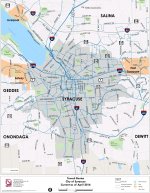
View attachment 55067


Commuter rail also already does a decent job picking up the dense downtown areas of the low density suburbs, but once you get more than 10 minutes away from the CR stop, population densities dropping below ~2,500 people per square kilometer, outside of those small, compact downtown cores, the well dries up for running meaningful 10-15 frequent bus service. Beefing up commuter rail frequencies to every 15 - 30 (or Highland D Branch/Mattapan Trolley style service), will cover most of these dense compact town centers. Here's a map of all the historical railroad ROWs overlaid on Teban's population density map, showing that the railroads already serve (or used to serve), these compact town centers.

If your outlying suburban exurb isn't near a MBTA CR stop, chances are that suburban exurb is SOL anyways. The population density of areas more than a 10 minute walk of a historical RR ROW are most likely, below 2,500 people per square kilometer, much lower than suburban Toronto's densities that sustain those frequent suburban buses that run every 10 - 15 in Toronto. (Areas in red are the streetcar suburbs). You would be hard pressed to find any large conglomerate of census blocks outside of the streetcar suburbs, with more than 2,500 people per square kilometer, and be more than 10 minute's walk away from a historical RR ROW. (focus on areas just outside the yellow areas, NOT outside the red areas)
View attachment 55071


Man, I'm kinda both depressed and very surprised at how far the English speaking world lags in providing good transit (there's literally NO pair of anglophone cities that are connected by high speed rail today... Paris and Brussels don't count --- also, somehow Auckland/Melbourne/Sydney rank highly in "quality of life" - but 15 minute frequent transit only serves like 30 - 60% of the city - so 40 - 70% of those cities are also transit poor).

I've always been under the impression that a metropolitian area needs millions of residents strong, to have a large network of single digit frequencies of transit routes. It seems like only Toronto, NYC, Vancouver, and London do this right with a large network of single digit frequencies, aside from Vancouver, all of them are over 5.5 million strong. 15 minutes isn't frequency. It's still "check a timetable before going".

To live in a city of only 150,000, can a city of 150,000 even have good single digit frequency transit? Is public transit in Lowell, Lawrence, Worcester, Framingham, or Brockton, ever going to be a "legit form of transport", or are they forever relegated to being "social/welfare services", and only Boston streetcar suburbs can go car free? A city of 150,000 is typically always going to be so small that 15 minute frequencies aren't going to compete, if the distance to the edge of the city is "so short". Yet the population is also going to be tiny to justify demand for sub-10 minute frequency.

Still kinda wild and boggles my mind that almost all of the anglosphere essentially gutted small towns to become car sewers, save for a college town or two, meaning only downtown and the streetcar suburbs of big cities of 4.55 million+ (or maybe some obscure college town) can go car free.
I mean, a significant part of this is going to be accounted for in "when did those towns develop?" The US population was ~130M in 1940. The 200M we added to get to 330M largely coincided with the automobile as "the way of the future" and suburbs. The UK was at ~48M in 1940, and only grew modestly to 67M, and France went from ~41M to 67M. (Not accounting for the millions lost during WWI and II), and their reconstruction efforts were largely focused on the cities.

Secondly, the French railroad, like the Belgian, was almost always a nationally planned endeavor- the country's economy wasn't able to sustain the level of private construction that led to Britain - and the US's - intricate networks. The thing is, France has a long history of infrastructure beauracracy - look up the canal du midi. A centrally planned system doesn't necessarily need to dip and dodge in the same ways a privately built one does, in saving costs or otherwise. The historic French railroad was always straighter than the British ones as a result, and combined with a post war reconstruction plan...

Finally, I'd point you at Buffalo, Rochester and Syracuse NY as smaller cities that have reliable non car options for transit, reflected in their low car ownership rates. It's not show up and go, with most routes in those cities at a 30min frequency, but each has remarkably good coverage for a city it's size. Then look at their population growth - all of them reached their peak before their advent of the common automobile, and all had minimal growth in their suburbs. Syracuse only grew 2.5% from its 1970 numbers.
 
Last edited:
Boston-NY-Philadelphia-Washington DC
Well that's mostly due to sheer luck by concidence. Early railroad engineers building the Boston & Providence Railroad did not know that the trains/tracks could go on curves in the 1830s. So they built the B & P railroad all with only 1 degree curves out to Providence from Canton.

Some quotes from this particular article: https://web.archive.org/web/2024030...1/02/early-rail-designers-were-just-guessing/

no one really seemed to know what kind of curves and grades would be allowable. So, it seems, they guessed.
Measuring each, they all almost exactly 1˚, a speed good for about 130 mph. This is the speed the line runs today.
There are not many legacy rail lines which allow for high speed operation, certainly outside of very flat areas. Railroads want to avoid hills and before high speed operations they were generally built to go around them rather than over or under. Pretty quickly (or in the case of the B&O, very quickly) engineers realized that a 3˚ or 4˚ curve was perfectly fine, especially with stronger rails. No one in 1840 was going 100 mph, it was inconceivably fast. A few 5˚ curves were far easier than moving mountains.

But the Providence Line, because of—as far as I can tell—little more than happenstance, wound up with a high-speed right of way. It will never have 180 mph / 300 km/h service on those curves, and smoothing them out, especially at the Canton Viaduct, is nearly impossible.
But for a 190-year-old railroad, it’s not bad. It’s a shame engineers figured out so quickly that 1˚ curves weren’t necessary or we could have much faster rail service much more easily.

If the Boston & Providence Railroad was built with 3 degree curves. There would be no high speed rail between Boston and Providence today. The US and/or Massachusetts would be whining and putting their heads away from building a "Boston - Providence HSR" if that was the case.
 
Last edited:
I mean, a significant part of this is going to be accounted for in "when did those towns develop?" The US population was ~130M in 1940. The 200M we added to get to 330M largely coincided with the automobile as "the way of the future" and suburbs. The UK was at ~48M in 1940, and only grew modestly to 67M, and France went from ~41M to 67M. (Not accounting for the millions lost during WWI and II), and their reconstruction efforts were largely focused on the cities.

Secondly, the French railroad, like the Belgian, was almost always a nationally planned endeavor- the country's economy wasn't able to sustain the level of private construction that led to Britain - and the US's - intricate networks. The thing is, France has a long history of infrastructure beauracracy - look up the canal du midi. A centrally planned system doesn't necessarily need to dip and dodge in the same ways a privately built one does, in saving costs or otherwise. The historic French railroad was always straighter than the British ones as a result, and combined with a post war reconstruction plan...

Finally, I'd point you at Buffalo, Rochester and Syracuse NY as smaller cities that have reliable non car options for transit, reflected in their low car ownership rates. It's not show up and go, with most routes in those cities at a 30min frequency, but each has remarkably good coverage for a city it's size. Then look at their population growth - all of them reached their peak before their advent of the common automobile, and all had minimal growth in their suburbs. Syracuse only grew 2.5% from its 1970 numbers.

Aren't low car ownership rates in those upstate NY cities mostly just a function of poverty levels? You see higher rates of no-car households in many poorer cities like Detroit or Baltimore, and it's not because they have good transit.
 
Aren't low car ownership rates in those upstate NY cities mostly just a function of poverty levels? You see higher rates of no-car households in many poorer cities like Detroit or Baltimore, and it's not because they have good transit.
Sure, not having adjusted for income, it's absolutely a confounding factor, but it's one with an interesting correlation question. I'd like to dig more into the literature, but do people live in cities because they don't have a car, and need closer/transitable access to services, or by living in a city a car is less important in daily life? In theory, holding income flat, a household that lives in an area with *some* reliable transit should be able to be car-light in a way a household that lives in a rural community isn't likely to be. Buffalo is roughly analogous to Providence/Pawtucket, and Rochester to Worcester population wise. And while Providence and Worcester are higher income, it's about equal once adjusted on a CoL basis.

Therefore, I would post the question why are the upstate NY communities, Baltimore, Detroit still lower car ownership compared to other, equally low income cities, in New England and beyond? Bridgeport CT is equally populated, even poorer than those communities, and has higher car ownership despite being on the NEC, so there must be additional factors. Hartford is lower car usage, and has a decent local bus network, so I'm inclined to claim better local transit is the difference. And no - transit in Buffalo/Rochester/Syracuse isn't good, per se, but they have better coverage than you might expect for cities their size. Compare the below route maps to say the WRTA, or even RIPTA.
1000036985.jpg
1000036975.jpg
 

Attachments

  • 1000036980.jpg
    1000036980.jpg
    1,002.3 KB · Views: 11
Has anyone else realized bostonplans no longer has any of the documentation under each project and instead only has community meeting dates listed? Wtf is that? That would be insane if all of that information is going away with the rest of the changes.

https://www.bostonplans.org/projects/development-projects
This is a terrible change. Thanks for pointing this out!

.... time to find an email and ask for them to revert this change.
 
I
Has anyone else realized bostonplans no longer has any of the documentation under each project and instead only has community meeting dates listed? Wtf is that? That would be insane if all of that information is going away with the rest of the changes.

https://www.bostonplans.org/projects/development-projects
I don't know if it was when you looked, but when I'm on the site I can still see all of the documents attached to each application. For example, for the newest project (Project Lite Brite) I still can pull up the PNF.
 

Attachments

  • Screenshot_20240909_133315_Chrome.jpg
    Screenshot_20240909_133315_Chrome.jpg
    449.9 KB · Views: 10
  • Like
Reactions: DBM
I

I don't know if it was when you looked, but when I'm on the site I can still see all of the documents attached to each application. For example, for the newest project (Project Lite Brite) I still can pull up the PNF.

Ditto that; I just went to the site and there's been no changes and everything's still available as it was prior; all that's been done is they appended that modest disclaimer banner to the very top stating, "as of July 1, we are no longer the BPDA" (words to that effect)
 
I just checked they must have fixed it today. It had been like that for the last 3-4 days and I was getting worried it was a new change.
 
This was a solid piece on the challenges facing Downtown Denver, which are pretty similar to what most US downtowns are facing right now. What I found interesting is that apparently the mayor of Denver and his team visited Boston:

Johnston and others have mentioned the need to restructure Skyline Park and have visited Boston to study the ways it uses Boston Common to activate the neighborhoods surrounding the 50-acre public park.
 
Met recently with a few members from Denver's Dept of Transportation about Denver Moves Everyone. This is part of a broader project we're doing looking at how cities across the country are approaching mode shift. Considering the disadvantaged starting point a city like Denver has compared to northeast corridor cities, I don't know that there is any city out there making as robust of an effort. I'd highly recommend skimming through DME and getting engaged with the currently ongoing GoBoston2030 update.
 

Back
Top