General Infrastructure

Ahhh. I get it. I thought we were discussing infrastructure and development, but it's just pedantic tomfoolery. Gedankenexperiment! I'm in.

Company A owns lots 1, 2, and 3 and pays it's fair share of property taxes for them. Lot 1 is a materials plant, Lot 3 is the equipment yard that supports the plant without which the plant on Lot 1 can not operate, and Lot 2 connects the other two lots, on which company A made a road to connect them. The big gubmint came in and took lot 2. We think Company A, who still pays lots of property taxes on Lot 1 and Lot 2, should also pay for the right to use the road they built or stop using the road because it's owned by the gubmint now. The gubmint really doesn't need the road anymore, or use the road anymore, but wants to keep it just in case.

Here are Company A's options:

- Pay to use the road they built and the gubmint took and doesn't use because your current use of the road underneath the highway and next to the train yard is unsightly.
- Use some other roads for free that the gubmint owns, driving through commuter traffic and local streets transporting your dozens and dozens of cement trucks all hours of the day and night.
- Invent some Star Trek type transporter beam s#1T to move your trucks from the one property to the other using the massive cement biz profit margins you're raking in.
- Go out of business you bourgeois purveyors of concrete.

While we're at it, let's all meet up tomorrow on the North Bank Bridge end of the skatepark and picket the Keolis employee car parking.
 
This video starts around Entrance 1 and sprints through most of the stuff in yellow. Nearly all of it is on the West of the Orange Line. BSG has carte blanche on everything from the Sullivan Square approach to the River.

From the looks it from that video Entrance 1 and the roadway as far as to where it splits at the Leverett Connector ramp also serves to access this building. That's a state parcel (I'm not sure what it is, but for some reason I always thought it was an electrical substation); I assume that it's probably also accessible via Entrance 2, but that wasn't clear from the video. I don't think it's particularly unreasonable for the state to think it's a good idea to allow access to their building from both ends, especially since putting a road in that goes up to Entrance 1 parallels both rail lines and provides easier access to both those lines and the elevated highway structural supports.

Now what that means is that even if BS&G is the heaviest user of that stretch of road and Entrance 1, it's not solely for their use. The easiest access to one and sole access to another of Clear Channel's billboards (and their leased parcels) is also off that road, though of course the road predates the billboards. It's a touch hard to tell from the video, but the video is showing state property as far as to where the road goes under the Orange Line, where (per GIS) it looks like it goes onto MBTA property. To that point in the video, the only thing that looks like it might be BS&G spilling off their own property is that it looks like some of their stuff might be parked on the ROW of the disused Mystic Wharf Branch (though show me a long-inactive railroad that doesn't get stuff stored and parked on it).

On the far side, after going under the Orange Line, the road is literally a road squeezed between a transit line, an elevated highway's support columns, and an active railroad line. Literally the only structures that can fit in there are trailers (there are a couple of them in that video next to the CR ROW, I don't know whose or what they're for). That's MBTA land anyway, and it's functionally impossible to put to any meaningful use because of the shape, constraining structures, and access issues (not to mention that the MBTA itself presumably finds it useful as an access road for ROW maintenance).

Per the video the road splits, one side appears to access the brightly-colored state-parcel building, the video goes the other way, which is far too narrow to build anything meaningful on before you hit the Gilmore Bridge. The rest of the video seems to be areas that are either fragmented between various state parcels and BS&G parcels, or outright-BS&G owned parcels.

So, I'll reiterate my earlier question: what on Earth are you talking about?

All I see in your video 'evidence' is a road that has multiple uses and is so constrained by everything around it that it's utterly impossible to use for anything other than what it's used now. I don't see why BS&G is somehow in the wrong for using a road, when it's in significant part needed because of the state's own highways making access to the facility difficult in the first place, and where using only the south entrance would require that BS&Gs trucks pound the mixed-use pavement of the other surface roads to access their satellite equipment yard.
 
That logic only plays with arguing children

Not if the logic is actually "we were here first, you wanted to take (some of) our land for Big Dig purposes, and rather than make you eminent domain it, we agreed to let you in exchange for X, Y, and Z".
 
I’ll be the adult here and say while I may not entirely agree with the tone, I admire each participants dogged tenacity. I welcome discussion… though not on this subject, as collars are hot for some reason.
I yield back the balance of my time.
 
I’ll be the adult here and say while I may not entirely agree with the tone, I admire each participants dogged tenacity. I welcome discussion… though not on this subject, as collars are hot for some reason.
I yield back the balance of my time.

Collars are hot because there's rather less discussion than there is lecturing without direct engagement coupled with a gigantic haze of uncertainty as to what is actually being talked about. In the interest of trying to tie up this conversation a bit, I have a few final points of thought, which I'll endeavor to deliver with a minimum of snark.

The first issue is that none of us, as far as I am aware, has read whatever agreements may exist between the state and Boston Sand & Gravel. I have tried, without success, to find such documents. We know that the Big Dig resulted in BS&G's old access road being removed and reconfigured, and it's fairly apparent that the Tobin Bridge ramps, the Leverett Connector, and probably the Zakim Bridge approaches were all built through BS&G's property. None of that was the state's simply to take by fiat. They would have had two options: fight for eminent domain (and pay whatever price the courts determined, plus the legal fees, and the delays) or induce BS&G to allow them to use their property (some of which they are still using; everywhere there's a highway support column on BS&G land is a part of their property they can no longer use). It would absolutely be perfectly reasonable for BS&G, as a private entity, to say "this is the price" for using and giving up some of their land, and for that price to include re-configured access roads, and use of the state's own access roads. (We don't know for sure that's what they did because we don't have any agreement documents, but it certainly wouldn't surprise me.) It's also not unreasonable for the state to think that such a bargain would be better than incurring the costs and delays of going the eminent domain route (especially since doing so would piss off a concrete supplier in the middle of a massive state engineering process.)

The TL;DR version of the above is that we don't know the details, but it's objectively within the realm of reasonableness for the state to make a deal in which they essentially build a road or roads to a private facility in exchange for taking one of said facility's roads and permanently taking some of its land to build a highway through it. That's not corruption, that's a government that understands that property rights are a thing deciding that the friendly, don't get bogged down in an eminent domain case route is probably the smart move.

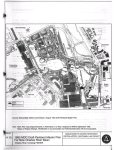
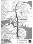
As to the "Entrance 1" northern access road as featured in the linked video. It objectively has uses beyond BS&G, even if they may use it more heavily than other users. It is an access point for the multi-colored state building (whatever it is, it's a state-owned parcel that appears to belong to MassDOT), and the sole meaningful access point to the stretch of Commuter Rail ROW between the Orange Line and the Lowell Line embankment separating the Eastern/Western routes from the Engine Terminal. (And I have personally seen Clear Channel and what I assume were MBTA and/or MBCR/Keolis workers on that road.) And to the extent that BS&G is the main private user of that road, it's a perfectly valid decision for the state to decide that it would rather that the cement mixers not use the back road through the BHCC campus (if that's even useable at all to get to the industrial park, so much of it is taken up by parking) or, worse, use Rutherford, to get from the BS&G plant to their satellite equipment yard. It's also entirely possible that such a road was a component of a deal between BS&G and the state, again, we don't know the details.

As to the other, hazier issue, regarding the use of the land that road is on and surrounding it, supposedly "squatted" on by BS&G (albeit in a manner that was not clearly explained), that land is effectively worthless. Between the inactive but non-abandoned Mystic Wharf Branch, the Orange Line, the Commuter Rail (including the dead storage track), and highways and their support columns, there's no meaningful room to build anything of use. It's industrial wasteland for a reason. Pick an area of industrial wasteland, any industrial wasteland, and you'll probably see vehicles and equipment strewn about without any meaningful care for where the property lines are...because it's industrial wasteland that would simply be empty otherwise. It's literally not worth caring about. If you tried to somehow tax BS&G for squatting on industrial wasteland, they'd just move any encroaching stuff onto their own property, and you the state would have wasted some of your employees' time and effort and the taxpayers' money. To the extent that they're using public land (other than roads) for their stuff, it's because it's literally not worth it to the state to care because of how little value the land has.

Again, the TL;DR version is basically this: we don't know what the terms of the agreement between BS&G and the state over the Big Dig stuff was and can't, therefore, make a final determination on its reasonableness. The rest is simply a facts-lite, foggy ideological argument, essentially over whether the state should build facilities that primarily benefit specific entities (in this case BS&G) combined with both a distaste for BS&G apparently using industrial wasteland that the state doesn't care about because it's industrial wasteland, possibly motivated by a desire to see that land be put to productive use despite the fact that its location and condition makes it, in practice, thoroughly unsuitable for development.

To the extent that the debate and discussion is over what concessions BS&G got from the state in exchange for its cooperation in the Big Dig stuff, I reserve final judgment on the terms' reasonableness until and unless someone finds the agreement documents, but I have no issue whatsoever with the state making the (frankly objectively reasonable) decision that a deal on friendly terms was better for them than going the eminent domain route. To the extent to which it's over BS&G using state land and roads not included in the deal (which may be extensive or not at all, without any deal documents, assuming that such agreement does in fact exist, we don't know) for no charge, my view is that it's simply not worth the state's effort to try and enforce such on industrial wasteland. BS&G will simply move its stuff off the state's land (and the next time there's a state construction project the price of concrete might go up a little) and the state will have wasted its energy for nothing. And to the extent that it's about the desire to develop or otherwise productively re-use that land, and BS&G being the obstacle to that (rather than it being industrial wasteland), my view is that the contention that BS&G is a fatal blocker has not been supported by evidence, and the land in question is largely valueless for any meaningful development anyway.

If you've managed to read this entire wall of text, congratulations, here's a delicious virtual cookie 🍪 for sticking with it, and without objection my participation in this particular conversation is adjourned.
 
You all have me reading the original FEISs from 1985 to 1993. Unfortunately, the final EIS from 1993 which covers the Charles River crossing, aka the Zakim bridge, does not actually reflect conditions as built. The State agreed to provide access as compensation for it's takings... But via Rutherford Ave, and not in the form as currently built. The current northerly access that is the root of the complaint is apparently temporary access, all over MBTA property, provided via easement as a staging consideration until such time the agreed upon permanent access road is complete. Since it never has been, they keep their temporary access.

Apparently, the reason this stretch of road exists is that a fork/merge was to be provided here, providing a ramp and access to a new signalized intersection below I93, created by filling in the upper portion of the Miller River Basin.
Screenshot_20211216-020805_Google Play Books.jpg
Screenshot_20211216-021255_Google Play Books.jpg

This intersection would have provided a connection from I93S to Rt1N, City Square and BSG, as well as local access to I93N.

Now, I don't have the foggiest clue as to why this plan was never completed. The documentation, if it exists, isn't accessible, and as far as I can tell no local new coverage exists either. As far as I know this was the last project change notice filed, and other than this, this segment was substantially built to these plans. Maybe they were waiting for the overall Rutherford reconstruction to happen? Maybe they didn't get approval to fill in the Miller as proposed? Probably the most likely reason, tbh - have to imagine that river fill was a hot button topic for the CLF back then but I can't know that they would have been able to block it with any certainty.

I do think this plan is worth another look in the 2020s, however without the fill. That said, I don't think decking it over should be out of the question.
I think It'd be worthwhile- it would enable some movements which today are very annoying to make, and the site which is now Galvin Park is inefficiently occupied by a ramp which can go away, and the BHCC lot redevelopment is probably impacted by the BSG access considerations as well.
 

Attachments

  • Screenshot_20211216-021539_Google Play Books.jpg
    Screenshot_20211216-021539_Google Play Books.jpg
    482.5 KB · Views: 94
  • Screenshot_20211216-020733_Google Play Books.jpg
    Screenshot_20211216-020733_Google Play Books.jpg
    459.2 KB · Views: 102
  • Screenshot_20211216-021642_Google Play Books.jpg
    Screenshot_20211216-021642_Google Play Books.jpg
    423.6 KB · Views: 97
  • Screenshot_20211216-021624_Google Play Books.jpg
    Screenshot_20211216-021624_Google Play Books.jpg
    287.4 KB · Views: 90
Last edited:
You all have me reading the original FEISs from 1985 to 1993. Unfortunately, the final EIS from 1993 which covers the Charles River crossing, aka the Zakim bridge, does not actually reflect conditions as built. The State agreed to provide access as compensation for it's takings... But via Rutherford Ave, and not in the form as currently built. The current northerly access that is the root of the complaint is apparently temporary access, all over MBTA property, provided via easement as a staging consideration until such time the agreed upon permanent access road is complete. Since it never has been, they keep their temporary access.

Apparently, the reason this stretch of road exists is that a fork/merge was to be provided here, providing a ramp and access to a new signalized intersection below I93, created by filling in the upper portion of the Miller River Basin.
View attachment 19629View attachment 19630
This intersection would have provided a connection from I93S to Rt1N, City Square and BSG, as well as local access to I93N.

Now, I don't have the foggiest clue as to why this plan was never completed. The documentation, if it exists, isn't accessible, and as far as I can tell no local new coverage exists either. As far as I know this was the last project change notice filed, and other than this, this segment was substantially built to these plans. Maybe they were waiting for the overall Rutherford reconstruction to happen? Maybe they didn't get approval to fill in the Miller as proposed? Probably the most likely reason, tbh - have to imagine that river fill was a hot button topic for the CLF back then but I can't know that they would have been able to block it with any certainty.

I do think this plan is worth another look in the 2020s, however without the fill. That said, I don't think decking it over should be out of the question.
I think It'd be worthwhile- it would enable some movements which today are very annoying to make, and the site which is now Galvin Park is inefficiently occupied by a ramp which can go away, and the BHCC lot redevelopment is probably impacted by the BSG access considerations as well.
Good contributions from the FEIS! Thank you. Light not heat.
Brattle Loop' summary and this post = Fantastic.
I thought I smelled something possibly rotting (and others seemed mad that I had a nose). You showed me where some of the produce was stored. Everything is else is speculation and editorial. That's why I come to aB!(y)

Also, in trying to figure out where this thread jackknifed, I found this little gem: The 1968 Charlestown Illustrative Site Plan on Map Junction. So much color! So many dreams!
 
I have tried, without success, to find such documents.

I really have nothing to contribute on the discussion in regards to my own opinion. But in true land survey fashion, I find the subject of "such documents" to be too good not to research. Attached is the deed for the access roads. And below are some of the plans of interest:


8770-433.JPG


9194-663-1.JPG

9194-663-2.JPG

9194-663-3.JPG
 

Attachments

  • Deed 9194-668.pdf
    70.1 KB · Views: 56
When I made my original post, the stuff above is what I had in mind. Trying to decipher the muddy cross-jurisdictional property lines, the easements, the ROWs, the ownership pool, possible malfeasance or just legal laziness, the not-really public roads and general access prohibitions... this whole area is a bag of broken glass and nails with a mystery amount of cash at the bottom (A nickel? A million bucks? Who knows?)

It has fascinated me for years. Thank you, thank you all for not shrugging your shoulders! Stlin and C-Town, you rock!
 
Even if it takes forever and screws over the tax payers, I’ll take the overpass option.
An overpass design makes no sense considering that MassDOT is tearing down overpasses on McGrath because of how much they damage the urban fabric. This is an intersection of parkways, not highways, and it’s directly adjacent to rapid transit.
 
An overpass design makes no sense considering that MassDOT is tearing down overpasses on McGrath because of how much they damage the urban fabric. This is an intersection of parkways, not highways, and it’s directly adjacent to rapid transit.
I'd go for an underpass instead of an overpass. Same plan as the overpass, but the through route 16 would be below grade.
 
Even if it takes forever and screws over the tax payers, I’ll take the overpass option.
As much as I hate overpasses and their effect on a neighborhood, the 6-10 lane options are incredibly dangerous. This site has massive downstream effects of backups in both Malden, Medford, Everett, and Somerville making them less safe. I like the overpass here. I really don't see any of the other options "connecting" Station Landing more than the overpass could or providing as much additional greenspace, but I don't like that they didn't include the crosswalk locations on that option.

WellingtonOverpassConcept.png
 
Correct me if I'm wrong.
This is looking East-ish above just south of Wellington Circle -- From front to back: Station Landing in the foreground, then pre-Wellington Station trainyard, then the river, then Gateway/Encore when it was the pre-Superfundy nastiness of PetroChemicalDumpInTheRiver World. You know... the good old days!
1641569971992.png

Link
 
I'm not sure what the right answer is, but Wellington Circle is the main reason I gave up on trying to commute via the Orange Line from Winchester. In optimal conditions, it's about 15 minutes from my house. During commute ours (pre-COVID, at least) it ranged from 30-45 minutes, with most of the delay coming at that intersection.

The big issue in the AM is that traffic going south on 28 backs up to the "circle". The short term plan definitely improves things for non-cars and doesn't seem to do anything for traffic, but maybe that's the plan. The medium term plan seems like it would just make the backup from southbound Middlesex Ave even worse, as that traffic will get stuck in that southbound backup and have trouble even making the turn onto 28 south. Again, it does seem to be an additional, incremental pedestrian improvement, though.

The separation of left turning and through traffic flows in the redesign is also pretty interesting, though a fair number of cars make left turns from 28 north and south to 16 west and east, respectively (at least it seems that way in the many years I've had to traverse this intersection).

While I generally don't like under/overpasses, I think this intersection may warrant it since both roads have heavy through volume.
 

Back
Top