F-Line to Dudley
Senior Member
- Joined
- Nov 2, 2010
- Messages
- 9,970
- Reaction score
- 12,305
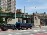
Is it me, or is that bridge height kind of low?
15 ft. That's only a foot underheight by default MassHighway clearance standards, 3 ft. taller than the old span, and 1'1" taller than the adjacent McGrath Overpass.