[continued]
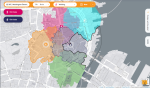
Assuming no heavy rail conversion for GLX, the transit desert is clearly the vast space between Orange and Blue lines: Charlestown, Chelsea, Everett, Revere. Urban Ring can offer circumferential service, but they do have the density for a radial service.
Yeah, this is where the fun begins. This is indeed the transit desert, and I think you could argue in favor of
multiple radial services through here: from Wellington to Orient Heights is 4 miles; Wellington to Harvard is 3 (which of course is halved by the GLX), while JFK/UMass to Jackson Square is about 2.5. (Even Jackson Square to Harvard -- skipping over multiple radial corridors covered by the Green Line -- is only 3.5 miles.)
Three miles from the system center, the radial corridor spacing is generally about 2 miles, but there are cases where it's closer to 1 mile (depending on where you define your corridors to be):
- JFK/UMass <> Uphams Corner: >1 mile
- Jackson Square <> Huntington Ave/Brookline Village: 1 mile
- Brookline Village <> Packards Corner: 1.5 miles
- Packards Corner <> Harvard: 1.5 miles
- Harvard <> Union Sq: 1 mile
- Harvard <> East Somerville: 1.5 miles
So, yeah: if we use 2 mile spacing, that points to one corridor between Orange and Blue. But if we use 1.5 miles, that points to two corridors if not more.
One thing I'll note from the examples above: the spacing between
heavy rail corridors tends to be about 3 miles, with light rail corridors interspersed. So I think the question of how many corridors and where they go is impacted in part by the kind of service that is provided -- which brings me to the next point.
Charlestown and Chelsea can be easily linked via a God-Mode tunnel in the vicinity of Tobin Bridge. But then you face a choice between Everett and Revere, and both are just a bit too far from Orange and Blue lines. Here, I present both options, and I'd say both have good arguments for them.
Regardless of which city you pick, a tunnel under the respective Broadway will probably work best, though also expensive. Both options rejoin at Linden Square (the Revere alignment has the additional benefit of serving Northgate shopping center while doing so). I did consider following Route 1, but the density and land use along the highway ROW is not great.
I agree that both Broadways make for strong corridor candidates. But I think you may be too quick to dismiss Route 1.
First, the 111 -- the closest thing to a blueprint for radial service -- actually adheres pretty close to Route 1:
The biggest deviation is to Cary Square, which doesn't get covered well by a Route 1 alignment -- but I'll note also doesn't get served by a Broadway alignment either.
Now, the first thing to point out here is that the northern half of the 111 runs parallel to Route 1, but does so on a proper city street, as opposed to a highway ROW with that much less accessibility. And this is a good point!
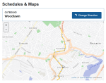
But, at the (very reasonable) three-quarter mile stop spacing you are proposing, a Route 1 alignment would probably only have stations at
Woodlawn and
Revere Beach Parkway-ish -- both locations where a highway station walkshed would overlap pretty well with the bus route's walkshed (particular with concurrent pedestrian access improvements). The local stops along Garfield and Sagamore Aves aren't gonna be replaced by a rapid transit line either way. (What
would happen likely is the 111 getting cut back to a transfer station in Chelsea, a la Dudley in the days of old, which would improve reliability on the route as a feeder service.)
And it's a similar story to the south: after
Revere Beach Parkway, you probably aren't going to have any intermediate stops until you hit the commuter rail line (at which point the Route 1 alignment probably provides the best access to the current
Bellingham Sq station, and affords a slightly long, but still viable, connection to the Chelsea commuter rail station).
So, yes: much of the Route 1 ROW is located away from density and development. But at key
locations along the Route 1 corridor -- the places where you'd put a station -- its access is relatively favorable.
And this is where we come back to what kind of service this is: if it's a Cambridge Subway-style route that is designed to link up transfer stations (e.g. to local routes along Park Ave, Revere Beach Parkway, Washington Ave) at high speeds, then I think the Route 1 alignment is a reasonable contender (and potentially one that could move this proposal out of "God Mode" and into "Crazy Transit Pitch" territory).
If, on the other hand, this is meant to be more of a Blue Line/Green Line-style route, where the radial service itself is providing the "local" service -- akin to the Revere section of the Blue, or the Ashmont Branch -- then I think you're looking at closer stop spacing, and the Broadway routes become more favorable.
If we're in true God Mode, though, I'd suggest an HRT line along the Route 1 corridor, with a pair of LRT lines along each of the Broadways. No idea where I'd connect the LRT lines to the south, but that's an exercise for another day.
Finally: you could also reroute the Orange Line through Everett, and use electrified Regional Rail service to keep modest frequencies to Wellington. You can keep service to both Sullivan and Malden Center, and you can even continue the Orange Line north to Reading if you want. If the Chelsea subway is a Red-X extension, express service to Sullivan + Wellington + Malden Center could be the pair-match for high-frequency Fairmount service.
A rough sketch from last year (where Fairmount service gets divided between Lynn and Malden, but obviously you can play around with that):