Providence developments

Thanks, F-Line, for your typically comprehensive and nuanced overview. I've probably done the 7:45 am from Wickford to South Station (arriving 9:40 am per the schedule) about a dozen times. It's always left on time--never with more than 25 or 30 passengers. I doubt the Wickford parking garage has ever been more than 50% full, ever.

So yes, so far, embarrassingly underutilized. Of course, who can blame the locals? 115 minutes to traverse 62 miles of track (as I measured it). In 2019, that's beyond woeful (although sadly equivalent to Worcester--South Station on the Worcester CR line).

Big picture though: in an ideal world, shorn of petty turf battles/jurisdictional spats and everything else, would a quad-state compact (NY, CT, RI, MA) between Amtrak, MBTA, and the Metro North operator, yield efficiencies? Or is Metro North so vastly dissimilar in terms of infrastructure/logistics (and institutional culture?) from the MBTA's Providence CR line as to make that ludicrous?

The fact is, there looks to be approx. 220 miles of AMTRAK line between South Station and Penn Station--of which 135 miles or so are shared/overlapped with MBTA and Metro North. Well over half!
 
Big picture though: in an ideal world, shorn of petty turf battles/jurisdictional spats and everything else, would a quad-state compact (NY, CT, RI, MA) between Amtrak, MBTA, and the Metro North operator, yield efficiencies? Or is Metro North so vastly dissimilar in terms of infrastructure/logistics (and institutional culture?) from the MBTA's Providence CR line as to make that ludicrous?

Well, at one point it *was* all Penn Central running every intercity and commuter train on the Corridor from Boston to Washington, D.C. But the mega-bankruptcy?...yeah, didn't work out so well.

There is most definitely a hard line at the CT state line where further intermixing becomes impractical. Shore Line East gloms off Metro North's fare system, while RIDOT is all-Charlie for RIPTA buses and will be going AFC 2.0 lockstep with us. There's a similar divide with the Hartford Line vs. PVTA buses in Springfield. Until somebody comes up with an EZ-PASS equivalent for transit that can seamlessly unite the MTA back offices in New York and the MBTA back offices in Boston, this is going to be a difficult divide to heal. That's like AFC 3.0 territory...with the added difficulty that the MTA is many times worse than the T at getting anything half-coherent strung together between its modes.


Lesser but still significant problem is the equipment. Everything MNRR/ConnDOT orders is contingent on being able to fit into Grand Central. The T's bi-level coaches won't fit at all. For EMU's, the need to be able to change from 12.5 kV to 25 kV current at New Haven to operate on Shore Line East adds some complexity, while the need to run on 750V DC third rail to get into Grand Central or Penn Station adds lots of complexity. The M8's are hugely expensive, hugely overweight, and hugely intensive to maintain. No system that did not have those specific conditions of an AC-to-DC change and an AC voltage change would ever opt to buy that car. The T arguably would not be able to afford to pursue RER electrification if it were bound to buying that car with stuff it didn't need just on the chance that fleet overlaps would send some of theirs to New Haven.

As is, if the T wanted to buy New Jersey Transit's new MLV EMU they'd be able to get them cheaper and lighter weight than NJT by omitting the 12.5 kV voltage taps and omitting the 25 Hz frequency transformer core needed for running on the NY-D.C. portion of NEC. You could even run them to New London or Old Saybrook if you wanted to...just don't cross into New Haven where the 12.5 kV changeover is. Seeing as how there's a crapload of Amtrak schedules going that way already...not a big loss if "no New Haven = $$$$ to spend on more RER in Greater Boston where it matters".


And yes, there are some institutional problems...though nothing out of the ordinary. The MTA has flirted with merging LIRR and MNRR into one management entity for streamlining, but they're so different in ops and cultures it proved impractical (as well as the geography served being too divergent for commonality). Amtrak is the line maintainer from South Station to the junction with the Springfield Line in New Haven, and line owner from RI state line to the Springfield Line merge. Same landlord as today. Charter-wise, MNRR crews rule the roost from New Haven State Street station west. Shore Line East trains run to Bridgeport, but the Amtrak crews who are contracted to run SLE have to switch to MNRR crews in New Haven. The arrangement works well, so isn't as cumbersome as it seems on-paper. But when an agency's charter spells out things like that, it's extremely difficult to change it without the legislatures from 2 states getting involved. When the Penn Central bankruptcy court ruled that all operated commuter services had to go public or cease, it took less than 1 year (1973) for the T to re-charter itself into a bigger district with full control of southside commuter rail. It took 10 years (1983) for "Penn Central Metropolitan" to re-charter itself into Metro North...with extremely reluctant interim operator Conrail stuck running it in limbo while the politicians deadlocked.


The way it's always been envisioned, ConnDOT badly wants SLE extended to Mystic and Westerly. Westerly Station is exactly 3 blocks over the state line from Pawcatuck village by foot, and 400 ft. over the state line by rail. Pawcatuck is the most densely-settled part of Stonington, CT...and Westerly is the de facto Stonington stop. There is also a former freight yard and current Amtrak maintenance yard adjacent to the station that would make an ideal SLE layover yard, since they have none in New London and the options by state pier over there are ham-fisted. So it's very much an in-district constituency for them, and has all the operational benefits. They will likely pursue a Westerly extension for SLE with or without a reciprocal RIDOT extension from Kingston.

RIDOT's whole overriding philosophy on the various moving parts of its intrastate dreams is that if you draw a backwards "C" shape by rail from Woonsocket to Pawtucket, Providence, Kingston, and Westerly...four-fifths of the state's population is within 10 minutes of a potential rail station. So while the working group several posts up is making icky-poo faces at Westerly for being an outlier, RIDOT sees it as a core duty to serve the whole state. Both opinions have merit, but the working group needs to stop listening to the sound of its own voice and realize: RIDOT's ultimate opinion is the one that's going to matter. I think you could certainly accommodate Providence-Westerly on a sparser headway and use service layering to densify the I-295 belt. It's pretty much how the T is netting :15 Urban Rail headways on some lines through the interlining of two :30 schedules. No reason why some combo of that can't treat Westerly. Plus the layover yard can be shared by both states regardless of whether they're using unlike fleets; it saves money to have 2 tenants.

The local-to-local transfers at Westerly are no doubt an asset. But because of the different ticketing systems and difficulties therein, it's probably a *little* overrated as a perk. ConnDOT probably cares about the Westerly transfer a bit less than RIDOT does, because as-above Westerly is the Stonington stop by any other name and they meet all their service goals just tapping their own citizens' walkup at the station. There have been various informal proposals to either take SLE north to Kingston or the RI Purple Line south to New London; both of those (moreso SLE-Kingston) start getting rather absurd on distance and constituencies multiple times removed from the train's core service area. So it's a little murky. At the end of the day it's very cut-and-dried to see SLE enthusiastically setting up shop there, and probably an eventuality that RIDOT someday meanders over there. Someday just may be down in the queue over getting more of their intermediate stops built out.
 
As always, F-Line, you are an amazing wellspring of information on these matters--thanks for sharing...
 
Hey folks – now that I can post, here's some news....

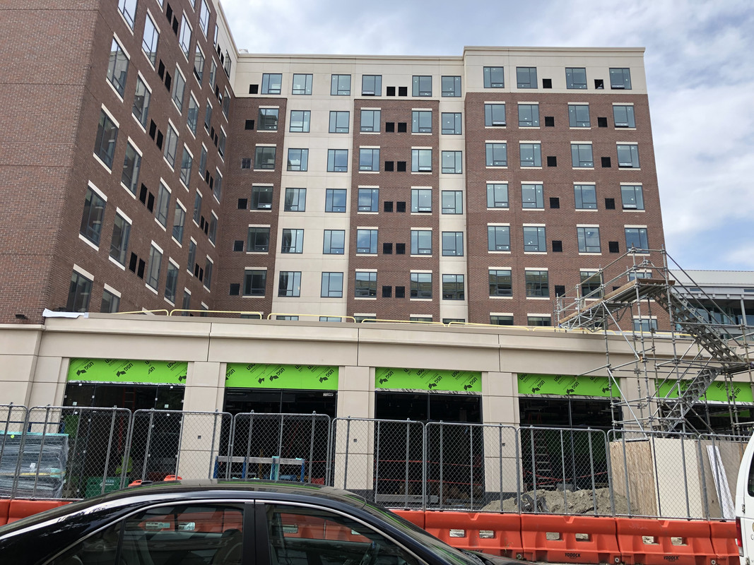
I-195 board gives initial nod to 295 apartments in 2 projects. Parcels 6 & 28. Mess of materials in rendering for 28 but I'll take it. https://www.providencejournal.com/n...s-initial-nod-to-295-apartments-in-2-projects

I also wanted to add a few Fed Hill/ West End projects that haven’t been shared. These are not huge by any means, but they’re filling some holes.

Some infill (yay!) on Westminster:

- Housing under construction at 1492.
via: Providence Planning https://static1.squarespace.com/static/547486a6e4b081cfb2fbb049/t/5b22b08bf950b764ddb87849/152902378

- Extension on top of a storage shed/ garage for Big Nazo. Not yet approved I don’t think but they presented at a neighborhood meeting and the comments were, for the most part, very positive.
Pic and more info: https://www.wbna.org/events/2019/6/4/neighborhood-neighborhood-development

- A fugly stumpy under construction at 1292. This one is topped out
via: Providence Planning http://www.providenceri.gov/wp-content/uploads/2018/01/Planning_DT_1292-Westminster.jpg

- This one is next to the stumpy. Obviously in the beginning stages. It’ll be a new space for Community MusicWorks.
via: Providence Planning http://www.providenceri.gov/wp-content/uploads/2019/05/communitymusicworks.jpg

Nearby we’ve got:

- This boring apt building at 473 Washington. Good to have more bodies around though. They demolished a single-story industrial building to plop this one in. There’s a brick muli-story industrial-type building across the street I hope gets developed. https://www.wbna.org/news/2018/10/24/cdc-project-reviews-110-hudson-473-washington

- And this loooooong awaited co-op (opened today) and apt complex: http://www.providenceri.gov/wp-content/uploads/2018/10/laundrysite.jpg

- With terrible plans moving ahead for the Providence Viaduct, I do home they crush the Dean Street onramp and try and stich back Fed Hill with the Valley. Won’t hold my breath but I understand this was discussed.
 
Thanks, Nicanbot.
I like those Wickenden apartments, Providence needs something like those.
 
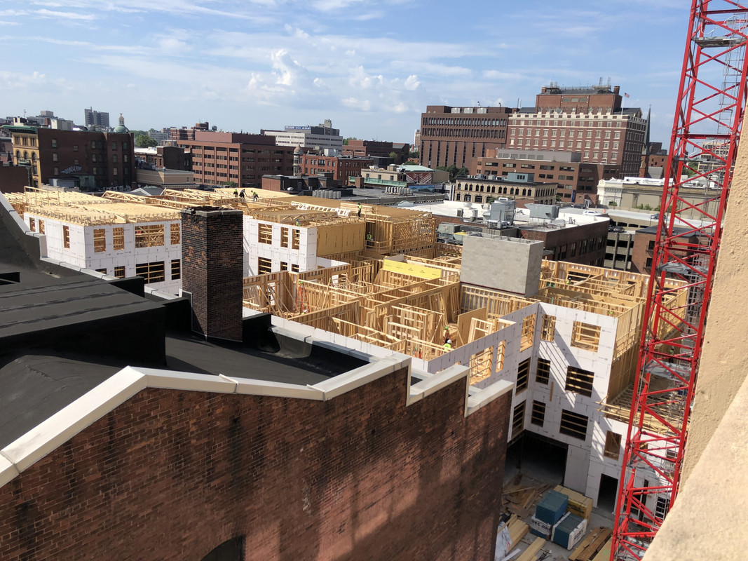
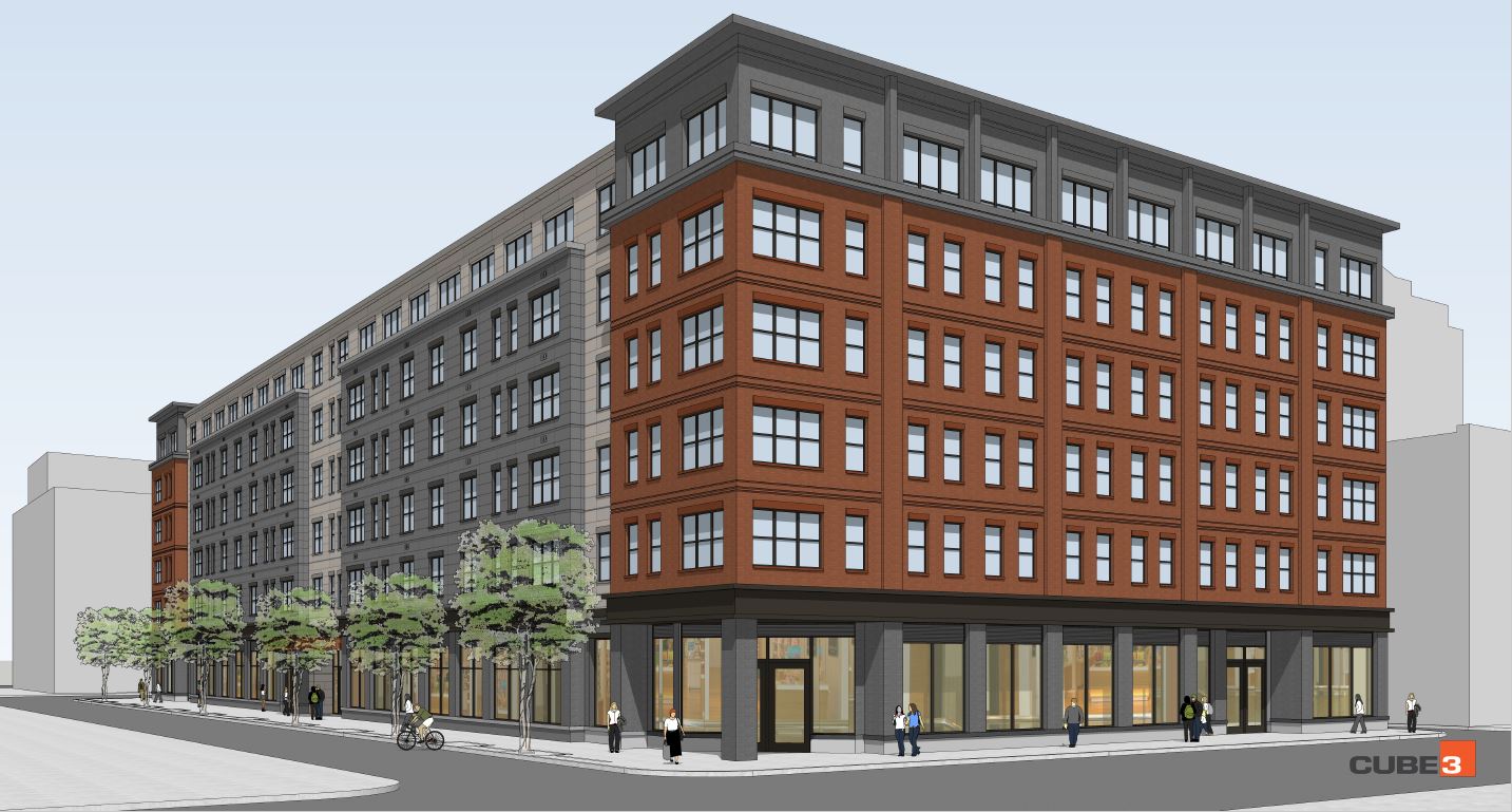
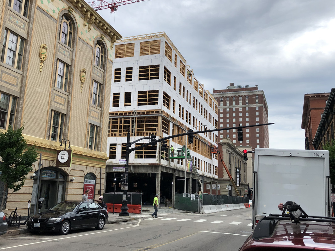
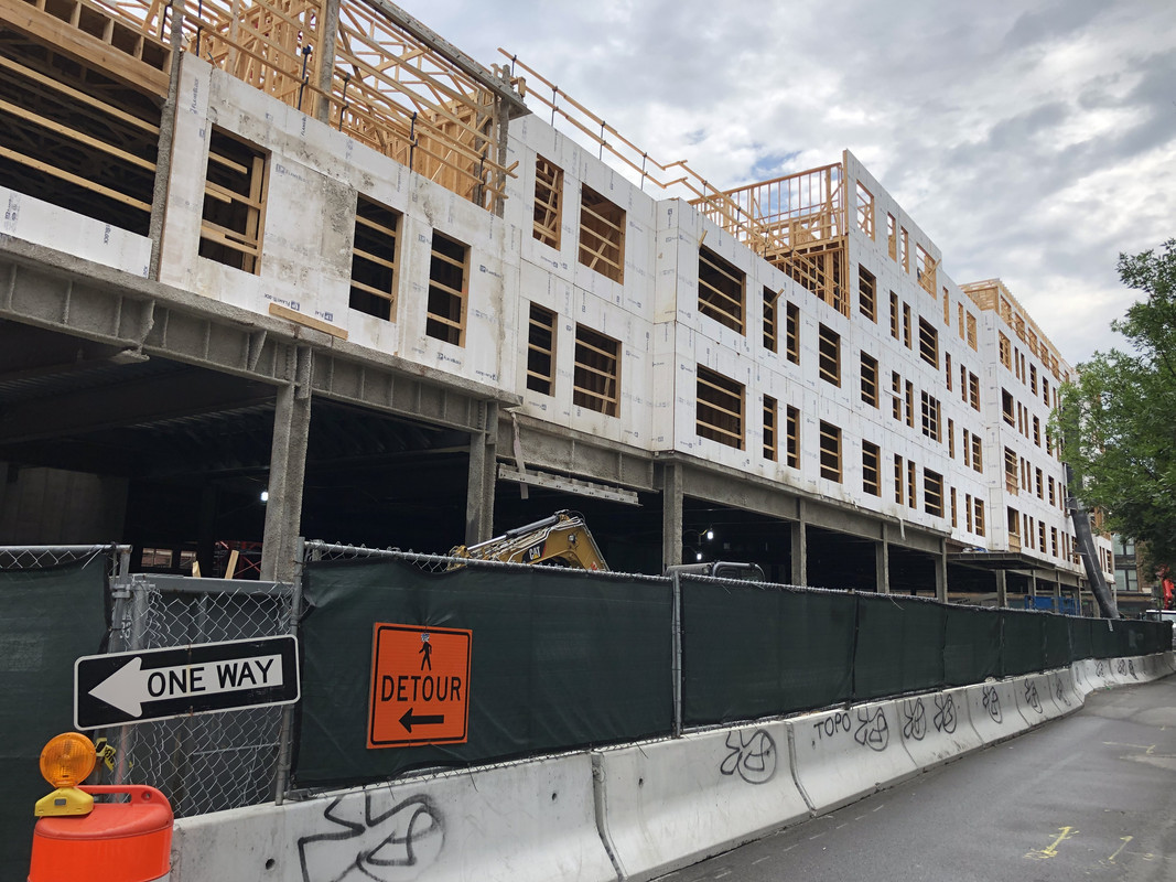
78 fountain st well on its way

https://falloutfacts.com/microfusion-cell-bulk

PVD.jpg
 
That one is a real game changer! Huge lot being filled. :dance:
 
PS. Sharing this note from the PPS in the event somebody wants to go:

--
I-195 Redevelopment District

The Commission meets Wednesday, July 24. The agenda includes action on proposed development at Parcels 6 -- Truth Box/D+P Real Estate and Parcel 28 -- Exeter Property Group, along with presentations on the City Walk and Aloft Hotel (191 Dorrance).

The Commission will meet at 5 pm at 315 Iron Horse Way, Ste 101. The full meeting agenda can be found here: https://opengov.sos.ri.gov/Common/DownloadMeetingFiles?FilePath=\Notices\5943\2019\339588.pdf
 
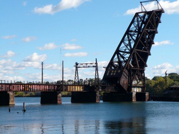
It looks like the Crook Point Bascule Bridge over the Seekonk is being scheduled for demolition in 2026-2027

2809746.jpg


One additional interesting thing of note is that this is at the eastern portal of the East Side Railroad Tunnel (not to be confused with the Trolley Tunnel), which spans under College Hill (passing below the Brown University Sciences Library) and used to link Union Station to East Providence. The western portal is near N Main St. and Elizabeth St., pointing directly at One Citizens Plaza and potentially the Edge College Hill 2 even sooner. This tunnel has been shuttered for a long time and there appears to be no serious proposals for reuse, only a couple of sketches and musings. The main headaches seem to relate to how to link it in any way to the inconveniently relocated train station. While there are certainly many downsides and expenses to the following idea, I think it could be interesting to consider running a form of light rail from Moshassuck Ct. (or a tunnel under the Avalon to connect internally to the station), elevate to the tunnel, and then continue to a reclaimed East Bay Bike Path all the way to Roger Williams University. Perhaps an addition (directly under?) to the Mt. Hope Bridge could then carry it to the existing rail line to Newport (or a new tunnel - bore or c&c down 114).

It'd be about 30 miles of rail on largely (but not entirely) existing ROWs, with the opportunity for a couple of branches (for instance, east after Mt. Hope to go to Fall River MA on existing rail):
pti6D4bl.png

And could compliment the only existing RI regional rail plan, which is entirely focused on the NEC:
Z9sQgAjl.png
 
With the success of the Hartford Line, it seems the writing is on the wall for RI to develop commuter rail. It'll be a bizarre world for Hartford to succeed on the failings of Providence especially in the age of CT's fiscal dilemma, but here we are.

The proposal to connect Providence to Fall River and New Bedford through the tunnel seems like a smarter long term proposal than SCR.
 
$400 million Pawtucket project includes pro soccer stadium:


Some welcome news for buds in Pawtucket. Fingers crossed!
 
$400 million Pawtucket project includes pro soccer stadium:


Some welcome news for buds in Pawtucket. Fingers crossed!

I like the idea of the Commuter Rail stop. But as we speak, my Rhode Island friends are in full denial over the fact that they lost the PawSox and I got shut down for saying that you can blame BOTH your governor and Larry for this. No need to pick sides.

Meanwhile, taxpayers are footing somewhere between $70-80 million for this mea culpa of a project. It truly is “sorry about the PawSox. Here’s a USL team to fill the void. You’ll still be footing the bill whether or it it takes off.”

Gina didn’t want to write the PawSox a blank check, so she ushers in a USL team to Pawtucket based on the league’s success out in Phoenix. Got it.
 
The proposal to connect Providence to Fall River and New Bedford through the tunnel seems like a smarter long term proposal than SCR.

I argued/advocated for this months ago on AB given my feeling (and I emphasize, mere feeling), that Fall River and New Bedford more "naturally" belong in Providence's hinterland than in Boston's, given that they're 20 miles away vs. 60 miles away, and therefore it's insane to do South Coast commuter rail when instead you could tether them to Providence like that.

But then F-Line, in his inimitable style, gave a typically comprehensive summary of why NB/FR commuter rail to Providence along the I-195 corridor is permanently screwed, for some very esoteric (as I recall) infrastructure reason.

Perhaps if he sees this post he can re-share it...
 
Where would they go? There aren't much in the way of jobs in Providence.
 
Where would they go? There aren't much in the way of jobs in Providence.

Well, there's got to be... something... causing I-195 westbound through Swansea, Seekonk, East Providence, to be badly jammed-up during the morning commute. Anecdotally, from the few times I've experienced it, it's quite congested.

They're predominantly using I-195 west to then drive up 95 N to head to jobs in metro Boston? Possibly--but then why don't they simply drive up 24 N?

FWIW, this site says a little over 820,000 jobs in metro PVD.
 
I argued/advocated for this months ago on AB given my feeling (and I emphasize, mere feeling), that Fall River and New Bedford more "naturally" belong in Providence's hinterland than in Boston's, given that they're 20 miles away vs. 60 miles away, and therefore it's insane to do South Coast commuter rail when instead you could tether them to Providence like that.

But then F-Line, in his inimitable style, gave a typically comprehensive summary of why NB/FR commuter rail to Providence along the I-195 corridor is permanently screwed, for some very esoteric (as I recall) infrastructure reason.

Perhaps if he sees this post he can re-share it...

There's no ROW available. The Warren Branch is obliterated after the state line by the entire Ocean Grove neighborhood of Swansea that built over it post-abandonment. And any/all attempts to try to find a graft-on trajectory to I-195 become an exercise in futility with all the wetlands, ocean inlets, and wretched insertion-angle geometry to contend with. Of all the Crazy Transit Pitches wishlist items that can be quantified with some tangible demand, this may be the most real-world physically impossible of the whole lot. Which is really saying something given the proposals we regularly toss around here. 😞


Unfortunately when the line was in-service it was handicapped by the extreme weight-restricted rail upper deck of the Slades Ferry Bridge, which could only take the wood-bodied ultralight interurban-like EMU's that the Old Colony ran captive to East Providence electric territory and not any type of standard RR equipment. All the steam trains hauling New York weekenders to Newport had to go the long way Providence-Attleboro-Taunton-Fall River, and no freight could ever cross the bridge. It was basically relegated to "the last unicorn" status of the whole pan-NYNH&H system equipment-wise, propped up through the 1920's only by pretty strong ridership. When the Great Depression wiped out the railroad's finances and hit ridership hard they had to immediately curtail the commuter-oriented EMU service to save money, leaving literal zero other traffic they were capable of running that way. With no excuse to keep the line open, it was immediately torn up. Had the bridge been able to take something/anything of standard car weight they would've easily been able to justify keeping it open because the NY-Newport trains would still be running through the late-50's and would save loads of time this way instead of the around-the-horn routing, while many freight routings could've been consolidated out that way providing further justification for its continued existence. Alas, no one had money to replace that flimsy bridge with something better until the failing road deck got condemned in 1970 and the state demolished the whole thing for scrap sans any planned replacement. The bridge was at the rotary-to-nowhere on MA 103 a stone's throw south of the now-derelict Brightman St. bridge, and connected on the Fall River side at the Remington Ave. dead-end. Excess retaining wall weirdness on Pearce St. behind the strip mall on Davol tips off where the Warren Branch met the Newport main at the old station entrance to Fall River Depot.

It doesn't help either that the Old Colony never filled the 3800 ft. gap separating the Newport main downtown from the stub end of the Wattupa Branch @ Plymouth Ave. precluding any direct thru-route connection to New Bedford, and that by the time the I-195 canyon and New City Hall air rights went into design in the late-50's the RR was too cosmically broke and eager to dump the Old Colony commuter rail lines that it didn't/couldn't make any design stand for a ROW reservation in the new expressway cut completing the missing link at long last (if for no other reason than freight-usefulness). By the time the first short segment of 195 opened downtown in '63 commuter rail to the South Coast had already been gone 5 years.

---- ---- ---- ----

In a parallel universe where the Slades Ferry Bridge wasn't such an achilles heel, you'd probably see the South Coast rail lines consolidated into something more like this:
  • fully preserved Warren Branch, and even if the East Providence tunnel still closed in '81 all the same at least some east-side freight out of Pawtucket still coming that way.
  • a Wattupa Branch that fully spanned the whole way from Fall River to New Bedford, acting as primary freight lane between both ports to this day.
  • a different Depression-era consolidation of the routes from Boston. As is, the Somerset Branch (a.k.a. south extension of the Stoughton Line straight out of Taunton) got truncated despite originally being the preferred passenger route so they could save coin retiring the Mallard Point drawbridge. Traffic got re-routed further east onto the *current* Fall River Branch (a.k.a. ex- Lakeville Branch) through barren Freetown State Forest at slight schedule penalty but much much easier maint costs and no drawbridges. Somerset Branch is full MassDOT-landbanked to within 1 mile of Mallard Point because it stayed in various states of use/semi-disuse until the 1980's, but the mile to the old draw is completely and utterly obliterated by rich housing. In the parallel universe where the Warren Branch stayed and crossed a newer/better bridge, they would've seen fit to re-route the Somerset Branch west of Somerset Reservoir for a few miles through (then) farmland along Route 138 to junction with the Warren Branch at a consolidated crossing. That is: all Boston OR Providence traffic crosses the river at the same place, and service to New Bedford vs. Newport branches at Fall River Depot dead-center downtown instead of way the hell out in Myricks.
  • Lakeville Branch (current route) in the forest between Myricks and FR Depot gets abandoned instead. New Bedford Branch (a.k.a. Old Colony mainline to Lowell) north of the airport probably stays after the dust settles as a secondary freight connector for the still present-day critical yards at Framingham and Middleboro...but never catches a whiff of passenger interest ever again because the FR Depot hub + Wattupa Branch are so much superior for pooling/distributing.
We don't live in a parallel universe, however, so all these pegs knocked out between 1938-1958 are utterly, totally nuked of any possibility of reconnection.
 

Back
Top