T photo of the day

No deal on talks to reopen GE gear plant for rail work
Originally Published on Friday, April 15, 2011
By Thor Jourgensen / The Daily Item
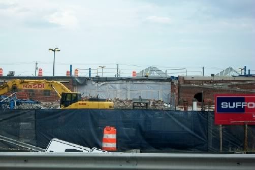
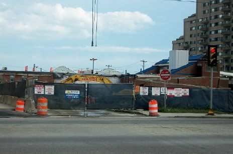
LYNN - General Electric has shelved a proposal to bring locomotive production to the River Works gear manufacturing plant

Company and union estimates on the amount of jobs the rail work would have generated ranged between 300 and 350. The gear plant closed last year after 75 years of marine gear production.

GE River Works executives opened talks with IUE in March to bring rail jobs to the gear plant after General Electric's Transportation Division started looking for plants to handle excess work orders for locomotives built at its rail plant in Erie, Pa.
With the gear plant talks ended, Gorham said GE Transportation will now consider locomotive manufacturing sites in other parts of the country, including Texas.

"We'll move forward with the original plan to demolish the building later this year," Gorham said.
 
Facility being demo'd: http://maps.google.com/maps?hl=en&ll=42.449586,-70.967115&spn=0.00268,0.005681&t=h&z=18

Facility still very much active: http://maps.google.com/maps?hl=en&ll=42.452492,-70.972592&spn=0.005359,0.011362&t=h&z=17


Since the one they're demo'ing is between the commuter rail and former BRB&L, I think the land should definitely be bought by the city, state, or MBTA. I've determined that a Blue Line yard here, should the extension happen, could be 2.5 times the size of the Orient Heights Yard, and then the Orient Heights Yard could be reverted (at least most of it) back to the Belle Isle Marsh. Otherwise, this will likely either be another empty GE lot in Lynn or a poorly placed, and potentially Blue-Line-blocking, development.
 
There are actually two plots, JohnAKeith--there's Forsyth Park (the area I think you are talking about) and the area right next to the MFA (the strip between the widewalk and the street). That strip is pretty substantial and integral to the MFA--it could easily be serviced from the museum. I think the strip is a no-brainer. Forsyth Park is definitely prime property that could be much better used as an outdoor space, but I can see why that would be hard to get rights to and to service (unless a facility were built on-site). Someplace like Forsyth Park would be a kick-ass beer garden--not a frat boy hangout, but a place with simple pub foods, some good local brews and a few house wines. I live about 30 yards away...they would be assured of at least one steady customer! :D

The MFA should work out a deal with BRA -- MFA puts a cafe into Forsythe Building ground floor city lets them spill out into the park April through November
 
On the upside, there are food trucks coming into this area of Fenway. I think one of the locations is right next to the Forsyth building.
 
IMG_0223.jpg


IMG_0224.jpg
 
The MFA should work out a deal with BRA -- MFA puts a cafe into Forsythe Building ground floor city lets them spill out into the park April through November

Great idea. (though MFA has leased the building to NEU for 5 years, I think).
 
On the upside, there are food trucks coming into this area of Fenway. I think one of the locations is right next to the Forsyth building.

Yeah, right behind my building. I don't think this is a positive thing. Food trucks are a transient flavor-of-the-month kind of thing that do nothing to improve the street life of a neighborhood. I think a truck over near the Duck House in the Fens is a good idea, however.
 
Facility being demo'd: http://maps.google.com/maps?hl=en&ll=42.449586,-70.967115&spn=0.00268,0.005681&t=h&z=18

Facility still very much active: http://maps.google.com/maps?hl=en&ll=42.452492,-70.972592&spn=0.005359,0.011362&t=h&z=17


Since the one they're demo'ing is between the commuter rail and former BRB&L, I think the land should definitely be bought by the city, state, or MBTA. I've determined that a Blue Line yard here, should the extension happen, could be 2.5 times the size of the Orient Heights Yard, and then the Orient Heights Yard could be reverted (at least most of it) back to the Belle Isle Marsh. Otherwise, this will likely either be another empty GE lot in Lynn or a poorly placed, and potentially Blue-Line-blocking, development.

You do realize they already have several of those developements blocking the path down the line...one at Oak Island Street, one at Carey Circle, and numerous backyards, streets, and even Rt. 1A itself built on top of the old right of way...GE letting someone get the land isn't a stretch when the state already did it decades ago.

They have to cross 1A between Jackson Street and York Street and joint up with the commuter rail line on the other side of the marsh because they can't possibly fight the needed battles to go the entire length of Point of Pines using the old routing.

Yes, I do realize, and stand by my routing.
 
Yes, I do realize, and stand by my routing.

Then you are being absurd(and I stand by my claim here) in forcing a routing that makes absolutely no sense economically, geographically, environmentally, or politically.

Keeping it that route not only impacts the most people but kills any potential chance the project has. It's one thing to be nostalgic and want the best, it's another to be naive and stubborn.


Economically: The BRB&L routing was deemed the cheapest (however, let's assume buying the properties that have built on the ROW weren't calculated, it would still be cheaper to toss them in).

Geographically: What's wrong with it? It goes through a populated area which could potentially be redeveloped into a very dense, close-knit place instead of through a marsh.

Environmentally: I support this routing over going through the Rumney Marsh, yes. I see that as better environmentally.

Politically: Who cares what's best for politics? Politics are trash.
 
Economically: The BRB&L routing was deemed the cheapest (however, let's assume buying the properties that have built on the ROW weren't calculated, it would still be cheaper to toss them in).

Enviromental mitigation will tie up a large chunk of money, as will the closure of several streets including the major Oak Island Street as well as the massive Rt. 1A flyover that will have to be built. Then you have the lawsuits that will tie up more money because it's going right behind the urbanized part of Point of Pines built on both sides of the routing.

Geographically: What's wrong with it? It goes through a populated area which could potentially be redeveloped into a very dense, close-knit place instead of through a marsh.

It's on a natural lowland that is flooded 95% of the time as well as being on the spine of Point of Pines cutting the entire length in half from the flyover to Revere Street. At least with a new rail flyover they could mitigate this entirely by putting it alongside the rail line above and away from the neighborhoods that actually CAN'T develope any more- they are packed in as it is with the marsh and the beach prohibitting further developements. The last actual attempts fell through and those were on the beach side away from the line.

Environmentally: I support this routing over going through the Rumney Marsh, yes. I see that as better environmentally.

This is a joke, seriously. This routing has MORE impact than the one putting it alongside the commuter rail. A several hundred foot long viaduct vs. a trackbed on top of the marsh stream is better environmentally.

THat's also not taking into consideration the impact the amount of required driving and backups that your routing will cause due to the project directly impacting Rt. 1A at multiple locations. You may not care about this, but we residents do.

Politically: Who cares what's best for politics? Politics are trash

Tell that to the people at Jack Satter House who hold the reigns for a large chunk of Revere's politics. These people would fight tooth and nail to kill the project as routed your way due to them being cut off from the city due to the line going right alongside their home with Oak Island Street cut off from the rest. It's trash to you but it's treasure to them.


Sorry to others for the tangent, but as a local in the neighborhood this hit a nerve. Pictures of the T with progress at Wonderland's developement coming as a payment for the tangent.
 
They haven't done an EIS so it is an unknown what complications either ROW has on it. Until the Army Corps does the survey minutiae they're both in equal play, and both probably have hidden complications that would turn up requiring mitigation. The BRB&L ROW is the better-studied of the two because that was the preferred routing for 50 years. Eastern Route is living on a trackbed that's been static over a century and hasn't needed any much of any fresh permitting for in-place work the T has done or floated as possibility.

So there are more unknowns with the swamp requiring deep survey than the BRB&L, even with the Eastern Route being the current #1 preference. There are EIS unknowns with the BRB&L, too, it's just not quite as much of a blank slate with it having a longer history of being attached to this proposal. But we have no way of truly knowing which is going to come out on top until a formal prelim EIS is performed. And as long as the T thinks laws are made to be broken on following the Transit Commitments, we apparently never are going to know.
 
Enviromental mitigation will tie up a large chunk of money, as will the closure of several streets including the major Oak Island Street as well as the massive Rt. 1A flyover that will have to be built. Then you have the lawsuits that will tie up more money because it's going right behind the urbanized part of Point of Pines built on both sides of the routing.

The Blue Line could have a brief flyover of Oak Island Street; that street doesn't necessarily have to be cut off. Also, a replacement of the General Edwards bridge could be rolled into the project of the 1A flyover. And one abutting side is a highway in Point of Pines, with any urbanized parts being on one side.


It's on a natural lowland that is flooded 95% of the time as well as being on the spine of Point of Pines cutting the entire length in half from the flyover to Revere Street. At least with a new rail flyover they could mitigate this entirely by putting it alongside the rail line above and away from the neighborhoods that actually CAN'T develope any more- they are packed in as it is with the marsh and the beach prohibitting further developements. The last actual attempts fell through and those were on the beach side away from the line.

There's still visible remnants of the embankment from the BRB&L which appear to remain pretty dry pretty often. Putting it away from the neighborhoods means putting it away from the ridership, present or future (assuming there's "not enough" at present). It's packed, but there's plenty of air above. When you can't build out, you can build up.


This is a joke, seriously. This routing has MORE impact than the one putting it alongside the commuter rail. A several hundred foot long viaduct vs. a trackbed on top of the marsh stream is better environmentally.

That viaduct doesn't just appear there at the wave of a wand, they have to get there, in the middle of the marsh to get that flyover in there. Then they have to work along that rail line in the middle of the marsh for a couple miles and widen the Eastern Route's ROW in the middle of this marsh. The stream I can see, until I actually get a chance to walk the BRB&L if possible at all, is a dug out channel alongside the BRB&L which runs down to Wonderland, under a neighborhood, and allows the area around the dog track to flush with the tides. This can be maintained where it is, or moved slightly to the west a couple feet if the width is needed, or even placed in a culvert as it already is under the neighborhood at Neponset Street.


THat's also not taking into consideration the impact the amount of required driving and backups that your routing will cause due to the project directly impacting Rt. 1A at multiple locations. You may not care about this, but we residents do.

For the most part, they could drive right up the ROW from various points, at either ends, or off of 1A at temporary cut outs. There's not going to be trucks, cranes, and whathaveyou just sitting on 1A hogging lanes all day.


Tell that to the people at Jack Satter House who hold the reigns for a large chunk of Revere's politics. These people would fight tooth and nail to kill the project as routed your way due to them being cut off from the city due to the line going right alongside their home with Oak Island Street cut off from the rest. It's trash to you but it's treasure to them.

Again, Oak Island Street doesn't need to be cut through, but can be passed over. I find it to be the definition of irony that potentially building a station is cutting people off from the city. Don't know who Jack Satter is, but he clearly shouldn't be at the "reigns for a large chunk of Revere's politics". This is about the overall benefit, and not just now, but the future too. This isn't about this guy's personal desires.
 
Don't know who Jack Satter is, but he clearly shouldn't be at the "reigns for a large chunk of Revere's politics". This is about the overall benefit, and not just now, but the future too. This isn't about this guy's personal desires.
Ha Ha! Jack Satter house is an apartment building for seniors next to Kelly's.
 
The Blue Line could have a brief flyover of Oak Island Street; that street doesn't necessarily have to be cut off. Also, a replacement of the General Edwards bridge could be rolled into the project of the 1A flyover. And one abutting side is a highway in Point of Pines, with any urbanized parts being on one side.


There's still visible remnants of the embankment from the BRB&L which appear to remain pretty dry pretty often. Putting it away from the neighborhoods means putting it away from the ridership, present or future (assuming there's "not enough" at present). It's packed, but there's plenty of air above. When you can't build out, you can build up.


That viaduct doesn't just appear there at the wave of a wand, they have to get there, in the middle of the marsh to get that flyover in there. Then they have to work along that rail line in the middle of the marsh for a couple miles and widen the Eastern Route's ROW in the middle of this marsh. The stream I can see, until I actually get a chance to walk the BRB&L if possible at all, is a dug out channel alongside the BRB&L which runs down to Wonderland, under a neighborhood, and allows the area around the dog track to flush with the tides. This can be maintained where it is, or moved slightly to the west a couple feet if the width is needed, or even placed in a culvert as it already is under the neighborhood at Neponset Street.


For the most part, they could drive right up the ROW from various points, at either ends, or off of 1A at temporary cut outs. There's not going to be trucks, cranes, and whathaveyou just sitting on 1A hogging lanes all day.


Again, Oak Island Street doesn't need to be cut through, but can be passed over. I find it to be the definition of irony that potentially building a station is cutting people off from the city. Don't know who Jack Satter is, but he clearly shouldn't be at the "reigns for a large chunk of Revere's politics". This is about the overall benefit, and not just now, but the future too. This isn't about this guy's personal desires.

In other words, no matter how much logic and facts are presented it's your routing or nothing. I get it, you demand the nostalgic routing and it doesn't matter what the hell anyone else says regardless.

I give, have your routing. End of discussion, to be picked up when anything actually happens regarding the project.

Now to return to the topic and delete this tangent some pictures of the day of the T: Wonderland Station's partial demolition and ongoing garage construction as part of the new Waterfront Square transit oriented developement paid for with your federal and state tax dollars...

100_0914.jpg

100_0912.jpg

100_0911.jpg
 
It has nothing to do with nostalgia. TBH, you sound like you're just being a NIMBY.
 
It has nothing to do with nostalgia. TBH, you sound like you're just being a NIMBY.

I live not far from the project area. I am directly impacted by it. Call me one if you feel that you need to win an argument about a proposed rail line that isn't going to happen for decades. Congratulations. You win. Bravo.
 
I live not far from the project area. I am directly impacted by it. Call me one if you feel that you need to win an argument about a proposed rail line that isn't going to happen for decades. Congratulations. You win. Bravo.

I don't feel the need to win; I thought we were having a lovely little debate but you folded like a lawn chair. But maybe I'm right if it was just that easy.

And judging by where you are, if I do indeed have it correct, either routing will still be your proverbial "backyard". I really don't see what the fuss is. We can build a line through a marsh to serve no one at all or we could potentially serve people by sticking to developed land.
 

Back
Top