Brattle Loop
Senior Member
- Joined
- Apr 28, 2020
- Messages
- 1,167
- Reaction score
- 2,084
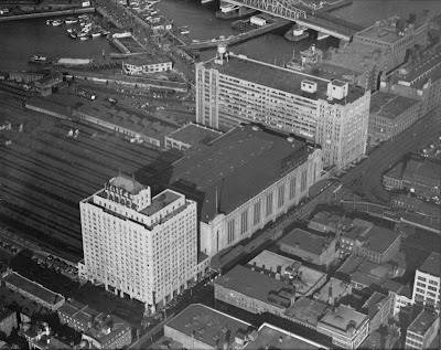
The high platform at the east end of the old Green Line el station (at North Station) was the stub northern end of the Atlantic Avenue elevated line, which was part of what is today called the Orange Line. The elevated line began as a single stub track alongside this high platform at North Station (with pedestrian access to North Station), then shared the OL elevated line along Causeway Street, then branched off at Commercial Street, continuing on Atlantic Ave (as a double track elevated) to South Station, then continuing further south to tie back into the OL elevated mainline at Washington Street, about where the Mass Pike is now.
Fascinating, I hadn't even realized the shuttle platform had ever been there. Apparently the shuttle trains stopped on the far side of the platform (closer to North Station than the trolley in the video Riverside linked). Anyone know if there was a passageway below the shuttle platform, or did you have to go via that platform to get to the connector to the Garden?


