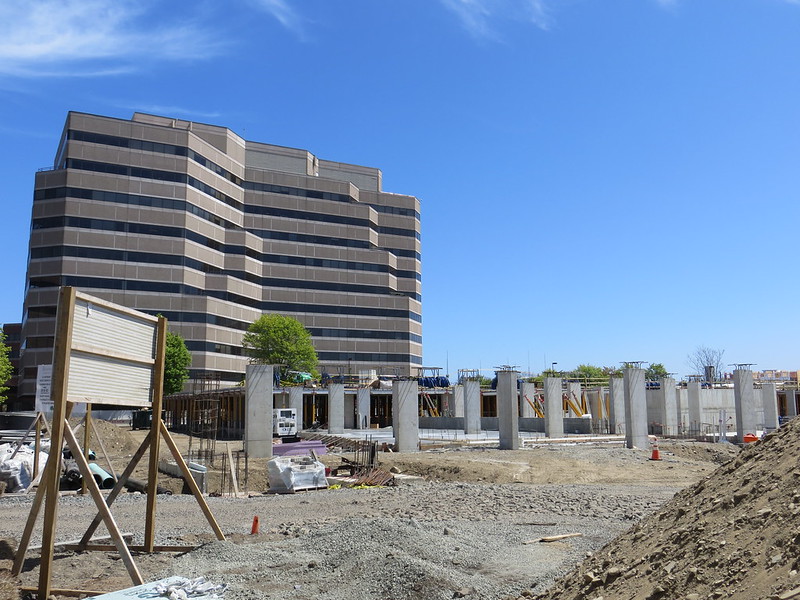
West Cambridge / Alewife Area Infill & Small Developments

Wow, that tunnel thing was from a cow path?! That's pretty cool.

I took a train to Belmont and back to kill some time a couple weeks ago and saw that -- I couldn't figure out what the heck it was! That'd be wicked awesome to use for a path, though.


The Fitchburg Cutoff Extension to Belmont Center and Belmont Station certainly is incredibly easy. I'm hoping it's official and starting ASAP -- it couldn't be any more simple.

Yeah. There is (or at least was prior to the bridge rebuild...don't know if it's been reinstalled) a placard on Walden St. next to the bridge describing the 19th century Porter Sq. slaughterhouses. The cattle were brought in to the West Cambridge freight yards, then hoofed it next to the tracks to get down the street to the meat-packing district. They grade separated Walden St. in part because of all that cattle traffic, and built the brick arch cow tunnel with the original bridge.

Since it's a historic structure, when they ripped out the old bridge 5 years ago they preserved it, did a full restoration job, and encased the new bridge abutments around it. Literally good as new. And it's literally just the same chain-link fence + pave job as the Belmont extension of the Cutoff path to get that Danehy footbridge-to-Sherman connector, then the Pemberton/Walden Sq. extension, then through the cow tunnel. The only tricky part might be the incline up Mass Ave. when it reaches Porter. I bet $1M is sufficient to do the entire at-grade length from Danehy to the foot of Mass Ave., then probably equal amount to get upstairs to Mass Ave. It's not like there's enough room on a single track berth of an active ROW to landscape benches or plantings or anything like the H2O Branch or Somerville Community paths. But the Fitchburg is so incredibly wide Porter-Belmont Ctr. because of the ancient freight yard leads and those old-timey cattle drives they used to do next to the tracks that it's tailor-made for a cheap and effortless rail-with-trail.

Plus, like I said, people are already using it as a shortcut to/from Danehy, Sherman, and the Pemberton overpass, and no amount of MBTA surveillance has curbed that practice. Especially with the kids. It's kind of they either acknowledge the fact that the people have already spoken--for decades now--on the need for this and do it already, or make sure they keep top-notch liability insurance for when the exploding residential population and school building boom around Alewife gets somebody flattened on the tracks.


EDIT: Wikipedia's got its own article on the Walden St. cow tunnel: http://en.wikipedia.org/wiki/Walden_Street_Cattle_Pass. Nice shots of the restoration job they did on it during the bridge rebuild. The tunnel is original 1857 construction...but the bridge is actually a third-generation span over the same old brick arch.


BTW..."Porter" Sq. is derived from. . .
. . .the Porter Hotel, owned by. . .
. . .Zachariah Porter, who was. . .
. . .originator of the "porterhouse" steak, served at his hotel.

Center of the beef universe, indeed. Except for all the best nearby steaks now being in Davis. :rolleyes:
 
Last edited:
EDIT: Wikipedia's got its own article on the Walden St. cow tunnel: http://en.wikipedia.org/wiki/Walden_Street_Cattle_Pass. Nice shots of the restoration job they did on it during the bridge rebuild. The tunnel is original 1857 construction...but the bridge is actually a third-generation span over the same old brick arch.
Found a finished view of the reconstructed brick. Clearly ready for its bike path ;-)

tmp3CE.tmp_tcm68-1368213.jpg
 
Found a finished view of the reconstructed brick. Clearly ready for its bike path ;-)

tmp3CE.tmp_tcm68-1368213.jpg

I've seen it up-close from the embankment. It's not quite as short as it looks in that photo, but they might have to scoop out a foot or more of fill from the floor so nobody standing up straight on a bike is in danger of hitting their heads. Those cattle were herded by dudes on horseback, so at one point it had to have had a bit more vertical clearance above the sediment than that.

But a very cool piece of history screaming for an everyday use.
 
I'm not sure how it fits into all of those other paths, but at the public hearing for 130 cambridge park drive (residential behind 100 cpd), the developer agreed to have a landing site for a ped/bike bridge over the tracks towards fawcett street.
It wasn't clear how the speed of a study would interact with a developer who's ready to go soon.
 
Womp, I still have the pipe dream of the GLX extending to Porter and beyond to Watertown. Realistically Porter will be the end point, but would be nice to share that RoW between LRV and a trail.
 
Womp, I still have the pipe dream of the GLX extending to Porter and beyond to Watertown. Realistically Porter will be the end point, but would be nice to share that RoW between LRV and a trail.

Problem is it's only landbanked to School St., Watertown. The section to the Square was abandoned by B&M in 1960 and has reverted back to abutters. Except for the B&W dealership plunked right on top of the ROW it is mostly intact through industrial backlots and even has surviving rail in spots. But it's constrained and wouldn't fit 2 LRT tracks. Whereas walk the finished portion of the trail from School to Arlington and it's like, "Damn, this thing is wide."

Watertown in its long-range plans wants to reclaim string a contiguous trail together and over the years flip all those scuzzy car shops over to street-facing redevelopment to make Arsenal a bit more vibrant a mixed-use neighborhood. But that's going to be a multi-decade effort when it comes to dealing with individual property owners, and getting new developers to shift their buildings to the street to allow for the trail easement. With long odds of total 100% success. So it's not like you could say "OK, target Green Line to H2O Sq. for x year" because it's not in anyone's control. As much as Watertown really wants it as an end goal.

I don't think the Mall is a good-enough terminal to start. A GL extension really needs to hit the Square to do well and recycle the carhouse. Arsenal street-running the remaining distance probably isn't going to cut it to anyone's satisfaction.


That said, this is gonna be a HEAVILY used trail when it's complete. Like, Minuteman to Arlington Ctr. utilization as a bona fide transit line. I can't stress enough from living in North Cambridge for years how much a royal PITA it is to get to a choice destination that's right fucking there as the crow flies. That's gonna be big. And DCR did an outstanding job with the landscaping on the first trail segment. Highly recommend checking it out. Surprisingly leafy and pretty. They even preserved the old track switch to the ex-Arsenal siding as a historical monument to the line's crucial role transporting WWII munitions.
 
Oh I love rail trails, especially when there's a lack of adequate transit to otherwise neighboring areas, like Minuteman to Arlington as you mentioned. As I said, Green Line to Watertown via Cambridge is just a pipe dream that won't end up in the tubes until the RoW is stitched back together along Arsenal. Definitely not in the next 25 years.

Besides the property issues in Watertown, the Fresh Pond Pkwy crossing would be troubling as well. Honestly it will also be an issue for a bike trail. Ins't there's plenty of room along the RoW back towards Danehy to elevate over the FP pkwy? The issue being that the elevated portion would need to be gradually reduced along the Fresh Pond side heading south, which NIMBYs would howl about (or NIMPs "Not-In-My-Park" I suppose).

The DCR trail plan doesn't include the parkway crossing. It's supposed to end at the Waterworks building and merge into the existing bike path along the parkway and Concord Ave. The tracks that go through the Waterworks front lawn are just going to become...lawn. And anyone crossing to the other side uses the existing crosswalks.

No plans as of yet for the ROW on the other side of the crossing behind the mall. Although that would be a pretty simple one, and beneficial for giving the schoolkids a safer walk to Danehy than along New St. But that segment would be a separate city job, not the official DCR "Watertown Greenway".


Obviously if the GL ever came through there the parkway would have to be grade-separated. A duck-under would be pretty trivial to do. But it's not necessary for the paths because the 4 ped lights flanking the rotaries on the parkway and Concord are pretty safe and have frequent cycles. Drivers are a lot more obedient at the reservoir crossings than they are at the more perilous Mall driveway/Terminal Rd. light or the Rindge and Cambridge Park Dr. lights.
 
Reminds me of the Tip O'Neil building as well. Is there a name for this kind of style?

I believe it's the "Tear it down ASAP and please try something totally different" School of architecture.
 
How crazy is it that now that the Fitchburg Cutoff bridge at Alewife is open, the Fitchburg Cutoff path is closed? Was it not possible to build the stormwater catching thing during the *two years* that we were waiting for the bridge?
 
The stormwater project has been going on for several years and is supposed to be finished this summer. In the meantime, get on the Fitchburg cutoff at the end of CambridgePark Drive.
 
The stormwater project has been going on for several years and is supposed to be finished this summer. In the meantime, get on the Fitchburg cutoff at the end of CambridgePark Drive.
Thank you, Ron, I'll give it a try.
 
Not wasting any time either. The cranes were out in force a couple hours ago drilling the shit out of the ground.


Whew, that article is a whole lot of words squeezed into very little news. Here's a rewrite:

"A lame 6-unit retail strip is going up where Fresh Pond Seafood was."

If you want an urbanist kicker, it'd be: "there's no second or third floor residential on this location which is walkable to the Alewife T in 6/10 of a mile. The location will probably get a cellphone reseller, a nail salon, and a convenience store selling mostly lottery tickets."
 
There really ought to be residential. Although it would be miserable driving to and from your apartment. Not super far from busses to Harvard, but nothing on the Parkway. Developers probably didn't think re-zoning and building costs were worth it.
 

Back
Top