You are using an out of date browser. It may not display this or other websites correctly.
You should upgrade or use an alternative browser.
You should upgrade or use an alternative browser.
Aerials
- Thread starter Mike
- Start date
briv
Senior Member
- Joined
- May 25, 2006
- Messages
- 2,083
- Reaction score
- 3

This is exactly why there will never be a 800' tower at the Gateway Center and why all the buildings in the SBW are short.
What's easier? Moving Logan or moving the CBD?
- Joined
- May 25, 2006
- Messages
- 7,064
- Reaction score
- 1,990
You move Logan and the CBD gets less desirable since it is now further from Logan.
It would be easier to move the CDB, just build tall buildings in the Back Bay or turn Dudley Sq into a CBD. Where are you gonna find land like you need for a modern airport anywhere inside 128?
It would be easier to move the CDB, just build tall buildings in the Back Bay or turn Dudley Sq into a CBD. Where are you gonna find land like you need for a modern airport anywhere inside 128?
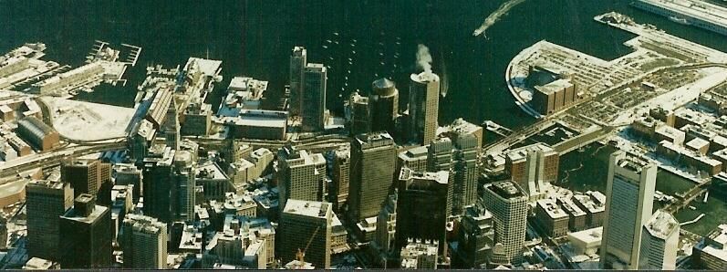
Is there any way to Infill and change the angle of the runway a bit? Besides the fact that it would be unpopular with the public, is it even feasible? It looks (from the photo) like you could change the angle slightly and move the approach further to the south... far enough from the Gateway site and the rest of the CBD. the SBW would probably still be stubby, but hey, maybe that would encourage more wall to wall density and a nicer human scale.
belmont square
Active Member
- Joined
- Jun 19, 2006
- Messages
- 365
- Reaction score
- 0
You'd have to fill in part of the harbor between the airport and Winthrop in order to shift runway 9/27 counterclockwise. And in order to miss the SBW and Gateway, you'd have to shift it far enough that it would be too similiar to the direction of runway 4/22 which would significantly reduce the capacity of Logan. Finally, on departures to/arrivals from the east on the altered runway, you'd be flying across the widest and most heavily populated sections of Winthrop.
I'm not suggesting that any of these reasons can't be trumped by the needs of the CBD, but as van points out it's probably more realistic to identify a satellite CBD somewhere (although the acres of vacant land in the SBW demonstrate that we are not close to requiring that yet).
I'm not suggesting that any of these reasons can't be trumped by the needs of the CBD, but as van points out it's probably more realistic to identify a satellite CBD somewhere (although the acres of vacant land in the SBW demonstrate that we are not close to requiring that yet).

Perhaps we can lower some of our goals, in hope of rising others.
http://www.flickr.com/photos/loupiote/508581524/
I dont think any one would complain about height in the seaport or else where if we got quailty development in the first place
Suffolk 83
Senior Member
- Joined
- Nov 14, 2007
- Messages
- 3,024
- Reaction score
- 2,512
Boston02124
Senior Member
- Joined
- Sep 6, 2007
- Messages
- 6,936
- Reaction score
- 7,088
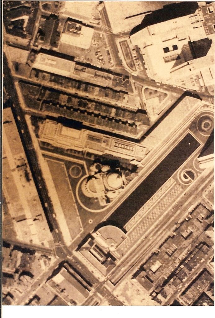
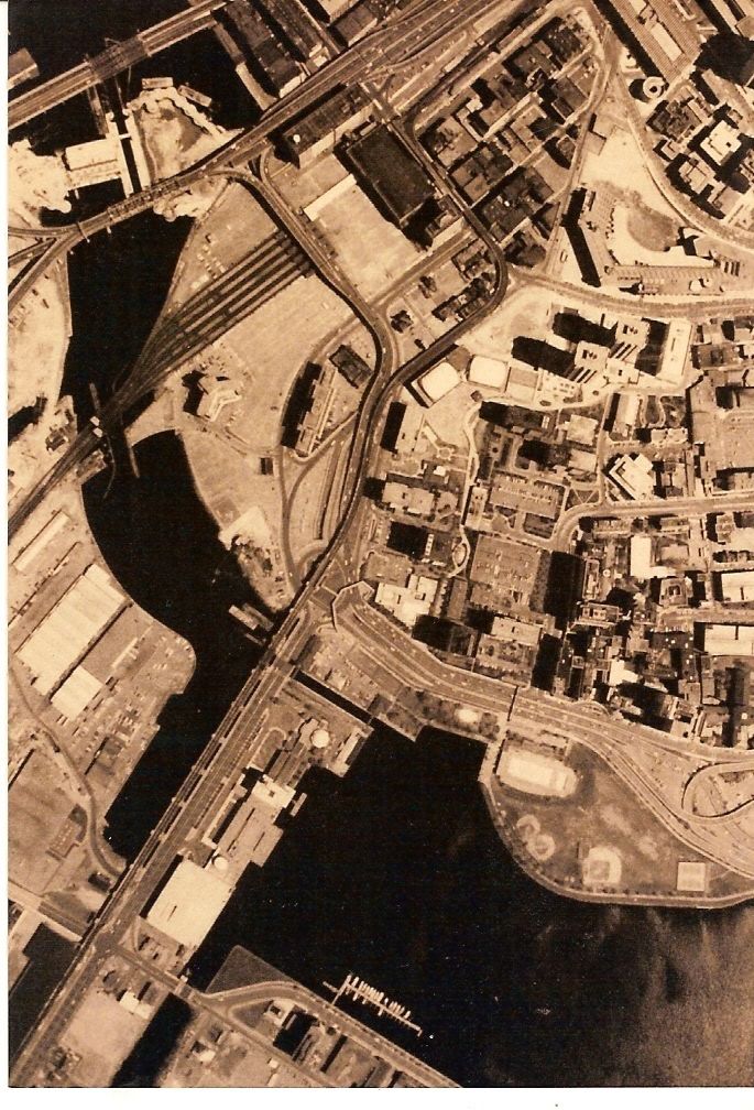
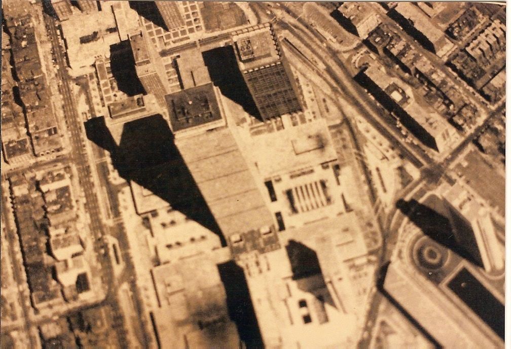
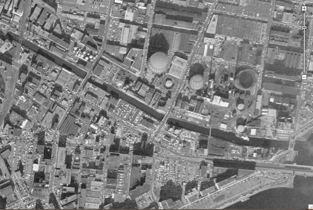
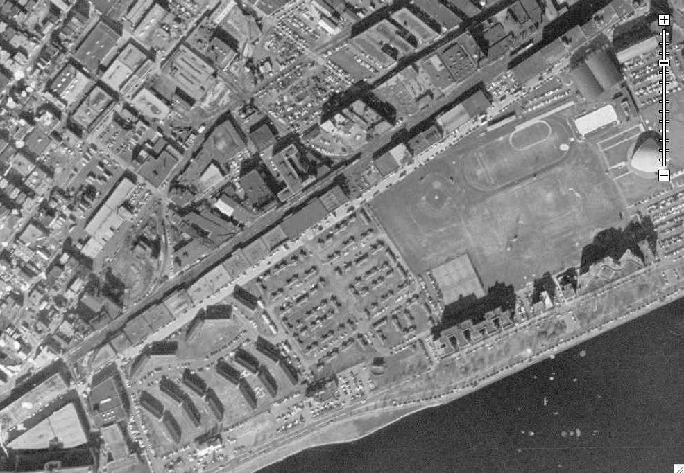
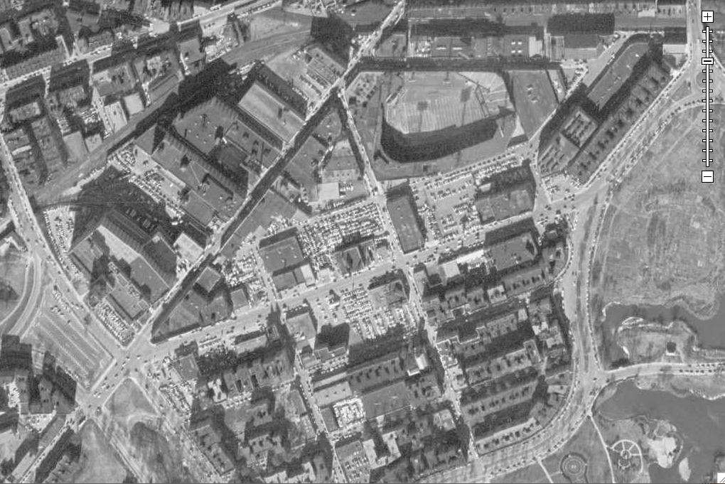
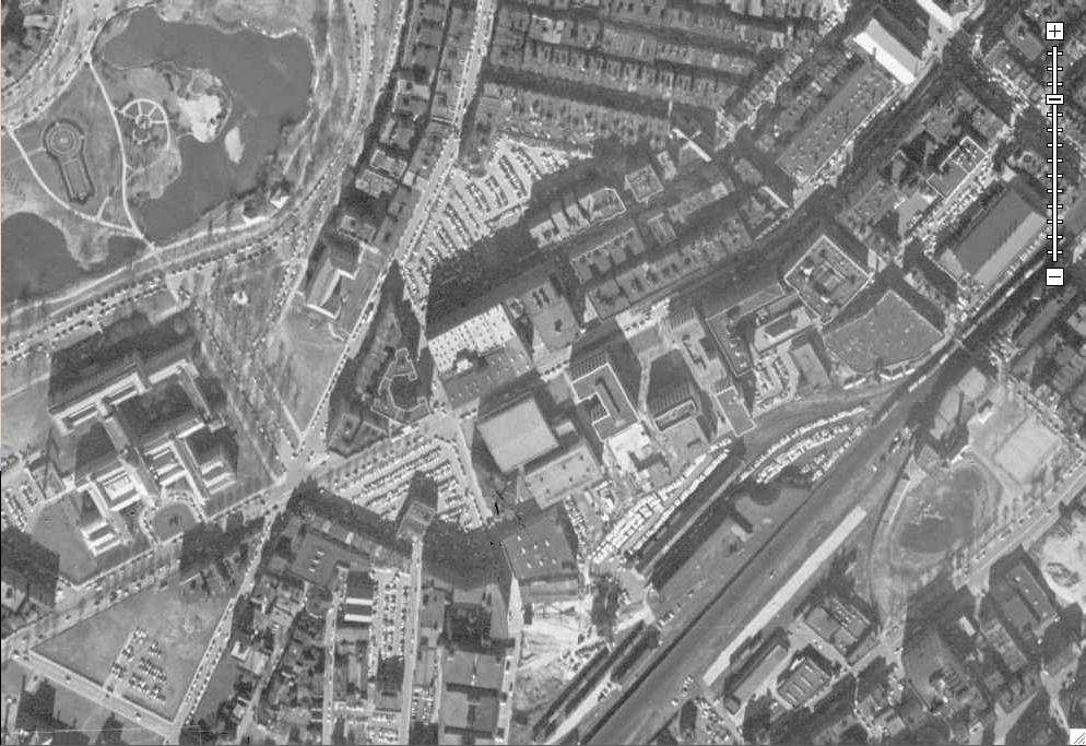
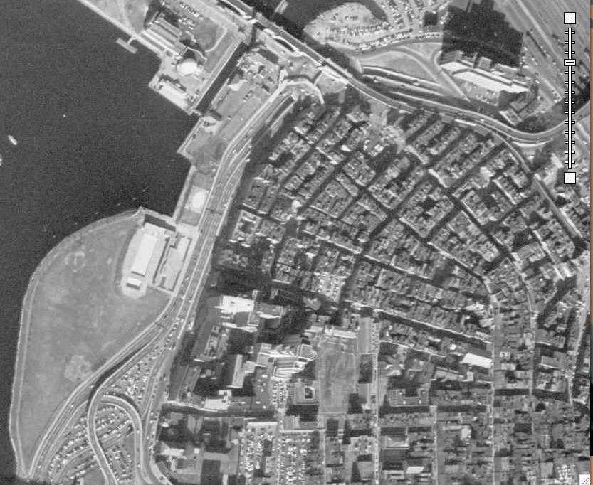
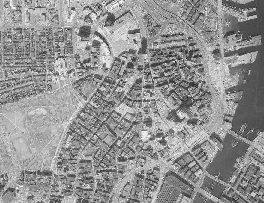
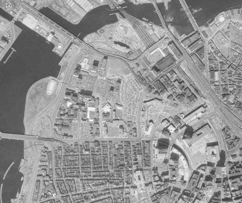
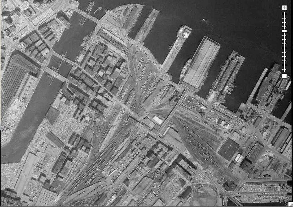
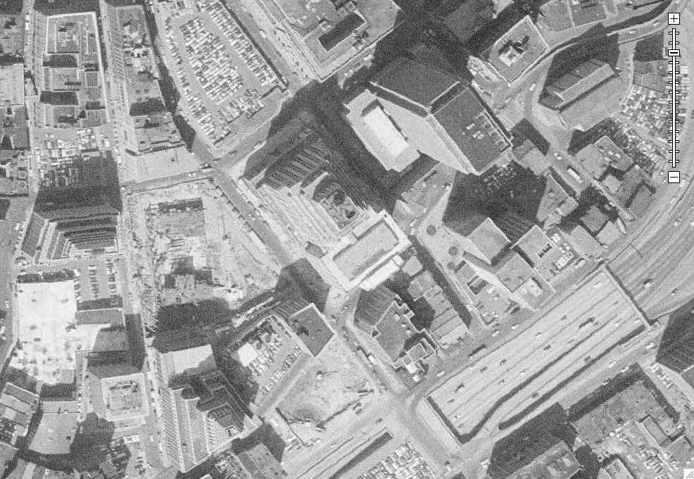
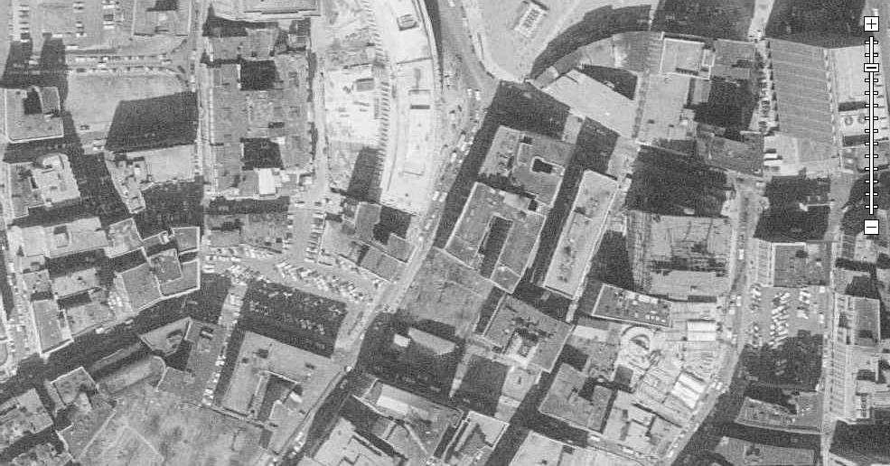
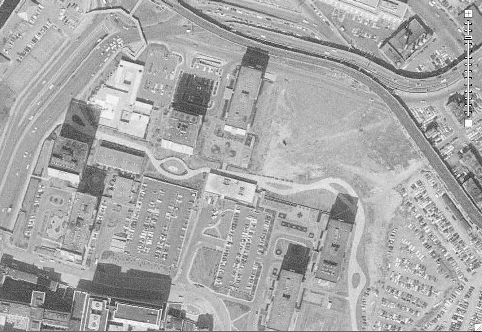
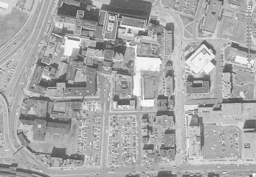
some aerials form 1987 and one from 2004
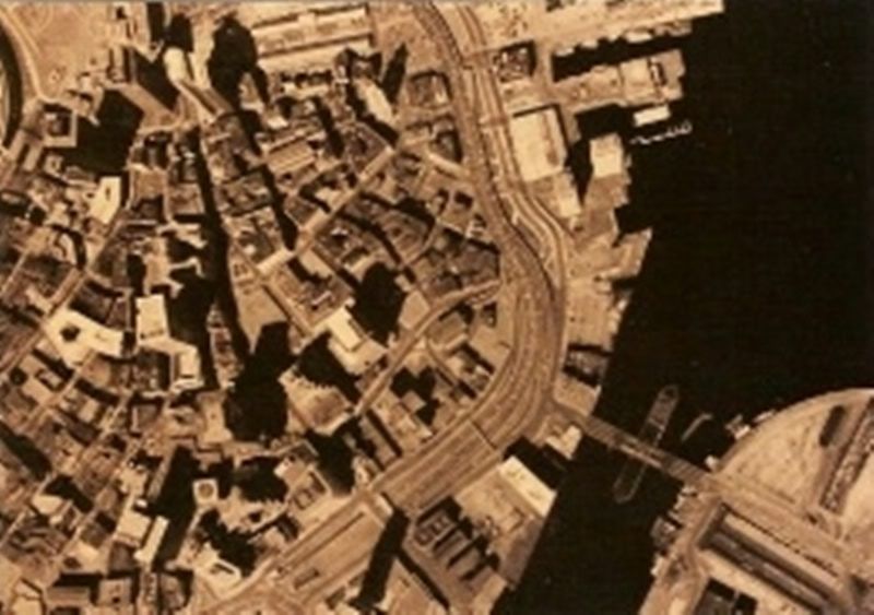 2
2
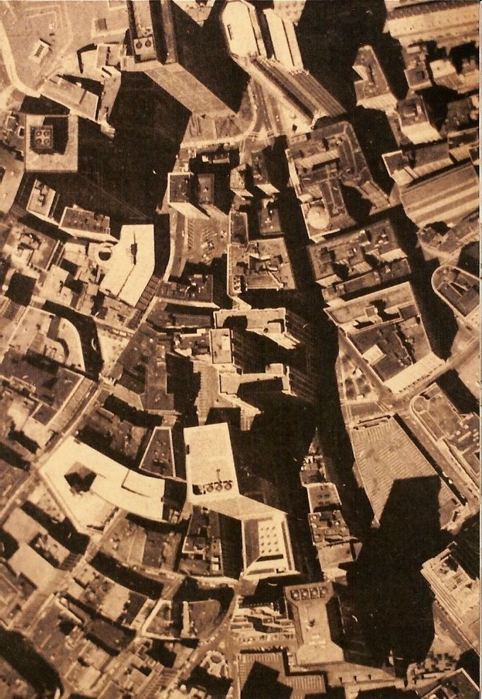 3
3
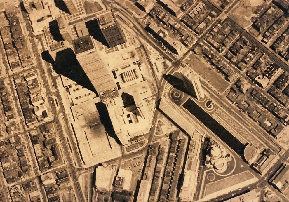 4
4
Last edited:
Boston02124
Senior Member
- Joined
- Sep 6, 2007
- Messages
- 6,936
- Reaction score
- 7,088
some more I found. I had photograph these in 1988? from some aerials your could get printed at the BRA map center

kz1000ps
Senior Member
- Joined
- May 28, 2006
- Messages
- 9,186
- Reaction score
- 13,715
I'd say those aerials are from about 1980. One Devonshire (1983), MGH's Wang building (1984ish), Greenhouse Apartments (1982).. none of them are built yet.
Still, thanks for sharing! I love pouring over old images trying to figure out their exact dates.
Still, thanks for sharing! I love pouring over old images trying to figure out their exact dates.
Charlie_mta
Senior Member
- Joined
- Jul 15, 2006
- Messages
- 5,150
- Reaction score
- 7,778
Looking at the second aerial of the ones just above: who is the idiot who allowed Spaulding Hospital to be located so it blocks the path to future expansion of rail apacity at North Station? Short sighted!
Boston02124
Senior Member
- Joined
- Sep 6, 2007
- Messages
- 6,936
- Reaction score
- 7,088
the maps were photograph in 1980
Boston02124
Senior Member
- Joined
- Sep 6, 2007
- Messages
- 6,936
- Reaction score
- 7,088
Thanks but,this is cool photographs you should go pro
I took these photos of a 24x36 sepia sheet you could buy at the BRA map center back in the 80's,these are not mine,I,m sure you can still go the the BRA map center on the 9th floor(If you get get thru the metal detector)and purchase up to date maps,they were $5 each back then! Here's what I did with one of the BackBay.
kz1000ps
Senior Member
- Joined
- May 28, 2006
- Messages
- 9,186
- Reaction score
- 13,715
All these are courtesy of the BRA's Digital Atlas. I encourage everyone to rummage around the site, as I'm sure there's plenty more gems to be found.
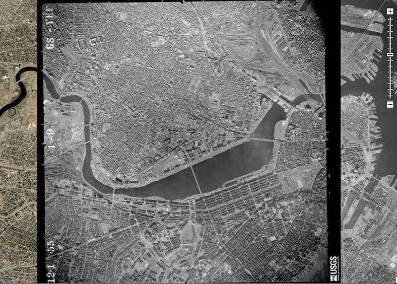
This first set is from December 1, 1955, starting with the overview image. You can see how the flash client "layers" whatever images you want it to. To the left is a 2001 aerial, to the right dates from 1969 (those are later in this post). You can toggle back and forth at will.
1.
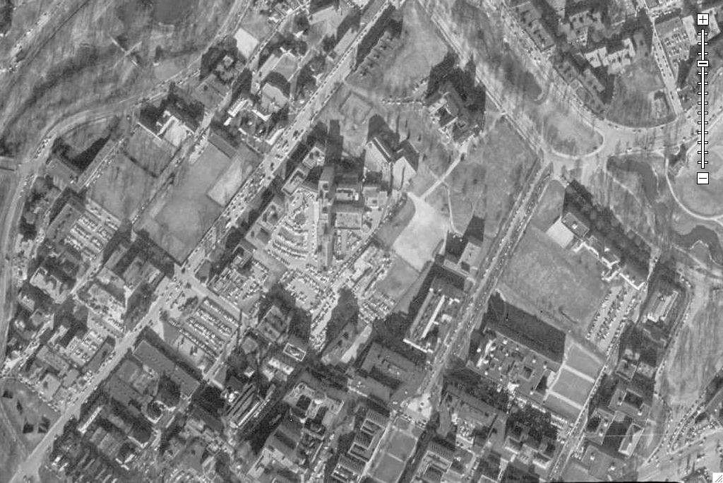
2. Harvard Square

3. Northern Harvard
4. East Cambridge railyards, future site of Northpoint.
5. East Cambridge
6. Kendall Square
7. MIT Central

8. MIT West.. what are those barracks looking structures?
9. Copley Square

10. Future Prudential Center site

11. West Fenway
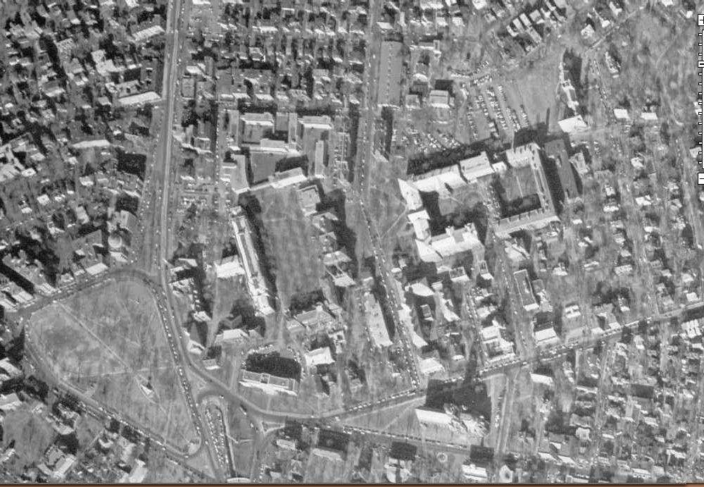
12. Northeastern
13. Longwood
14. Kenmore Square
15. BU Central
16. BU West... two years after the Braves left town
17. Finally, the old West End
--
--
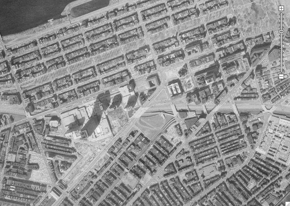
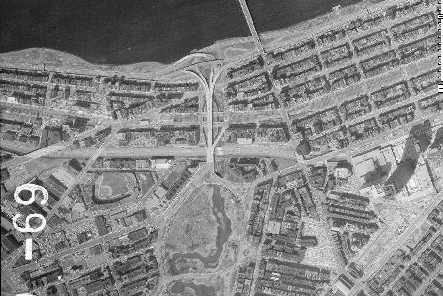
This other set dates to April 9th, 1969. As you'll notice, coverage differs between the images. For instance, this one shows the Seaport area, but not Longwood or Harvard.
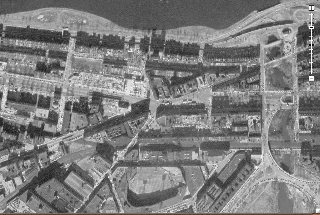
18. Downtown
19. My, oh my.
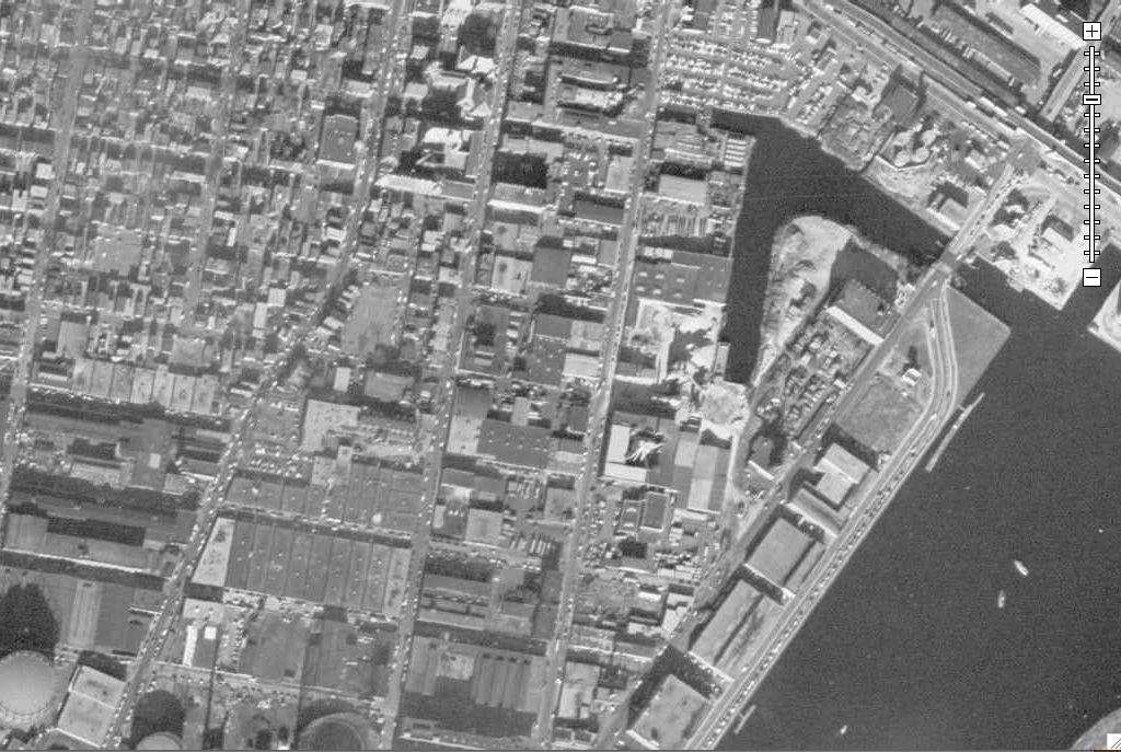
20. Seaport
21. Back Bay/Copley/South End
22. Fenway/Kenmore
23. Fenway/Northeastern
24. East Cambridge
25. Kendall/MIT

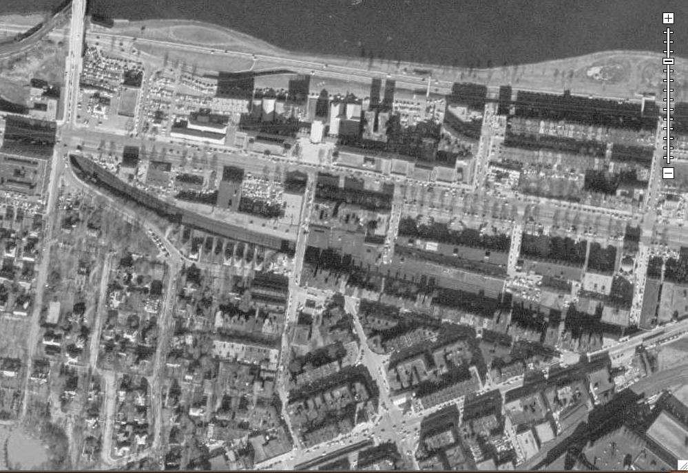
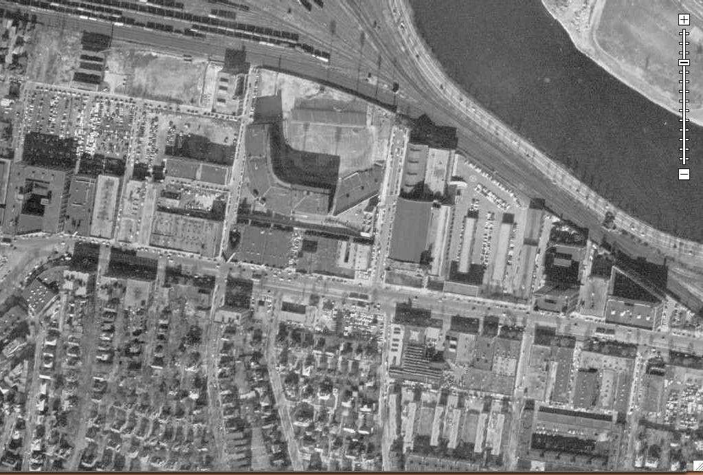
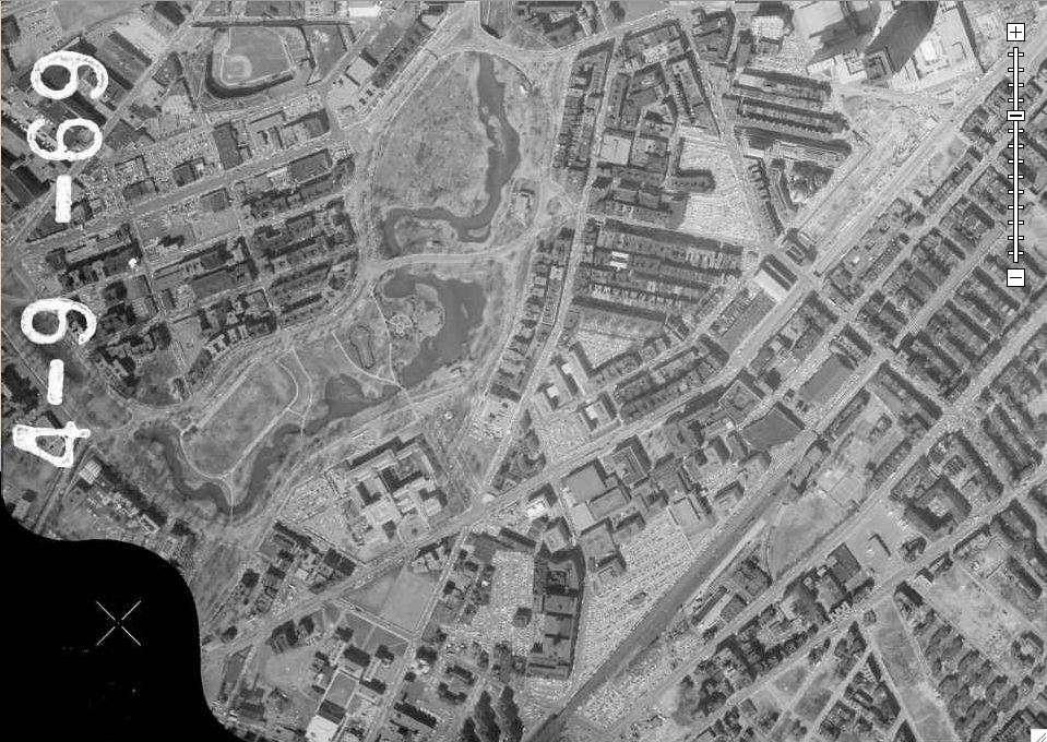
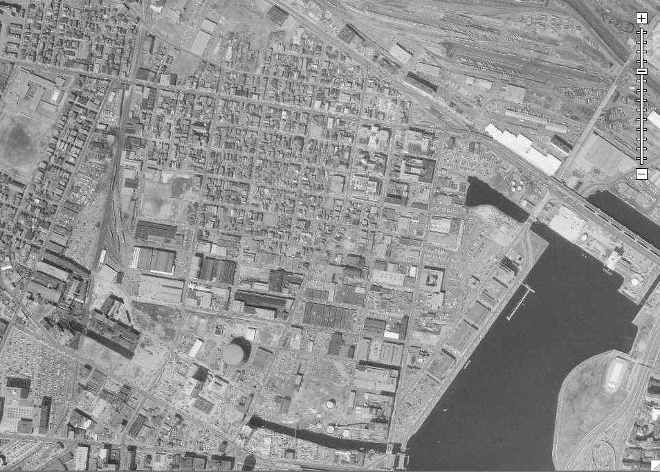
This image has a higher resolution than the 1955 one, so now we'll zoom in, focusing on visible construction projects.
26. Construction sites include 100 Federal and 99 High
27. Arch St. garage and the Five Cents Savings Bank, aka Borders

28. State Street environs

29. Center Plaza and One Boston Place
30. Northern Government Center

31. Yep
32. Mass General
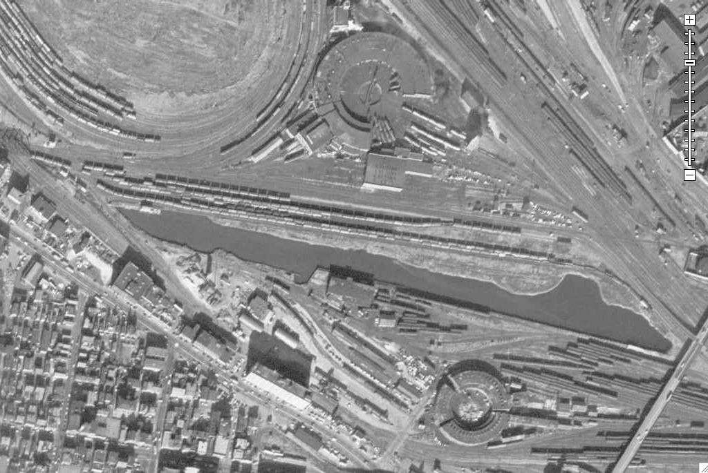
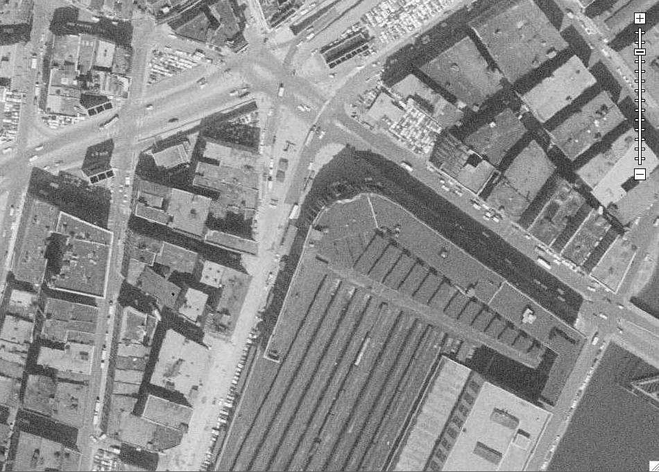
33. South Station. Note how much more of it used to exist
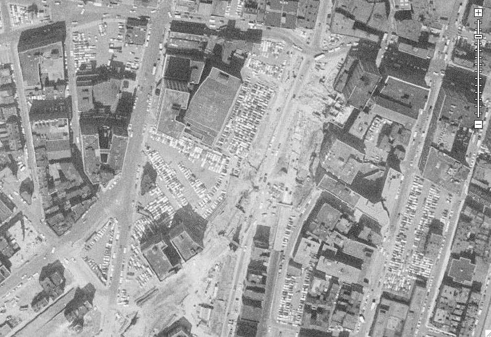
34. Tufts/New England Medical Center ripping apart Chinatown
35. Midtown
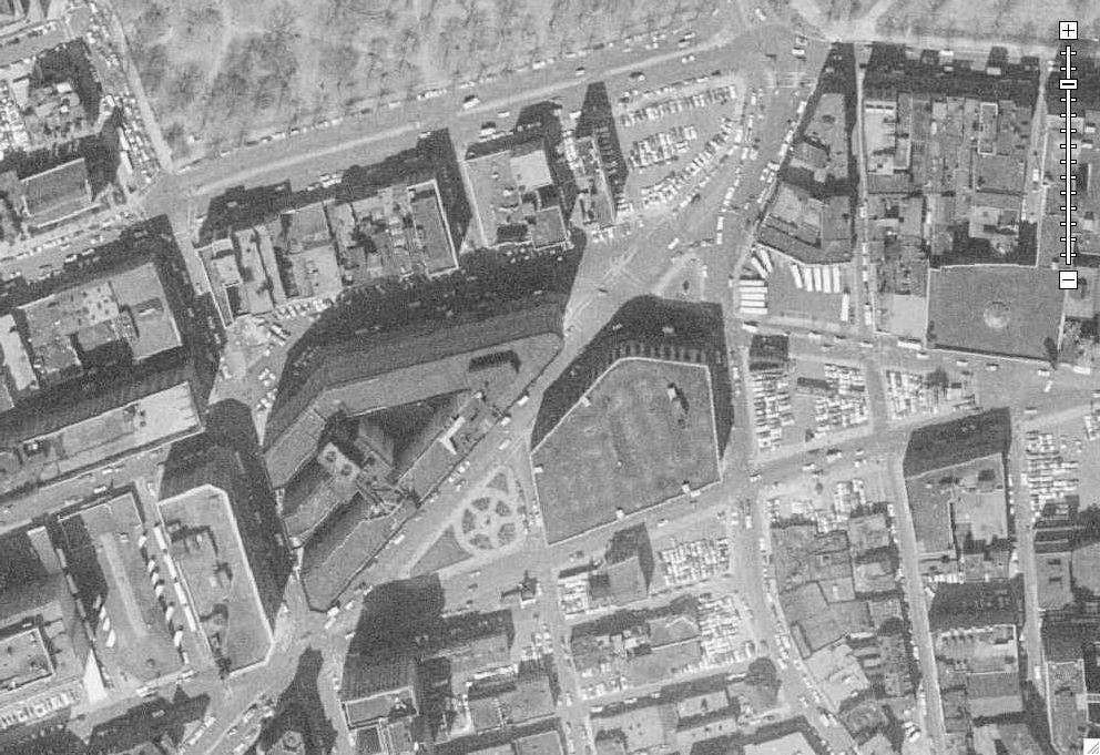
36. John Hancock being excavated, and the BPL prepping for the Johnson building

37. Future home of Copley Place
38. 101 Huntington in its infancy

39. Christian Science Center

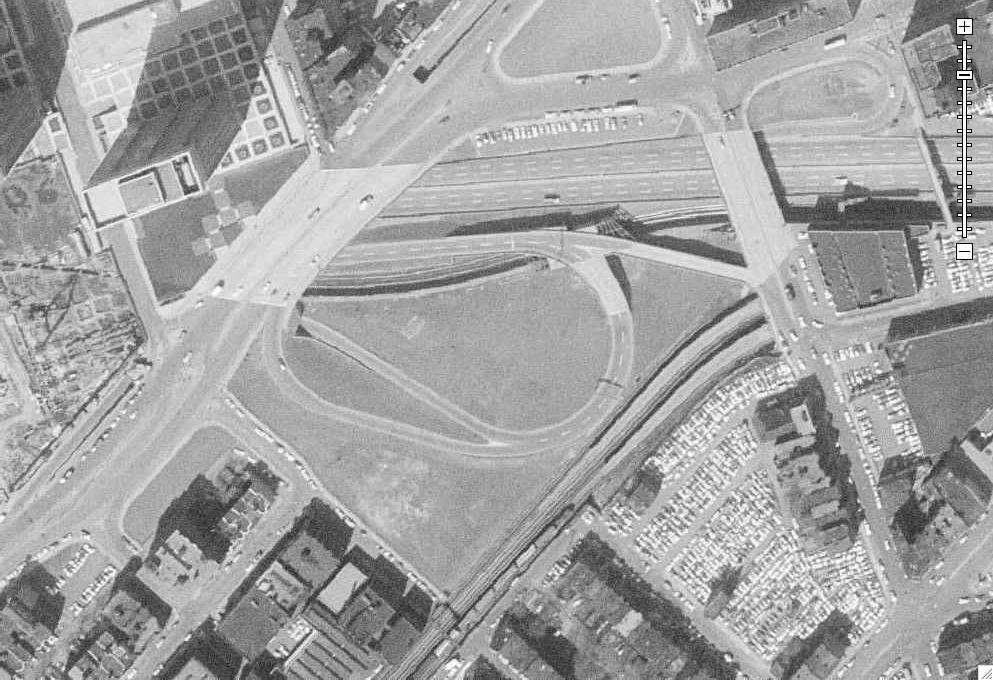
40. Last one, Kendall Square and the Volpe

This first set is from December 1, 1955, starting with the overview image. You can see how the flash client "layers" whatever images you want it to. To the left is a 2001 aerial, to the right dates from 1969 (those are later in this post). You can toggle back and forth at will.
1.
2. Harvard Square
3. Northern Harvard
4. East Cambridge railyards, future site of Northpoint.
5. East Cambridge
6. Kendall Square
7. MIT Central
8. MIT West.. what are those barracks looking structures?
9. Copley Square
10. Future Prudential Center site
11. West Fenway
12. Northeastern
13. Longwood
14. Kenmore Square
15. BU Central
16. BU West... two years after the Braves left town
17. Finally, the old West End
--
--
This other set dates to April 9th, 1969. As you'll notice, coverage differs between the images. For instance, this one shows the Seaport area, but not Longwood or Harvard.
18. Downtown
19. My, oh my.
20. Seaport
21. Back Bay/Copley/South End
22. Fenway/Kenmore
23. Fenway/Northeastern
24. East Cambridge
25. Kendall/MIT
This image has a higher resolution than the 1955 one, so now we'll zoom in, focusing on visible construction projects.
26. Construction sites include 100 Federal and 99 High
27. Arch St. garage and the Five Cents Savings Bank, aka Borders
28. State Street environs
29. Center Plaza and One Boston Place
30. Northern Government Center
31. Yep
32. Mass General
33. South Station. Note how much more of it used to exist
34. Tufts/New England Medical Center ripping apart Chinatown
35. Midtown
36. John Hancock being excavated, and the BPL prepping for the Johnson building
37. Future home of Copley Place
38. 101 Huntington in its infancy
39. Christian Science Center
40. Last one, Kendall Square and the Volpe