Green Line Extension to Medford & Union Sq

The existing map does have the orientation and relative positioning of the 77 and the Red Line at Davis and Alewife switched. Also, Chestnut Hill Ave, Cleveland Circle, and Reseroir nowhere near each other. Also, Landsdowne east of Fenway and Boston Landing west of Watertown Square. The current map is atrocious anyways.
 
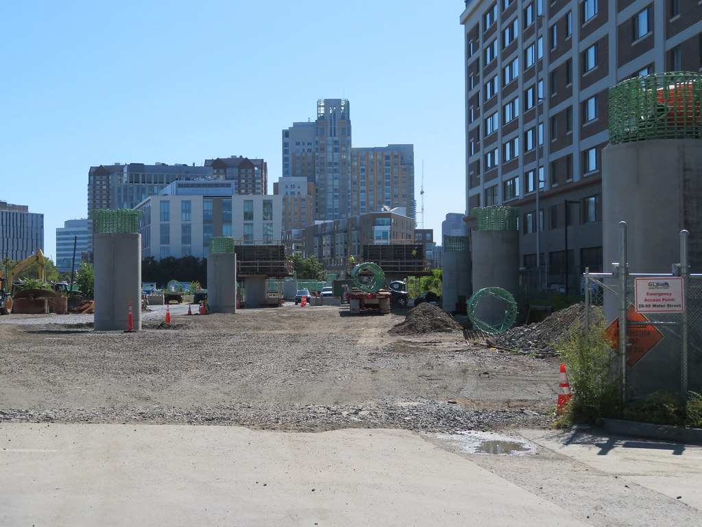
The Herzog machine was/is doing embankment & site prep on the footprint of the Tufts College Ave site today.
 
"Sept. 2014 v25"...but it has SL3 on it with prelim names. Maybe that was one of the mockups from a project document, but that was never a real map.

The current map is April 2019 v33. Shows Wollaston as accessible, shows Boston Landing CR, shows Blue Hill Ave. CR station intersecting the 28, still shows interim setup of old Chelsea CR station + no direct transfer w/SL3, has correct SL3 station names, shows discontinuance of Lynn Ferry and removal of non-MBTA Salem Fast Ferry from system map.

The final one still has other works in-progress that need to get incorporated in addition to GLX before the service ever opens: new accessible Chelsea CR direct-transferrable to SL3; Hynes, Symphony, and D Line accessibility; B Line stop consolidation. Nothing's going to be official until they know how many other projects with map touches have completions syncing in time for the sign shop's big GLX rollout.
 
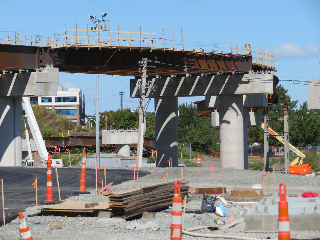
Some more photos of the construction of the new Washington St rail bridge from today (08/25).

jTAdaGU.jpg


WwQ2OVQ.jpg


YJmoNKr.jpg


N4zvjV9.jpg
 
This can't be official, as the T has announced that "Washington St" is going to be called "East Somerville" and "Lowell St" will be "Magoun Square."
Yes, not only are the stations on that branch named wrong, it puts them needlessly too-far-apart spacing on the College Ave branch, which pushes the end of the line too far north (too close to W.Medford CR, and doesn't leave space for a MVP/Rt16 stop)
 
"Sept. 2014 v25"...but it has SL3 on it with prelim names. Maybe that was one of the mockups from a project document, but that was never a real map.

The current map is April 2019 v33. Shows Wollaston as accessible, shows Boston Landing CR, shows Blue Hill Ave. CR station intersecting the 28, still shows interim setup of old Chelsea CR station + no direct transfer w/SL3, has correct SL3 station names, shows discontinuance of Lynn Ferry and removal of non-MBTA Salem Fast Ferry from system map.

The final one still has other works in-progress that need to get incorporated in addition to GLX before the service ever opens: new accessible Chelsea CR direct-transferrable to SL3; Hynes, Symphony, and D Line accessibility; B Line stop consolidation. Nothing's going to be official until they know how many other projects with map touches have completions syncing in time for the sign shop's big GLX rollout.

I never understood why the MBTA doesn't just print the maps on paper and have them behind protective plastic/glass like in New York City. It just doesn't seem practical to print the signs on metal like they do. (However, they do look great! It is just is such a pain when things need to be updated or changed.)
 
I never understood why the MBTA doesn't just print the maps on paper and have them behind protective plastic/glass like in New York City. It just doesn't seem practical to print the signs on metal like they do. (However, they do look great! It is just is such a pain when things need to be updated or changed.)
For the most part they have only been doing paper-behind-glass system maps for the past decade-plus. Per-line maps still get printed on metal or plastic resin because they change a lot less often.
 
What part of the project is Middlesex on? None of that is reflected in the schedules presented to the FMCB and MassDOT board
EDIT: Wait, this makes even less sense. It hasn't been 700 days since the NTP


Did you check the POSTER NAME of the guy????? ;)
 
The GLX Community Working group announced today that the Washington St Bridge is going to stay closed through April 2020, and the School St Bridge is going to close this fall. Since the latter is the detour route for the also-closed Medford St Bridge, this is going to suck most boisterously. As it is, both School St and Central St are jammed up solid every morning from Highland Ave all the way back to Broadway.
 
The GLX Community Working group announced today that the Washington St Bridge is going to stay closed through April 2020, and the School St Bridge is going to close this fall. Since the latter is the detour route for the also-closed Medford St Bridge, this is going to suck most boisterously. As it is, both School St and Central St are jammed up solid every morning from Highland Ave all the way back to Broadway.

Some things will loosen up when the Union Square water and sewer work is finished. Highland is currently getting choked from two directions. It will still suck though.
 
Random question. Has anyone seen what the new maps will look like with the 2 green line extensions? I'm wondering if they'll move the north red slightly down and to the left.
Official answer to "what will the map look like" question

The most recent 2019 Paper System Map version
(PDF linked on the MBTA site) has made the SLG a solid silver, and shows "dotted" GLX:

It also turns out that the 2016 - 2018 paper system map had both the SLG and GLX "dotted lined" into the system map. I can't find a link that points to this "previous" map, but it (as of a few days ago at North Station) the current one that most station agents are still handing out

So I'm thinking that just as they went dotted-to-solid on the silver, you can expect them to go dotted-to-solid on the green lines you see in the link above
 
Last edited:
Some more photos of the construction of the new Washington St rail bridge from today (08/25).

jTAdaGU.jpg


WwQ2OVQ.jpg


YJmoNKr.jpg


N4zvjV9.jpg
Are there plans to make the underpass deeper? This is a very low bridge.
 
Are there plans to make the underpass deeper? This is a very low bridge.
I thought that from those photos but went down and took a look, there's the same clearance as the old bridge, it seems fine, I doubt there's any plans to lower the road.
 
  • Like
Reactions: FK4
Last edited:

Back
Top