Pierce Boston (née The Point )| Boylston St/Brookline Av | Fenway

The FAA approved this for a height of 368 feet so your estimate is a little bit too tall odurandina.
 
Crane jump over the weekend; it completely dominates the skyline west of the Pru now.
 
The FAA approved this for a height of 368 feet so your estimate is a little bit too tall odurandina.

Are you sure about that? This one says 378', and it's numbered after the one you posted. (2250 vs 2242) Yours is "Point 1" and this one is "Point 9." If anything, it looks like it's at least 378', depending on the listings for Points 2-8.

We have had this listed as 378' on all other sites for at least 6 months.

https://oeaaa.faa.gov/oeaaa/external/searchAction.jsp?action=displayOECase&oeCaseID=233658935&row=15
 
Oops sorry you are right Point 1 is for the lower setback portion of the top. Thanks for catching that.
 
It just blows my mind how this is changing the dynamic of the entire area. Also, if Charlesgate 2 gets approved as is, these will be just amazing!

More cowbell!!
 
BLDUP just posted this on flickr


Pierce-Boston-October-2016 by BLDUP Boston, on Flickr

Looking at this picture just makes me wonder why Boylston st didnt continue through the fens when it was built. You could have made up for the green space off to the left. If this road had been a two way and went all the way to rt 9 in a straight line imagine how much less a pain in the balls this would be to navigate instead of having to go around in a circle around the fens for no reason if your heading towards the picture. Crossing the river the pierce really would have been the gateway to the city from the west much more than it will be now.
 
Looking at this picture just makes me wonder why Boylston st didnt continue through the fens when it was built. You could have made up for the green space off to the left. If this road had been a two way and went all the way to rt 9 in a straight line imagine how much less a pain in the balls this would be to navigate instead of having to go around in a circle around the fens for no reason if your heading towards the picture. Crossing the river the pierce really would have been the gateway to the city from the west much more than it will be now.

How about some BRT lanes along Boylston with a bus tunnel in the Fens. That would help to alleviate some of the congestion that the green line faces. (apologies for off topic transit pitch). Also extend the dedicated bus lane to Longwood (or brookline center) in one direction and up Boyleston and Tremont to Government Center in the other direction.
 
Looking at this picture just makes me wonder why Boylston st didnt continue through the fens when it was built. You could have made up for the green space off to the left. If this road had been a two way and went all the way to rt 9 in a straight line imagine how much less a pain in the balls this would be to navigate instead of having to go around in a circle around the fens for no reason if your heading towards the picture. Crossing the river the pierce really would have been the gateway to the city from the west much more than it will be now.

You'd have to ask Frederick Law Olmsted. His philosophies, which I'm sure could be more eloquently explained than I'm am about to do, was to break up the urban form with bits of nature; a balance of nature versus the city. The straight line was the enemy, with curves added to the urban form to give visual and natural intrigue around every corner.

So yes, Boylston could have been a boring, typically urban, straight line west to the suburbs. While a major artery, you have to imagine the Fens in 1879 not being so congested. The Emerald Necklace provided the break in the action, a curved, natural transition to the streetcar suburbs from the industrial expansion of late 1800's Boston.
 
Have they started sales and if so anyone know how they are going?
 
You'd have to ask Frederick Law Olmsted. His philosophies, which I'm sure could be more eloquently explained than I'm am about to do, was to break up the urban form with bits of nature; a balance of nature versus the city. The straight line was the enemy, with curves added to the urban form to give visual and natural intrigue around every corner.

So yes, Boylston could have been a boring, typically urban, straight line west to the suburbs. While a major artery, you have to imagine the Fens in 1879 not being so congested. The Emerald Necklace provided the break in the action, a curved, natural transition to the streetcar suburbs from the industrial expansion of late 1800's Boston.

you've won the thread.
 
Looking at this picture just makes me wonder why Boylston st didnt continue through the fens when it was built. You could have made up for the green space off to the left. If this road had been a two way and went all the way to rt 9 in a straight line imagine how much less a pain in the balls this would be to navigate instead of having to go around in a circle around the fens for no reason if your heading towards the picture. Crossing the river the pierce really would have been the gateway to the city from the west much more than it will be now.

Stick-- I'm guessing that Boylston and the Fen's developed the way they did might be because when Olmstead and friends did the planning in the 1880's that they didn't have a digital image from 140 years into the future showing the "High Spine"

Here's what Olmstead drew as the original plan for the Fens in 1887
BackBayFens1887Plan.png

the names on the map are hard to read.
Commonwealth can be readily identified by the split into two parallel roadways with a wide median [aka the Mall]
Mass aAve. runs nearly N-S on the Right Hand edge of the image
Boylston is the wide street crossing the image diagonally from the the Right [adjacent to the Compass Rose] and down until it ends at an intersection just before it would have crossed the park a 2nd time

As you can see -- a lot of things look superficially as they do today

But you have to remember that in the 1880's this area essentially marks the transition from the urban area to the right [East] and the rural marshey land following the Muddy River down and leftward [SW]
map from 1878 shows how Boylston to West of the Fens was just a rural road with no inteconnections until it ends at Brookline Avenue

General Landfill in the area was completed by 1890 and in the following map [1891] you can see the difference between those more solid uplands which already been developed to some extent and the recently filled low lands a blank canvas
1891.jpg


You also might checkout the discussion provided by this MIT Architecture and City Planning student paper
http://web.mit.edu/cron/class/city/archive/projects_2015/mch7rz/Fenway/natural.html
 
Last edited by a moderator:
Re: The Point (Boylston/Brookline)

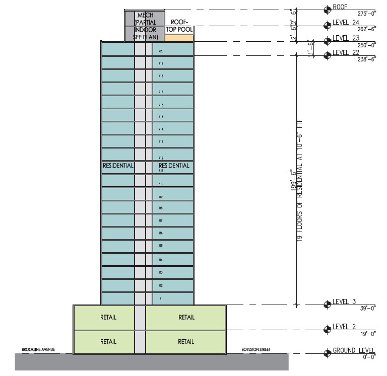
Webcam screen shot from today. 23 full floors. Very easy to count now that we know that the extra large floor is 18.

Capture by David Z, on Flickr

The top of the core is essentially the height of the original proposal. This is quoted from page 3 of this thread. (post 41) Pretty amazing that the final product will be 103' higher than the original proposal!!!

Alright, it's rendering time!

8476300425_2e4bd97ddb_b.jpg


West elevation is underwhelming, but far from bad:

8476299673_6f5f7342f2_b.jpg


East:

8477388806_2a8f32194d_b.jpg


South....one of the advantages of using metal panelling aka Alucobond is you can pull off gradient changes like this (which I am a fan of):

8477388568_9cf68f1ab5_b.jpg


8477388264_b20913d00e_b.jpg


8476298845_b046fdee5a_b.jpg
 

Back
Top