Seaport Square (Formerly McCourt Seaport Parcels)

Those are fixable issues. Repair the pavement and put in wayside stoplight signals and it does as good and probably better than 10 years ago. Bury that asinine D St. crossing and better still.

Is there a historical reason why the D St crossing exists? Why wasn't the tunnel extended another 50 feet? This part of D Street is pretty busy during rush hour and I imagine it will only continue to get more so.
 
Is there a historical reason why the D St crossing exists? Why wasn't the tunnel extended another 50 feet? This part of D Street is pretty busy during rush hour and I imagine it will only continue to get more so.

Cost-cutting. Grade separation to SL Way got lopped off somewhere in the bureaucratic sausage-making of final design. And of course it turned into such a clusterfuck that "T-under-D" has been teased ever since to fix that short-sightedness.

It's going to take one of these with onboard fatalities and a subsequent ass-reaming from the NTSB for them to get off their cans and fund the thing:

http://www.youtube.com/watch?v=CyK4dbiRDII
 
10478395_752109564832929_7046343777263024440_o.jpg


1502230_752109538166265_4894058897974162119_o.jpg
 
Equilibria, I am a little confused by the concept that an LRT can't beat the speed and capacity of an articulate bus in the transitway.

The stations are long, so you could do a three car tandem LRT. That has to be larger than an articulated bus. And the bus speed limit is 15 MPH in the transitway. You are suggesting that the green line doesn't beat 15 MPH in the tunnels? Really?

Serious question, but does it beat that speed in the Tremont St. subway? I suspect it does in the Boylston tunnel, but not elsewhere. That aside, I only see LRT coming to that tunnel as a shared presence with BRT. Can't go faster than the slowest vehicle in front of you, which means there would be a practical speed limit of 15mph for all vehicles. LRT makes sense only for connectivity or capacity, I don't see it making things any faster. But as Seamus pointed out, the speed is actually pretty good.
 
Serious question, but does it beat that speed in the Tremont St. subway? I suspect it does in the Boylston tunnel, but not elsewhere. That aside, I only see LRT coming to that tunnel as a shared presence with BRT. Can't go faster than the slowest vehicle in front of you, which means there would be a practical speed limit of 15mph for all vehicles. LRT makes sense only for connectivity or capacity, I don't see it making things any faster. But as Seamus pointed out, the speed is actually pretty good.

See my post a few up. It's not the Transitway where the trolleys would beat the buses...it's the connecting segment to the Central Subway. The SL Phase III tunnel was going to have a 90-degree turn from Atlantic Ave. onto Essex, curves on Essex, and an underground loop at Boylston Station that strains the minimum turning radius of an articulated bus. All of that because of the constraints of the street grid. Then, to portal-up to the South End and link the Washington St. segment it was going to have another 90-degree turn under Charles St., and a 70-degree turn onto Tremont at Eliot Norton Park. You'd have been talking no more than 10 MPH on the very short straightaways, and 5 MPH on the loop and right-angles.

THAT would've completely fucked the schedules, created horrible bunching, and probably kneecapped the capacity of the existing Transitway to lower than what it is now. It's defective by design in addition to being a good billion or two dollars more expensive to build as BRT vs. trolley. Trolleys through the abandoned tunnel would probably be able to hit 30+ MPH because it's a long straightaway, and would be able to make the Essex/Atlantic turn into the Transitway much faster than a bus because the turning angle would be a bit wider for trolley tracks vs. artic buses on tires. Depending on how you tunnel through or around the block from the corner of Essex/Surface/Chinatown Park to the Central Subway hook-in, so long as the construction doesn't include ugly hacks like another Boylston curve speeds are going to be a good 2-3x that of the bus. Think Huntington tunnel, because the connecting tunnel will be a relatively uncongested branch compared to the Central Subway with hardly any occupied signal blocks mid-tunnel restricting speeds or forcing pauses. It'll have no effect at all if a trolley pulls behind an SL1 bus at the South Station platform and has to crawl out to the end of the line at Silver Line Way.
 
Lovin' that glass side of the Envoy. I believe the side facing the city will be the same.
 
Though it's different for the immediate area, I'm not a big fan of the green panels. I feel a dark gray or black would look better here.
 
^^ I'm still reserving judgement for completion. I do like the massing, though.
 
I'm pretty sure the front will look just like the side that's completed and that what we're seeing are the opaque backing panels of which glass will be laid on top of.
 
The Northern Ave Bridge was closed to pedestrians today, so I had to hoof it over the Moakley on my way to catch the ferry next to the World Trade Center.

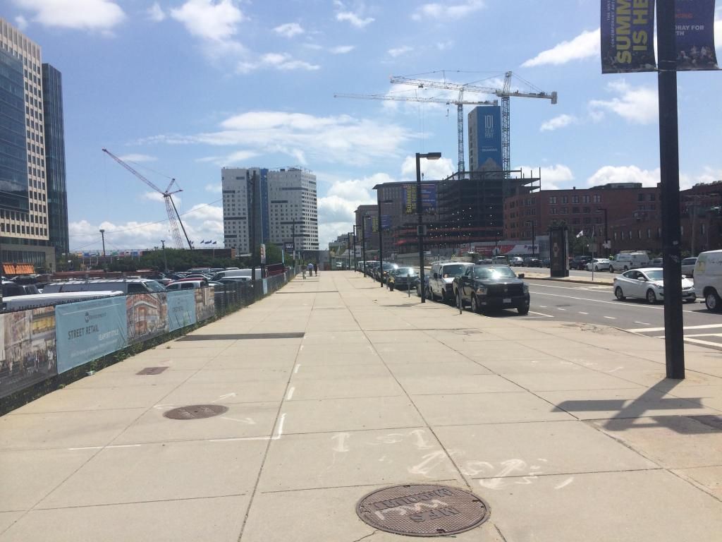
The pedestrian experience on Seaport Boulevard is horrendous! There is a huge, wide sidewalk and a chain link fence. That's it. Not even a single street tree.

What happened to the elaborate pedestrian realm plan from oh so many years ago?


And it's a really long block with no cross streets all the way to the intersection with Northern Ave. Google Maps shows a "planned" Fan Pier Boulevard just past Court House Station, but I didn't see anything even resembling a temporary path through the parking lots. Is there any plan to turn this into something less hostile in the future?

(The Moakley could use a few benches too.)
 
Last edited:
The Northern Ave Bridge was closed to pedestrians today, so I had to hoof it over the Moakley on my way to catch the ferry next to the World Trade Center.

The pedestrian experience on Seaport Boulevard is horrendous! There is a huge, wide sidewalk and a chain link fence. That's it. Not even a single street tree.

What happened to the elaborate pedestrian realm plan from oh so many years ago?


And it's a really long block with no cross streets all the way to the intersection with Northern Ave. Google Maps shows a "planned" Fan Pier Boulevard just past Court House Station, but I didn't see anything even resembling a temporary path through the parking lots. Is there any plan to turn this into something less hostile in the future?

(The Moakley could use a few benches too.)
Seaport-Square-B1-651x516.jpg


There will be trees lining both sides of the road along with the median. Also Fan Pier Blvd will be extended across from where it is now to connect to Seaport Blvd. Pier st. will be extended over one block farther down from that as well. After that there is another new road on the opposite side of seaport square. There will be 3 new roads on the left hand side of that picture before you get to the point where Northern ave connects today. It will look much less dead after all of that new retail is built on the left of that picture along with the new trees.
 
Last edited:
I know we've had this conversation to death, but gosh I'm so glad they extended the "East Service Road" name through the neighborhood. I can just hear the children growing up in this multi-use community waxing nostalgic decades from now about their childhood spent on "East Service Road" (or Boston Wharf Road, or Fan Pier Not-in-any-way-a-Boulevard)...

I will give credit where credit is due, though, for "Autumn Lane." At least SS gets more right than Fan Pier.
 
There will be trees lining both sides of the road along with the median. Also Fan Pier Blvd will be extended across from where it is now to connect to Seaport Blvd. Pier st. will be extended over one block farther down from that as well. After that there is another new road on the opposite side of seaport square. There will be 3 new roads on the left hand side of that picture before you get to the point where Northern ave connects today. It will look much less dead after all of that new retail is built on the left of that picture along with the new trees.

So I take it this will all get built piecemeal like the random streetscape we have on Northern Ave today?

It's really a shame that the "boulevard" is in such a poor state. If we have to wait another decade for parcel-by-parcel upgrades, it won't be much of a boulevard for a very long time.
 
If the boulevard doesn't have a cycle track down the center instead of a couple of trees and garden beds that will be overgrown that shows the total lack of cohesion. I'm not a cyclist, but if you want to talk about silver line overload, lack of rail, tourists on hubway weaver, so much gets relieved by a dedicated cycle track. There is literally nothing preventing this other than poor planning if it doesn't materialize.
 
If the boulevard doesn't have a cycle track down the center instead of a couple of trees and garden beds that will be overgrown that shows the total lack of cohesion. I'm not a cyclist, but if you want to talk about silver line overload, lack of rail, tourists on hubway weaver, so much gets relieved by a dedicated cycle track. There is literally nothing preventing this other than poor planning if it doesn't materialize.

Hear hear!
 

Back
Top