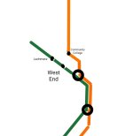
Alrighty, here we go. It is not totally finished; there are a number of small details I still want to tweak (including trying to adjust the spacing at the top to make it even just a little bit less cramped), plus I need to add a key and I do plan to add the ferries.
(Also the water is not at all the way I want it, so will probably rework that significantly.)
But the overall idea is here.
View attachment System Diagram Redesign Summer 2024 DRAFT.png
There are two themes of this redesign. The first is promoting the key bus routes into fully fledged members of the transit "family". In particular, there is a small set of routes which, in the Bus Network Redesign, are proposed to have all-day frequencies below 10 minutes, which are indicated here with the "double thickness" bus route language (though I grant that the stark difference in visual language overstates the difference between 6 min/9 min peak/offpeak frequences vs 8 min/11 min peak/offpeak). You'll notice that the labels for bus stops are identical in size and font to the rapid transit stops; this was intentional, as part of an overall effort to design the diagram around the bus routes as much as around the rapid transit routes.
The second theme, which emerged somewhat organically in order to accommodate the large volume of routes in the South End, Roxbury, Dorchester, and Mattapan, is an expansion of the "grid" formed by Park-DTX-State-GC downtown. The parallel Blue and Red lines are now joined (in order) by the 9, 8, 1, 12, 47, 28 & 22 & 12 & 66 & 15, 23 and 22 again, 28 & 32 (south of Blue Hill), and finally the 31. (Yes, the 31 is an odd distortion, bowing to the needs of practicality.) The parallel Green and Orange lines are now joined by the Ashmont + Mattapan Lines, the 16, Fairmount, SL4, Orange, 39, E, 28 & 12 & 66, the "Fenway Branch," and portions of the C and B. (The Blue Line also recapitulates the "north-south" axes of the Green + Orange.)
A separate grid is articulated in the northwestern quadrant of the map, where the 101, 47, 109, and 96 (oops, mislabeled!) create the rungs of a ladder formed by Red, GLX, and 101 again. As opposed to the 90-degree grid in the lower half of the map, this grid uses 60-degree rhombuses.
The northeastern quadrant is the odd one out (and, as mentioned above, became one of the hardest parts of the design), in that it has a 3-axis grid rather than 2-axis. Revere Center, Everett Square, and Bellingham Square create a triangle, from each point of which lines exit in 60-degree increments, creating a hexagonal grid, bounded by Blue and Orange. It definitely feels cramped, though.
One unexpected upside of coloring bus routes by "hub" while simultaneously dividing them into two tiers is that (I think) every route that flows through the Roxbury Crossing nexus actually has a unique appearance:
- Silver thin: 12
- Orange thin: 15
- Green thin: 22
- Orange thick: 23
- Green thick: 28
- Red thick: 66
This pattern holds broadly true in the rest of Roxbury/Dorchester/Hyde Park, where virtually no visually identical routes go anywhere near each other.
Finally, it's worth articulating the design constraints I put on myself:
- Must fit within frame of existing official map
- Must use same font sizes and line widths as official map (for accessibility)
- All labels must be horizontal
- All labels must be entirely on a solid background, without overlapping lines or water
Objectives 3 and 4, I believe I acheived.
Objective 2 was achieved, to the best of my knowledge; the thin bus routes are the same width as the key bus routes on the official map, and my hope is that having them in color doesn't disrupt their legibility, though I don't know for certain. I'm also not entirely sure that my bus labels would pass muster, although, again, they seem to be just as good if not better than the current map's light bronze.
I
think I achieved Objective 1... barely. As mentioned, the top of the map is quite cramped. I think I can probably scooch up the stuff at the bottom of the map and then shift the frame upward to create a little extra space at the top. I also need to go back and check whether I've used the margins too aggressively compared to the official map.
Like I said, it's not done, but I figure it's done "enough" to start and discuss.

