You are using an out of date browser. It may not display this or other websites correctly.
You should upgrade or use an alternative browser.
You should upgrade or use an alternative browser.
Aerials
- Thread starter Mike
- Start date
- Joined
- May 25, 2006
- Messages
- 7,064
- Reaction score
- 1,990
Wooorrrrrrrrrrrrd.
gooseberry
Active Member
- Joined
- Nov 24, 2009
- Messages
- 550
- Reaction score
- 3
Boston looks so sprawling and suburban outside of Boston proper.
- Joined
- May 25, 2006
- Messages
- 7,064
- Reaction score
- 1,990
Boston looks so sprawling and suburban outside of Boston proper.
Boston is actually a very small city.
Shepard
Senior Member
- Joined
- Mar 20, 2009
- Messages
- 3,518
- Reaction score
- 69
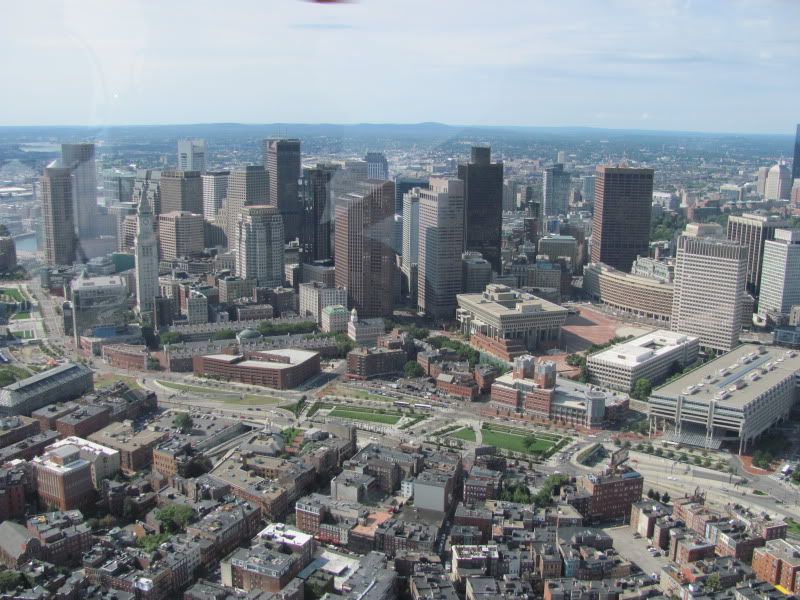
Makes me realize these North End parks could actually be a gem. Build the blackstone block, tear down that horrid Congress Street garage and replace with something urban and preferably tall, and, perhaps most importantly, build over the ramp parcels to confine the space along its most ambiguous edges.
J
Justin7
Guest
Yes please. Also, narrow Hanover between the parks to two lanes and pave it with something more pedestrian friendly.
Shepard
Senior Member
- Joined
- Mar 20, 2009
- Messages
- 3,518
- Reaction score
- 69
Will anything ever be built over the ramps? I've come to think they should build hollow faux residential buildings over these ramps adjacent to the North End parcels, four or five stories tall, with balconies and interior lights that come on randomly at night. Maybe if they build out from the ramps a bit, there can be room for actual ground floor restaurant kitchens (tables outside and/or in an adjacent pavilion) or shallow retail.
Ron Newman
Senior Member
- Joined
- May 30, 2006
- Messages
- 8,395
- Reaction score
- 14
Would it be any less expensive to build faux buildings than to build real ones of the same size?
Shepard
Senior Member
- Joined
- Mar 20, 2009
- Messages
- 3,518
- Reaction score
- 69
Even on solid ground I would say yes, but compared to building a solidly-engineered structure over highway ramps? I'd think definitely, since you would virtually not need to support any structure over the ramps themselves.
czsz
Senior Member
- Joined
- Jan 12, 2007
- Messages
- 6,043
- Reaction score
- 8
Will anything ever be built over the ramps? I've come to think they should build hollow faux residential buildings over these ramps adjacent to the North End parcels, four or five stories tall, with balconies and interior lights that come on randomly at night. Maybe if they build out from the ramps a bit, there can be room for actual ground floor restaurant kitchens (tables outside and/or in an adjacent pavilion) or shallow retail.
There's a power plant in some residential neighborhood of the Bronx that uses this effect.
I'd rather just see most of the ramps eliminated, though. Is there really a need for this many different auto access points to downtown Boston from the same highway? Why not just one or two, with the preexisting Greenway surface roads (do they have real names yet?) serving as feeders and collectors?
Shepard
Senior Member
- Joined
- Mar 20, 2009
- Messages
- 3,518
- Reaction score
- 69
One way or another, the highly visible and deadening highway ramps next to Quincy Market are an abomination considering how much it cost to bring down the whole mess.
Also, developing the ramp parcels adjacent to either side the North End parks would work to enclose that space and make it work better urbanistically.
Also, developing the ramp parcels adjacent to either side the North End parks would work to enclose that space and make it work better urbanistically.
Boston02124
Senior Member
- Joined
- Sep 6, 2007
- Messages
- 6,936
- Reaction score
- 7,088
cool^thanks
BostonUrbEx
Senior Member
- Joined
- Mar 13, 2010
- Messages
- 4,346
- Reaction score
- 140
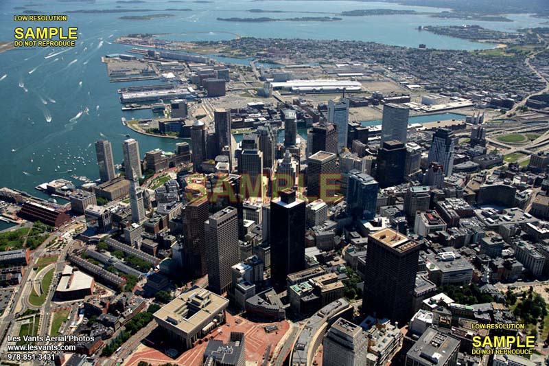
And here we have Barren Swath of Land #1, Barren Swath of Land #2, and Barren Swath of Land #3. Take your pick; grass, asphalt, or paving brick.

gooseberry
Active Member
- Joined
- Nov 24, 2009
- Messages
- 550
- Reaction score
- 3
Cool, so was the idea to take out a chunk of south station for some highway ramps or to just wipe out the whole thing and start with a clean slate? Hasta la vista Chinatown too!
BostonUrbEx
Senior Member
- Joined
- Mar 13, 2010
- Messages
- 4,346
- Reaction score
- 140
Hey, I recognize that photo. 


I found one of the few images like these somewhere, and found then found everything else by changing the numbers at the end of the URL. There's 3 others, of North Station, the "old BET", and Day Square-Orient Heights area, can't seem to find more. I know there was more I found...
I'm glad these highways didn't happen... Phew...