Green Line Extension to Medford & Union Sq

More detailed pictures of the large format historical Winter Hill Station and the original high school. All the storefronts along Medford St are fascinating. The old power lines are wild too.

View attachment 32986View attachment 32987View attachment 32991View attachment 32988View attachment 32989View attachment 32990

Great historical shots! Those are old telephone wires, not power lines — this was before multiplexing, so each wire could only carry a single phone call at a time, hence the huge number of them.
 
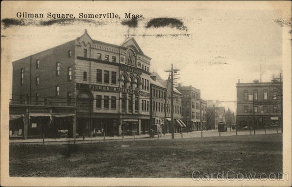
I was remarking to my sister a week or so ago about that picture of Gilman Square. It's so depressing. The loss of the corner lot at Medford and Pearl hits me the hardest. Hopefully the new train station invigorates that area again.
 
I'm lamenting the loss of the urban fabric. The photo evokes a bustling square of commerce that's been lost. We talk a lot about street walls here, and I feel that the corner lot really ties a lot of the old square together.

Now it's a green space which is better than a parking lot or another gas station, but it's a useless park that illustrates how wide and open the square is because of what was lost.
 
I was remarking to my sister a week or so ago about that picture of Gilman Square. It's so depressing. The loss of the corner lot at Medford and Pearl hits me the hardest. Hopefully the new train station invigorates that area again.
Just like acronyms, spatially vague descriptions of geography without a visual makes it difficult to understand.

Do you mean this area of Gilman Square?

20DC7F95-4B1B-4961-97E2-133D767997A9.jpeg


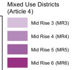
I peeked at the Somerville Zoning Ordinance atlas and not all is lost. Here is a zoning map of Gilman Square. The portion of the “corner lot” outlined in highlighter above is zoned MR4 (Mid Rise 4). So excluding the land at the very tip of the Medford Pearl intersection, the rest is technically zoned for development (I didn’t go so far as research property rights).
21CC91A5-FD2A-4DBB-9AD0-C980DEAADCBB.jpeg

0414C7BD-709F-4B14-B069-02FC0EA0CB7F.jpeg
So what is MR4 zoning exactly? Sounds very similar to the “urban fabric” you’re lamenting lost from the photos. See from the Somerville Zoning Ordinance how it is generally defined. An up to four story apartment, general, or commercial building. Pretty urban landscapey to me. Now if anything actually gets built, who knows?
1AB2C7C8-376D-4644-B657-41B16BCB5459.jpeg

(Oh, and if this wasn’t the “corner lot” you spoke of, then sorry for the waste of time :) )
 
I'd assume they were referring to the building in the photo that is gone, which I think is kitty-corner to the upper left of the lot you circled (MR6? next to the piano)? Could be not reading the photo right, though.
 
Gilman is my neighborhood and I've contributed to some of the city's visioning plans for the area. Unfortunately, I'd say all the extant material is past its expiration date. The neighborhood groups the city works with for input on development consider the 2014 plan as useless since it is built around the previous T station designs that included access directly from the Medford/Pearl intersection.

Walking around the neighborhood
  • Good Gas site on Medford St was nearly bought by Elan Sassoon but he backed out after the Piano Building owner threatened to sue. No real action at this point.
  • Piano Building (the only historical building in the square) has an owner that lives in Florida and has owned the building for 30 years. Looking at opening up the first floor for retail. No firm plans for the next couple years.
  • ABJ lot at corner of Medford/Pearl has a new owner who has proposed a few designs but nothing planned for the immediate future. The lot has some sewer pipe issues that make it difficult to do excavation.
  • Homans Building lot (previously staging area for GLX construction) is owned by the city and has been proposed as mixed use, open space and a variety of Somerville community wish list items (new fire/police station, new YMCA). Currently the Y is meeting with the neighborhood association about relocating there. Won't happen for many years because of city's long-term sewer system plans that involve utilizing the site.
  • Open greenspace triangle between Pearl and Medford is city owned and technically zoned for redevelopment. But there's absolutely zero plans for using the space in the near term.

So in short, there is nothing solid and active on any parcel. All just nightmares and dreamscapes.
 
Just like acronyms, spatially vague descriptions of geography without a visual makes it difficult to understand.

Do you mean this area of Gilman Square?

Thanks for the update on those lots, I was referring to MR4 & UR, which going back I realized is not in the pictures that @Dr. Rosen Rosen posted 🙄, but there is a picture at Gilman Station of it. Quick google search found this, which may or may not be the same photo but is the same building:
card00546_fr.jpg
 
Gilman is my neighborhood and I've contributed to some of the city's visioning plans for the area. Unfortunately, I'd say all the extant material is past its expiration date. The neighborhood groups the city works with for input on development consider the 2014 plan as useless since it is built around the previous T station designs that included access directly from the Medford/Pearl intersection.

Walking around the neighborhood
  • Good Gas site on Medford St was nearly bought by Elan Sassoon but he backed out after the Piano Building owner threatened to sue. No real action at this point.
  • Piano Building (the only historical building in the square) has an owner that lives in Florida and has owned the building for 30 years. Looking at opening up the first floor for retail. No firm plans for the next couple years.
  • ABJ lot at corner of Medford/Pearl has a new owner who has proposed a few designs but nothing planned for the immediate future. The lot has some sewer pipe issues that make it difficult to do excavation.
  • Homans Building lot (previously staging area for GLX construction) is owned by the city and has been proposed as mixed use, open space and a variety of Somerville community wish list items (new fire/police station, new YMCA). Currently the Y is meeting with the neighborhood association about relocating there. Won't happen for many years because of city's long-term sewer system plans that involve utilizing the site.
  • Open greenspace triangle between Pearl and Medford is city owned and technically zoned for redevelopment. But there's absolutely zero plans for using the space in the near term.

So in short, there is nothing solid and active on any parcel. All just nightmares and dreamscapes.

This is very informative and appreciated. The lot and related old ABJ building at the corner of Pearl and Marshall is the one big surprise to me, as one of the guys moving around used cars in that lot (it's been an ancillary lot for John's Auto Sales since... I dunno, the spring of '22?) described the dealer's use of the space as being "not for long! This whole area's gonna be completely different." While that (obviously) didn't feel like a detailed overview of any specific development or developments, I took it at face value as it seemed reasonable that a barren lot and abandoned garage directly across from a new Green Line stop and opposite the only restaurant to ever receive a five-star rating from the Boston Globe would be ideal for redevelopment.

Hadn't heard about the Sassoon drama re: the Good Gas site, but as that's where I get my car inspected and oil changed and it's convenient and the Good Gas guys are nice, I'm fine with status quo there.

I thought there were plans to get rid of the Fuel Fox/recently (within the past five years) rebranded Mobil station on the other side of the street and begin remediation relatively soon to prep for mixed use, but I don't see that lot mentioned in your summary?
 
Last edited:
A first for me, anyways - the new green line cars. (Sorry if there’s a better thread or the new cars are already old news!).

Super smooth and quiet ride (mostly - see below). Quality materials. Some new video monitors. And yeah, nice wide doors. Looks quite sleek as you walk up to it too. Funny story: the seats are hard but not slippery - which I learned on my ride today as it seemed like they were doing emergency brake testing. At least 3 such moments occurred where many passengers looked up at each other after a hard stop and were like, what was that for??

D3E5AC13-1BEB-4E61-A554-939F1F5479F8.jpeg
51A4240F-B630-4AD9-B154-3D7D34665C91.jpeg
D74E3930-CA1D-4B8B-8CEE-5677BA4A3F20.jpeg
8069EED8-9AF4-4F26-99E6-83E6E5507D99.jpeg
4999195F-2350-4744-9979-89E87B54230F.jpeg
C62D60D3-7DF2-4A4D-B564-893036B94554.jpeg
B97D4BF4-F4DC-4C47-A1B3-515A10D71BCB.jpeg
5A6CB31D-7D6A-4F5F-B9A0-0CD39BE96713.jpeg
 
Spitballing here, but my gut says hazardous material, especially if they've placed a barrier on it. If the station had lead paint, it's probably been leeching into the ground for years, along with many other nasty things. The cleanup for that is expensive and can be a rabbit hole if soil testing keeps coming back with over the limit amounts. Cheaper to cap it and wait for a developer who's willing to take on the costs.
 
NB from Park Street last night after a show around 10PM GLX-Medford was full - workers, families, then lots of Celtics fans - far more than I'd seen on any bus coming home. I'm very curious what month-1 ridership is compared to estimates, even though I'm sure inbound data are trash due to the senseless validation decision.
 
Yeah... I think that over time people are going to totally ignore validation. It's to shrink to a very honest subpopulation but rest essentially treat "inbound is free". Thinking about it, I hope nobody notices it as I can just imagine certain actors will try to use the data to say transit has failed or something like that with numbers far lower than usage. I wonder what is going on with AFC 2.0 internally.
 
Yeah... I think that over time people are going to totally ignore validation. It's to shrink to a very honest subpopulation but rest essentially treat "inbound is free". Thinking about it, I hope nobody notices it as I can just imagine certain actors will try to use the data to say transit has failed or something like that with numbers far lower than usage. I wonder what is going on with AFC 2.0 internally.
And even among the people that do validate, many think you just validate the card and don’t realize there’s a ticket. When I go to work in the morning I can just reach in the machine and there are a dozen tickets from that morning just sitting there.

Also if there is a train coming in 1-2 minutes no one is going to wait in line to play around with the machine.
 
Yeah... I think that over time people are going to totally ignore validation. It's to shrink to a very honest subpopulation but rest essentially treat "inbound is free". Thinking about it, I hope nobody notices it as I can just imagine certain actors will try to use the data to say transit has failed or something like that with numbers far lower than usage. I wonder what is going on with AFC 2.0 internally.

I always validate and when I did so the other morning on my way into work the dispenser was absolutely full of validation receipts. Took me a minute of digging to find mine. So it seems like people are validating their fare but not taking the paper validation receipts, which is really the entire point. Although I haven't seen any on board fare enforcement so it likely doesn't matter.
 

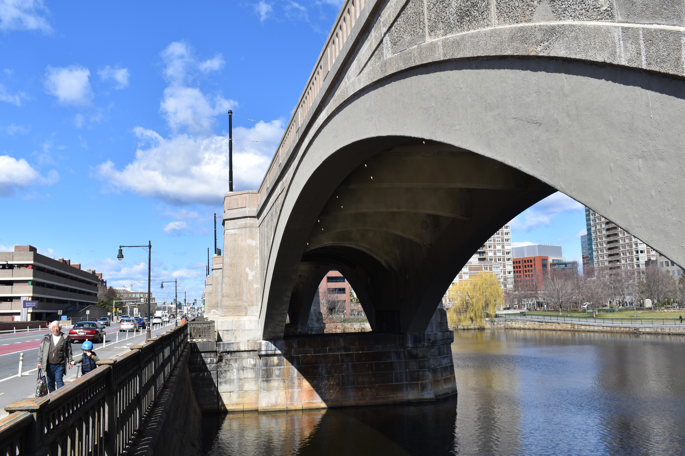
Apparently the 10 MPH limit on the Lechmere Viaduct is due to a lack of custom ties:

“The MBTA continues working diligently to execute safe and rapid strategies to eliminate slow zones across the system. The slow zone is in place at the East Cambridge Viaduct as the MBTA awaits custom ties for the 110-year-old bascule span of the viaduct,” Lisa Battison, MBTA spokesperson told StreetsblogMASS over email last week.

No date was given, but Battison said the ties will be replaced as soon as they become available.

“While these custom ties are being replaced, the MBTA will use this opportunity to access and replace rail. Based on projections related to working and weather conditions on the open deck structure over the Charles River and the availability of resources and materials, the work to remove the slow zone is scheduled to be completed in the spring of 2023,” said Battison.

Translating MBTAese to English, that means early 2024 at the earliest.

Even the 25 mph speed target – still unmet – may be the product of reduced expectations.

In the T’s design-build contract for the Green Line Extension, released in 2017, the agency called for contractors to design for maximum inbound and outbound speeds of 50 mph between Science Park and the Red Bridge Interlocking, the complex of bridges located just north of Lechmere Station where the D and E Green Line branches split to Somerville and Medford, respectively.

Kudos to the article for continuing to remind us that 25 MPH itself is a speed restriction.
 

Back
Top