MBTA "Transformation" (Green Line, Red Line, & Orange Line Transformation Projects)

Does no one care about converting it to a Red Line extension anymore? Seems like a really logical thing to do.
This was never a thing that made it past the internet. And it makes little sense unless Milton and one of the NIMBYest parts of Boston is going to build towers, not to mention any environmental issues from building alongside the Neponset.

What we can see from the counts is that most passengers are using the Trolley to get from Mattapan to Ashmont and points north, with a smaller portion going to Milton / lower mills. Many of those trips would be better served by the Fairmount Line if service were frequent or the Blue Hill Ave bus lanes that are in design along with better east/west routes in Dorchester. The trolley ridership was never higher than a middling bus line regardless of which counts you use.
Mattapan Line was designed and built with a future Red Line conversion in mind, though. Shows up in grade separation, ROW width, etc.
 
Mattapan Line was designed and built with a future Red Line conversion in mind, though. Shows up in grade separation, ROW width, etc.

Well, as I've said before, in the original public meetings for the "transformation" conversation was brought up in at least the Dot one, and the guy almost got tar and feathered from the public's reaction, and, the chief MBTA engineer on the project claimed there were points in the ROW in the cemetery that were not wide enough for a conversation to heavy rail, thus it wasn't technically possible. Now, obviously, the MBTA was bullshittng, since in the same meeting they were pushing the bustitution of the line as a real alternative, but, I think it's safe to say a conversion to the red line isn't politically happening any time soon.
 
Apropos of both nuking the Mattapan loop and of prepping the system for the Type 10s, (This is probably one for @The EGE) how are we doing on eliminating the tightest Green Line curves as listed in the Underground Station Layouts thread:

Greatly. Lechmere is 42-foot radius inner and 50-foot outer; Boylston is actually much looser at 80 (westbound) and 90 (eastbound), but the tunnel environment focuses the sound. Other tight curves (less than 75 foot radius):
  • 50-foot radius on Brattle Loop
  • 60-foot radius entering GC southbound
  • 49-foot radius on Park Street inner loop, including the SB inner track. 68-foot radius for SB outer track.
  • 55-foot radius in Kenmore Loop
  • 45-foot and 49-foot radii on the Lake Street Yard loops, several other 50-foot curves
  • 50-foot radii on Prendergast Alley (Reservoir Yard to Cleveland Circle, the alley next to Dunkies)
  • Lots of 58-to-70-foot curves in Reservoir Yard
  • A 57-foot and a 70-foot curve in Riverside Yard
  • 50-foot radii on both loops at Heath Street
If you really want to get into the weeds, I spent an whole appendix of my thesis speccing out various minimum-radii possibilities. tl;dr:
  • 45 feet is the new minimum after Lechmere is gone
  • 49 feet just needs mods to a couple yard curves.
  • 60 revenue/50 nonrevenue is possible if you move some columns at Park Street (and eliminate the inner loop) and deal with Heath Street.
  • 60 everywhere means lots of nonrevenue stuff modified, of which Brattle and Kenmore loops are the trickiest.
  • 66 everywhere (20 meters, the smallest off-the-shelf available) requires some changes to GC as well.
 
This was never a thing that made it past the internet. And it makes little sense unless Milton and one of the NIMBYest parts of Boston is going to build towers, not to mention any environmental issues from building alongside the Neponset.

What we can see from the counts is that most passengers are using the Trolley to get from Mattapan to Ashmont and points north, with a smaller portion going to Milton / lower mills. Many of those trips would be better served by the Fairmount Line if service were frequent or the Blue Hill Ave bus lanes that are in design along with better east/west routes in Dorchester. The trolley ridership was never higher than a middling bus line regardless of which counts you use.
4 track NSRL has a better chance of being built than the bus lanes on Blue Hill Avenue.
 
Assuming full staffing, what is the maximum throughput they’re targeting with all the transformation projects? I’m thinking of the Cambridge Day article about the disappointment at the GLX opening, and the comment about the head ways.
 
Assuming full staffing, what is the maximum throughput they’re targeting with all the transformation projects? I’m thinking of the Cambridge Day article about the disappointment at the GLX opening, and the comment about the head ways.

I believe the Orange is 4.5 minutes, and the Red is 3/6 minutes on the trunk/branches respectively. That's a 40% increase in capacity on the Orange and 50% increase on the Red.

Speaking of, most of that also relies on the new signalling systems. The Red was originally tagged for 2021 (if I recall), and the T currently claims it is 55% done in 2023. The Orange was 2022, and the MBTA currently marks it as 30% done. Also, from the weekly updates, the Orange Line's signal upgrade has been on hold since the end of April. Seems like the train wreck (pun intended) of the new rolling stock is getting all of the attention, but, the signal system upgrade is also woefully behind schedule.
 
Last edited:

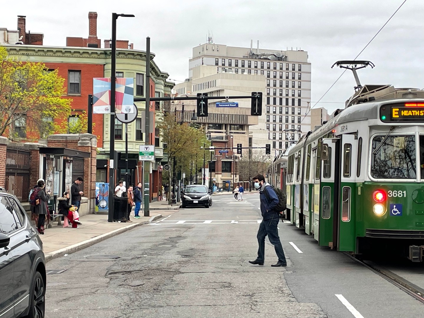
Huntington Ave. Redesign Will Eliminate Last Mixed-Traffic Segment of the Green Line By 2027​

HuntingtonAvenueEBranchGreenLineStop.jpg


“On Tuesday evening, officials from the City of Boston and the MBTA officially kicked off a planning effort that will ultimately redesign Huntington and South Huntington Avenues in Boston's Mission Hill neighborhood.

The project will likely eliminate the last segment of the Green Line where trains share a lane with – and frequently get stuck behind – motor vehicle traffic.

The reconstruction of the redesigned streets will need to be complete by 2027 so that the E branch can accommodate the T's new "Type 10" light rail vehicles.

To meet that deadline, the City of Boston and MBTA will need to agree on a new design for these streets and its new Green Line stations by the end of this year.…”

https://mass.streetsblog.org/2024/0...xed-traffic-segment-of-the-green-line-by-2027

Edit: This comment was also posted underneath the article:

Christian MilNeil streetsblog:
“City officials at this meeting did say that they're designing "not to preclude" a future extension of the E branch toward Hyde Square – even though there's no funding or serious effort being put to that project at the moment.”
 
Last edited:
Eliminate all on-street parking, add bike lanes, keep one traffic lane in each direction, construct a GL reservation down the middle, and there you have it!
and also make the center-running lanes GL + bus-only.

When I was playing around with streetmix I was having trouble squeezing that with sidewalks into the 55' ROW, unless you made the sidewalk or travel lanes really narrow.
 
and also make the center-running lanes GL + bus-only.

When I was playing around with streetmix I was having trouble squeezing that with sidewalks into the 55' ROW, unless you made the sidewalk or travel lanes really narrow.
In the Streetsblog article it said it was between 55 and 60 feet curb to curb, which isn't counting the sidewalks. So with sidewalks it's more like 75 to 80 feet (which measure distance on google maps seems to confirm) so that means you can easily fit everything in:

1715192321439.png


The only caveat would be what to do at the actual stops where you'd need platforms. Probably make the sidewalk narrower and increase the width of the medians surrounding the transit lanes, something like this:

1715192507640.png
 
In the Streetsblog article it said it was between 55 and 60 feet curb to curb, which isn't counting the sidewalks. So with sidewalks it's more like 75 to 80 feet (which measure distance on google maps seems to confirm) so that means you can easily fit everything in:

View attachment 50335

The only caveat would be what to do at the actual stops where you'd need platforms. Probably make the sidewalk narrower and increase the width of the medians surrounding the transit lanes, something like this:

View attachment 50336
At the meeting I believe the requirements mentioned were that the platforms are required to be 9 feet wide, the transit lanes need to be 12 feet wide, and the two-lane cycle path will be 13 feet wide.
 
At the meeting I believe the requirements mentioned were that the platforms are required to be 9 feet wide, the transit lanes need to be 12 feet wide, and the two-lane cycle path will be 13 feet wide.
If that's the case then it would still be possible, they'll just have to stagger the platforms and have the travel lanes swerve around the platforms which shouldn't be a huge deal:
1715196174121.png
 
At the meeting I believe the requirements mentioned were that the platforms are required to be 9 feet wide, the transit lanes need to be 12 feet wide, and the two-lane cycle path will be 13 feet wide.
Green Line specs are that platforms must have 6 feet of width between platform edge and obstructions (columns/fences, light posts, benches, signage, trash cans). I guess 9 ft. is appropriate if you're going to have bus-shelter type shelters with 4 posts, but the B-line ADA stations and Columbus Ave. bus stations were able to design them much closer to the Design Guide minimums by having 2-peg shelter supports.
 
Green Line specs are that platforms must have 6 feet of width between platform edge and obstructions (columns/fences, light posts, benches, signage, trash cans). I guess 9 ft. is appropriate if you're going to have bus-shelter type shelters with 4 posts, but the B-line ADA stations and Columbus Ave. bus stations were able to design them much closer to the Design Guide minimums by having 2-peg shelter supports.
Just doing a quick measure on Google Earth and it seems like the new B Branch stops and Columbus Ave stops are all about 9 feet wide, so I'd assume they'd go for the same width on this project.
 
The other day I saw a Type 9 on the B with a headsign reading "Express to
Harvard Ave" which I have not seen displayed before. I don't know if I've conveniently never seen an express Type 9 from the outside and only been in them where the interior signs do display express
 
The other day I saw a Type 9 on the B with a headsign reading "Express to
Harvard Ave" which I have not seen displayed before. I don't know if I've conveniently never seen an express Type 9 from the outside and only been in them where the interior signs do display express
I've seen type 9s on the C branch that had the same sign but express to coolidge corner.
 

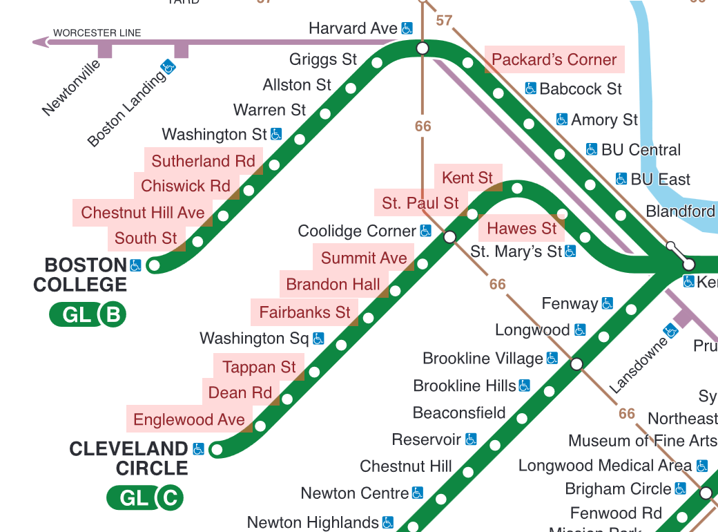
Washington Pledges $68 Million for Green Line Accessibility Upgrades​

MBTAGLAccessProjectsFTAAward2024.png

“The Federal Transit Administration (FTA) today announced that the T will receive $67.6 million to upgrade 14 Green Line stops on the B and C branches to provide accessibility upgrades and compliance with the Americans with Disabilities Act.

The funding comes from the Federal Transit Administration's All Stations Accessibility Program, which pledged $343 million in grants for eight transit systems on Tuesday. The Bipartisan Infrastructure Law allocates more than $1.7 billion for this program through 2026….”

https://mass.streetsblog.org/2024/0...million-for-green-line-accessibility-upgrades
Hopefully they will also lengthen the platforms, so they can all accommodate two type 10 trains when they are rolled out.
 

Back
Top