You are using an out of date browser. It may not display this or other websites correctly.
You should upgrade or use an alternative browser.
You should upgrade or use an alternative browser.
Winthrop Center | 115 Winthrop Square | Financial District
- Thread starter vanshnookenraggen
- Start date
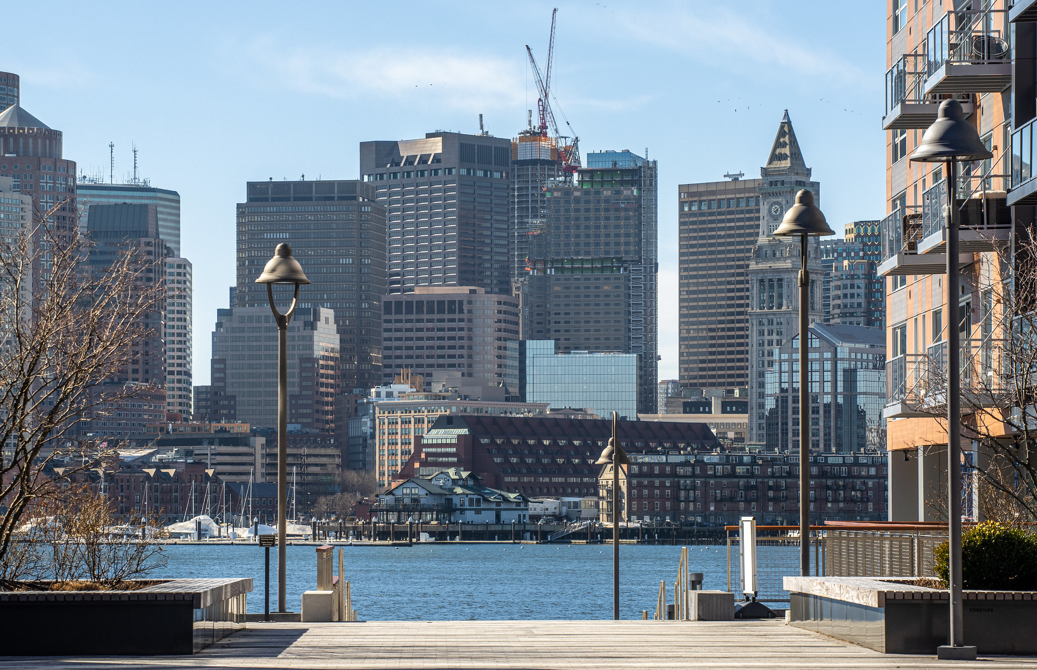
 IMG_8137
 IMG_8138
 IMG_8160
So, yes - I think they left about 10 feet or something trivial on the table vs. the FAA mandate. I think I pointed this out before, but, the BPDA/City on their RFP for the site was pretty shady with their height limit that was way above the FAA limit. If I recall, the FAA limit was known well in advance - going back to Menino's day calling a for a 1000' here, so I have no idea wth the City was doing. That said - I thought one of the driving reasons behind the height limit (in this area of the city, at least) was radar and interference. I somewhat recall (perhaps on the Menino call) it being thrown out there that maybe the developer could just way to move/install new radar, but it went basically no where.
- Joined
- Jan 7, 2012
- Messages
- 14,173
- Reaction score
- 23,688
 IMG_1739 by Bos Beeline, on Flickr
 IMG_1763 by Bos Beeline, on Flickr
 IMG_1740 by Bos Beeline, on Flickr
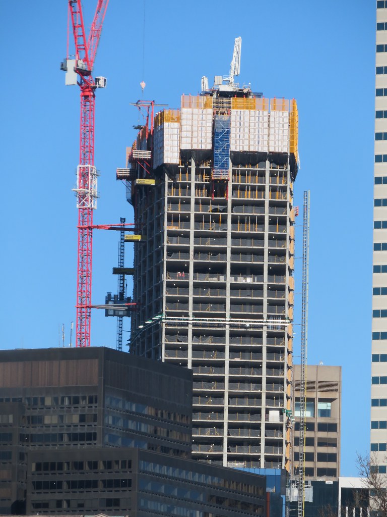 IMG_1764 by Bos Beeline, on Flickr
 IMG_1880 by Bos Beeline, on Flickr
 IMG_1881 by Bos Beeline, on Flickr
 IMG_1882 by Bos Beeline, on Flickr
Last edited:
Brad Plaid
Senior Member
- Joined
- Jan 17, 2013
- Messages
- 1,310
- Reaction score
- 1,559
bigpicture7
Senior Member
- Joined
- May 5, 2016
- Messages
- 4,068
- Reaction score
- 10,551
Today (2/12)

citydweller
Active Member
- Joined
- Aug 23, 2019
- Messages
- 487
- Reaction score
- 766
I would love too see another 20 floors but I think it's nearing the top floors at this point.
beck4537
Active Member
- Joined
- Oct 31, 2019
- Messages
- 517
- Reaction score
- 2,332
Anyone know how many floors this has left to go before topping out?I would love too see another 20 floors but I think it's nearing the top floors at this point.
Anyone know how many floors this has left to go before topping out?
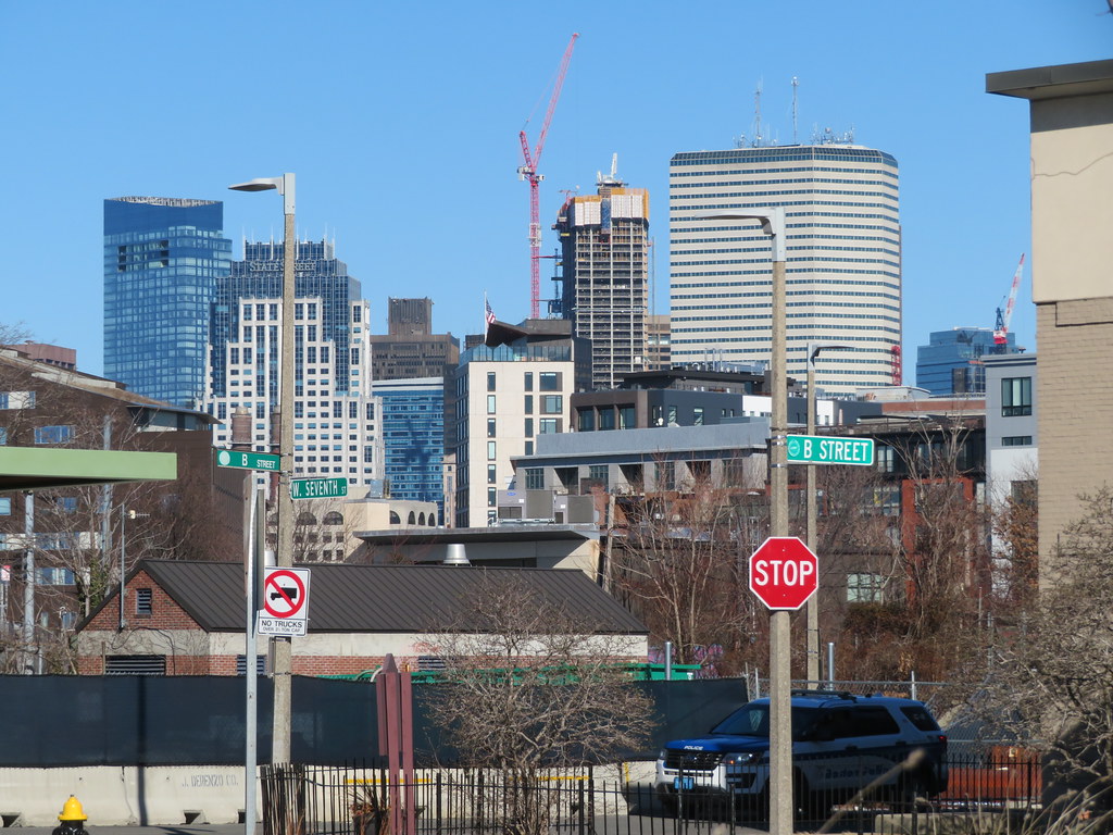
I think it's at 48, which means 1 more, plus 3 penthouse floors making up most of the crown, plus the double height mech at the top capping the crown. So my guess is it's around 600'-610'.
Nibbles O’Plenty
Active Member
- Joined
- Aug 24, 2020
- Messages
- 213
- Reaction score
- 738
It is the best we will get in the downtown area for a very long time.Underwhelming
It is the best we will get in the downtown area for a very long time.
Sadly true. I doubt the South Station tower is going to turn out any better.
- Joined
- Jan 7, 2012
- Messages
- 14,173
- Reaction score
- 23,688
 IMG_2116
 IMG_2117
citydweller
Active Member
- Joined
- Aug 23, 2019
- Messages
- 487
- Reaction score
- 766
Sadly true. I doubt the South Station tower is going to turn out any better.
There isn't much in the way of building density at South Station compared to the density at Winthrop square so I think that the SST will really stand out quite nicely. It may even be dramatic in the skyline.
Last edited:

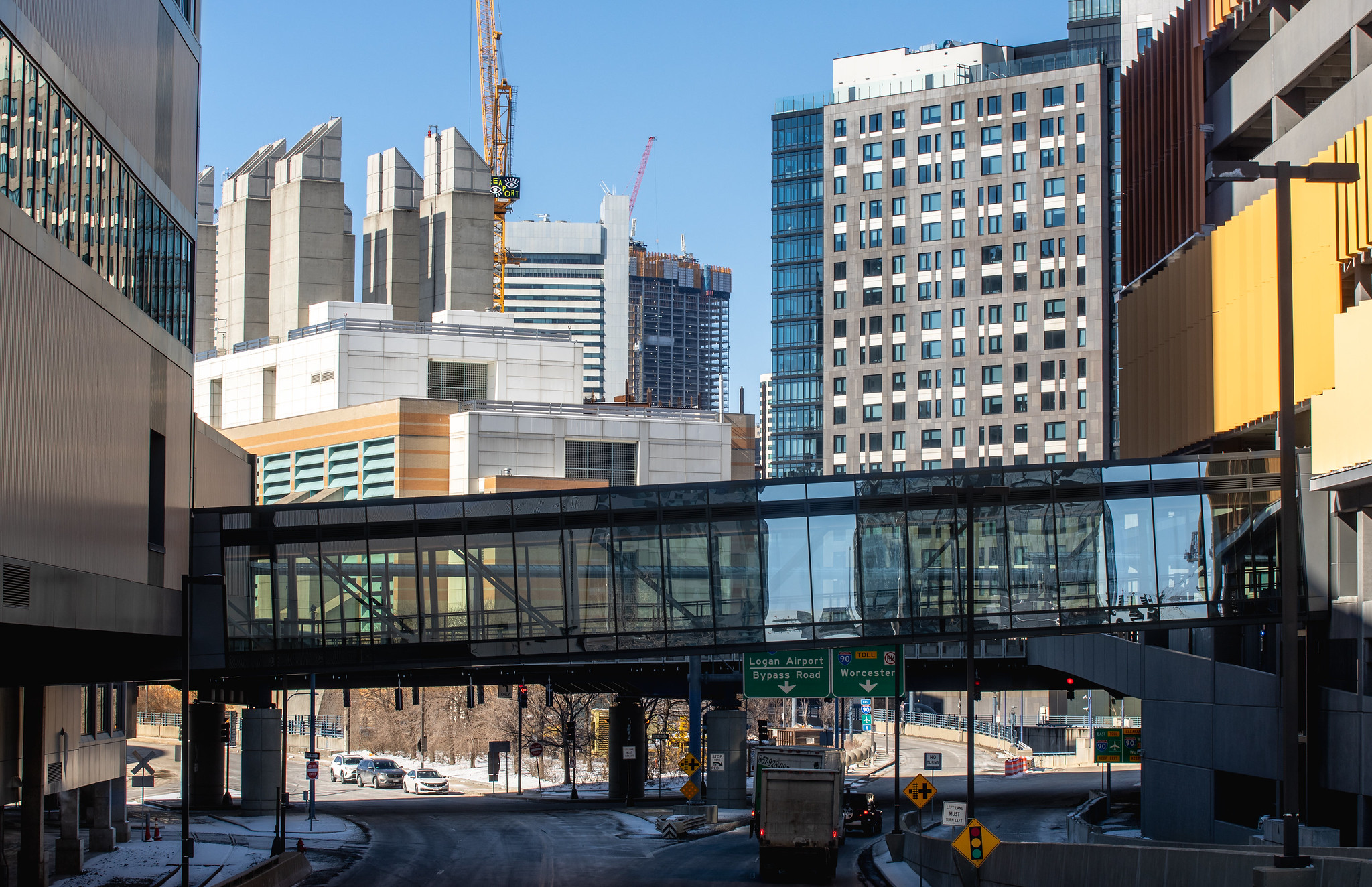


 IMG_8168
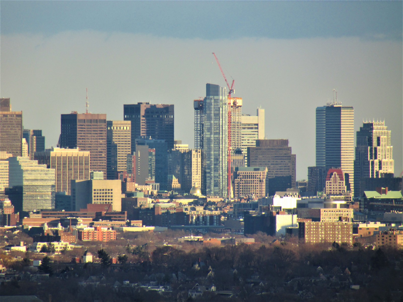 IMG_8170
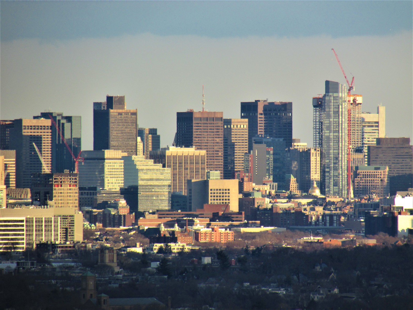 IMG_8201
 IMG_8205
Boston02124
Senior Member
- Joined
- Sep 6, 2007
- Messages
- 6,936
- Reaction score
- 7,088
beck4537
Active Member
- Joined
- Oct 31, 2019
- Messages
- 517
- Reaction score
- 2,332
View attachment 21535View attachment 21536View attachment 21537View attachment 21538Looking like it’s the 2 nd tallest from far away
Was your first pic from Chickatawbut road near the tower?