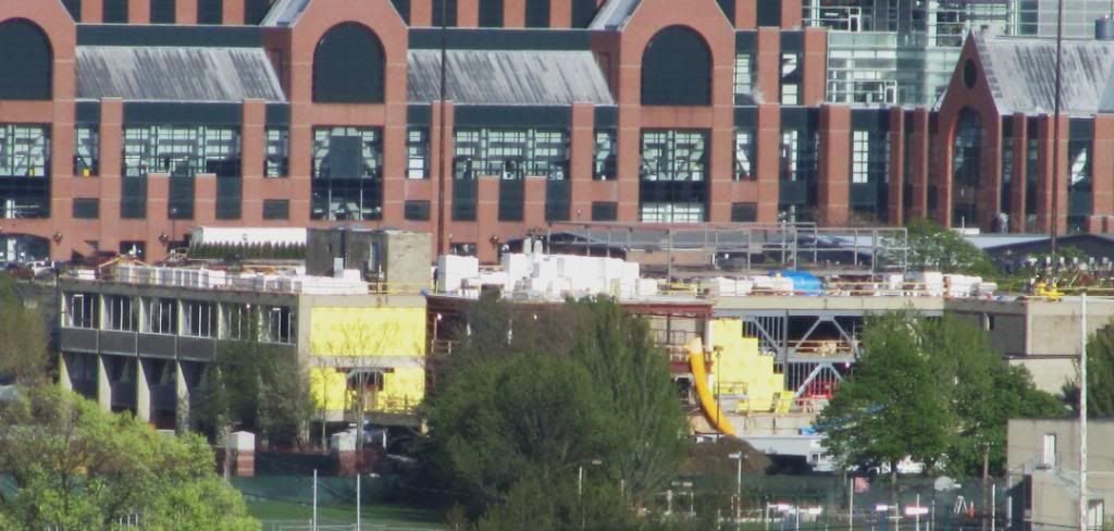
Allston-Brighton Infill and Small Developments

What is Harvard planning to build at the current Charlesview site?

Back in the original plan, that area was to be a museum/cultural complex.

North of it, where the soccer field, is now was to be the Graduate School of education.

Harvard is about to start renovating all the river houses, and take about 15-16 months for each (one academic year + a summer). (Cost about $100+ million a house.) The first renovation will only be part of one house, so that the residents can be-relocat6ed without too much of a hassle. However, doing a whole house will require Harvard using swing space elsewhere. Harvard has not said where the swing space will be.

http://www.thecrimson.com/article/2011/1/14/quincy-houses-old-house/

Might Harvard do some inexpensive renovations to Charlesview and use that as swing space????
 
That makes some sense, but it's a long and lonely walk to Harvard Square, especially in the winter. Much worse than being in the Radcliffe Quad. If Harvard owns the Harvard Square Hotel in Brattle Square, that would be a better choice to use as swing space.
 
That makes some sense, but it's a long and lonely walk to Harvard Square, especially in the winter. Much worse than being in the Radcliffe Quad. If Harvard owns the Harvard Square Hotel in Brattle Square, that would be a better choice to use as swing space.

As part of Harvard's 50 year plan for Allston, one of the plans are to create another "square" (like Harvard Sq.) at Barry's Corner...

See the "Plan for Harvard in Allston Executive Summary" -- @ http://www.edumetrics.info/Allston.pdf

--
Or the boiled down versions:

Article: Harvard unveils its vision of campus across Charles - By Donovan Slack, Globe Staff
Date: January 12, 2007
Source: www.Boston.com - Boston Globe
Link: http://www.boston.com/news/local/ma..._unveils_its_vision_of_campus_across_charles/

--

Article:Harvard's 50-Year Plan
Date: March-April 2007
Source: www.harvardmagazine.com - Harvard Magazine
Link: http://harvardmagazine.com/2007/03/harvards-50-year-plan.html

--


I think if the state played their cards right, maybe Harvard would like to throw in some money for a subway line from Harvard Square out to Allston, and heading out towards Watertown? Page 15 of the Harvard plan listed above says "Reserve Urban Ring tunnel or surface right-of-way".

On Page 40 it states: "Urban Ring: There is a possible eventual fifth transit element: an extension of the proposed Urban Ring transit system into Cambridge via Allston. A sufficient right-of-way for a tunneled solution has been provided under Stadium Way or a route could be accommodated at the surface. Either a surface or an underground route (west of the Stadium) could tie into the Red Line in Cambridge."
 
Last edited:
As part of Harvard's 50 year plan for Allston, one of the plans are to create another "square" (like Harvard Sq.) in Allston...

See the Plan for Harvard in Allston Executive Summary -- @ http://www.edumetrics.info/Allston.pdf

--
Or the boiled down versions:

Article: Harvard unveils its vision of campus across Charles - By Donovan Slack, Globe Staff
Date: January 12, 2007
Source: www.Boston.com - Boston Globe
Link: http://www.boston.com/news/local/ma..._unveils_its_vision_of_campus_across_charles/

--

Article:Harvard's 50-Year Plan
Date: March-April 2007
Source: www.harvardmagazine.com - Harvard Magazine
Link: http://harvardmagazine.com/2007/03/harvards-50-year-plan.html

--


I think if the state played their cards right, maybe Harvard would like to throw in some money for a subway line from Harvard Square out to Allston, and heading out towards Watertown? Page 15 of the Harvard plan listed above says "Reserve Urban Ring tunnel or surface right-of-way".

On Page 40 it states: "Urban Ring: There is a possible eventual fifth transit element: an extension of the proposed Urban Ring transit system into Cambridge via Allston. A sufficient right-of-way for a tunneled solution has been provided under Stadium Way or a route could be accommodated at the surface. Either a surface or an underground route (west of the Stadium) could tie into the Red Line in Cambridge."

Harvard's been thinking about that for close to 30 years. The old Red Line tunnel to the former Eliot Shops yards that occupied the whole of the JFK School land is still there preserved and unused. Where the Red Line starts curving into the new station you'll see a cinderblock false wall on one side of the train (right inbound, left outbound) right after the abandoned old Harvard platforms. That tunnel kept going more or less straight instead of curving, the bi-level inbound/outbound tunnels merged back at-grade, and then it widened to 3-track and went under Eliot St. all the way to the intersection with Bennett St. at the foot of the JFK School. The old yard started below street level with the tunnel portal under the sidewalk and covered the whole plot of land out to Memorial Drive that the JFK School sits on. The place where the bi-level tunnels meet at-grade is basically along the station concourse wall at bottom of the main stairs, directly across from the bus tunnel entrance.

On Google Maps you can trace a straight line along the Stadium from the Allston side straight between buildings at the JFK School, straight into this tunnel. Harvard laid out the JFK School purposefully to preserve re-use options in the tunnel for a future cross-Allston subway.


Harvard prefers a rail solution because...well, the T's BRT plan for Phase II of the Urban Ring is idiotic. The official proposal was for dedicated right of way branching off the main Ring route, going through the BET yards and Harvard land to the Stadium area, then mashing back onto North Harvard and getting stuck in traffic the rest of the way. With nebulous ideas of maybe sorta fixing this for rail Phase III which nobody ever believed they were serious about. Harvard would rather have light rail from Day 1, or at least a full grade-separated BRT route under the Charles that can get converted to rail. If it's BRT it would feed directly into the bus tunnel. If it's light rail it would be a stub-end terminal fed into the old Red Line tunnel. Kind of moot at the moment because the T withdrew support for continuing the EIS for Phase II, effectively killing the project dead.

IF it were to get revived with a design less farcial than the BRT kool-aid the T was drinking, a light rail line could go the whole grade-separated surface distance through Harvard's BET land, curve behind Ohin Field (probably with overpasses at Western Ave. and N. Harvard or something), go underground behind the Stadium, and then shoot in a deep-bore tunnel across the Charles. Go under the JFK School pathway...in a deep-bore tunnel the building foundations aren't a huge deal and can be underpinned from inside the bore if there's abutting issues. Then incline up into the old Red Line tunnel. Put a stub-end platform at the end of the 3-track section, knock down the wall at the concourse, and off you go.


Actual re-use for the Red Line wouldn't work so well because the bi-level tunnels merge at-grade too close to the station lobby and there wouldn't be enough room to stick in turnback crossovers for the return trip. The platforms would have to be moved further back in the tunnel and be very awkwardly separated from the station lobby, and there wouldn't be any stub-end space to store a couple extra trains like there is at Alewife or on the Blue Line at Bowdoin. So unfortunately it doesn't have any use getting revived for a Red Line short-turn. Light rail coming the opposite direction wouldn't have the same problem...platforms can go right up to the lobby without dealing with crossovers, and you'd still have a stretch of 3rd track before the station to store a couple trains.

Good foresight on Harvard's part 30 years ago to keep this alignment open. I'm sure they had little inkling back then that they'd eventually own near 100% of the right of way land for such a service.
 
Bus route 86 is the perfect routing for a new rail line.

http://mbta.com/schedules_and_maps/bus/routes/?route=86

It would connect with the orange, green red, green and green lines.

The rails down chestnut already exist!

Cleavland Circle,Boston--Brighton Centre(almost)--Barry's Square,Allston-- Harvard Square,Cambridge--Union Square,Somerville--Sullivan Square,Charlestown. That *is* a good route. That's a lot of municipal centres on that line.... Afterthought, maybe it might take some pressure off the 66 as well.
 
Harvard's been thinking about that for close to 30 years. The old Red Line tunnel to the former Eliot Shops yards that occupied the whole of the JFK School land is still there preserved and unused. Where the Red Line starts curving into the new station you'll see a cinderblock false wall on one side of the train (right inbound, left outbound) right after the abandoned old Harvard platforms. That tunnel kept going more or less straight instead of curving, the bi-level inbound/outbound tunnels merged back at-grade, and then it widened to 3-track and went under Eliot St. all the way to the intersection with Bennett St. at the foot of the JFK School. The old yard started below street level with the tunnel portal under the sidewalk and covered the whole plot of land out to Memorial Drive that the JFK School sits on. The place where the bi-level tunnels meet at-grade is basically along the station concourse wall at bottom of the main stairs, directly across from the bus tunnel entrance.

On Google Maps you can trace a straight line along the Stadium from the Allston side straight between buildings at the JFK School, straight into this tunnel. Harvard laid out the JFK School purposefully to preserve re-use options in the tunnel for a future cross-Allston subway.


Harvard prefers a rail solution because...well, the T's BRT plan for Phase II of the Urban Ring is idiotic. The official proposal was for dedicated right of way branching off the main Ring route, going through the BET yards and Harvard land to the Stadium area, then mashing back onto North Harvard and getting stuck in traffic the rest of the way. With nebulous ideas of maybe sorta fixing this for rail Phase III which nobody ever believed they were serious about. Harvard would rather have light rail from Day 1, or at least a full grade-separated BRT route under the Charles that can get converted to rail. If it's BRT it would feed directly into the bus tunnel. If it's light rail it would be a stub-end terminal fed into the old Red Line tunnel. Kind of moot at the moment because the T withdrew support for continuing the EIS for Phase II, effectively killing the project dead.

IF it were to get revived with a design less farcial than the BRT kool-aid the T was drinking, a light rail line could go the whole grade-separated surface distance through Harvard's BET land, curve behind Ohin Field (probably with overpasses at Western Ave. and N. Harvard or something), go underground behind the Stadium, and then shoot in a deep-bore tunnel across the Charles. Go under the JFK School pathway...in a deep-bore tunnel the building foundations aren't a huge deal and can be underpinned from inside the bore if there's abutting issues. Then incline up into the old Red Line tunnel. Put a stub-end platform at the end of the 3-track section, knock down the wall at the concourse, and off you go.


Actual re-use for the Red Line wouldn't work so well because the bi-level tunnels merge at-grade too close to the station lobby and there wouldn't be enough room to stick in turnback crossovers for the return trip. The platforms would have to be moved further back in the tunnel and be very awkwardly separated from the station lobby, and there wouldn't be any stub-end space to store a couple extra trains like there is at Alewife or on the Blue Line at Bowdoin. So unfortunately it doesn't have any use getting revived for a Red Line short-turn. Light rail coming the opposite direction wouldn't have the same problem...platforms can go right up to the lobby without dealing with crossovers, and you'd still have a stretch of 3rd track before the station to store a couple trains.

Good foresight on Harvard's part 30 years ago to keep this alignment open. I'm sure they had little inkling back then that they'd eventually own near 100% of the right of way land for such a service.

Yes. You can see it. The large curve is behind the large escalators into the station. If you follow that straight line you'd come to the ramp up towards the current busway. Part of that tunnel area towards JFK is under construction now, for an elevator to the street. (Brattle Square.)
 
In the separate Harvard Allston Campus thread there was discussion of proposed alignments and stations for the Urban Ring through Harvard's 'campus' in North Allston. I believe the design (utility infrastructure) for the now-suspended science complex made allowance for a future right-of-way.
 
And from the point where it branches off the main Urban Ring at BU I wouldn't even pursue the T's billion-dollar tunnel through Brookline that's an utter NIMBY non-starter. There's an easy-as-pie way to ring it to Boston: build out the subway from Kenmore a half-mile up Comm Ave. to BU Bridge, cut-and-cover style under the current B reservation. Where Comm Ave. meets the Pike start curving the tunnel around the outline of the Pike into the edge of that no-man's-land/hobo colony park wedged in between the Pike/Storrow/BU Bridge approach. Put a flying track junction under there. 1 set of tracks goes to a portal in that park where they split again on the surface northeast onto the Grand Junction branch for the planned ring route through Cambridge to Lechmere, and one direction under the Pike Viaduct through BET land on this Harvard route. Allow bi-directional access so you can do Harvard-subway, Cambridge ring-subway, Cambridge ring-Harvard. Then the other set of tracks in the flying junction cuts narrowly under the Pike at 45-degree angle and quickly back on-alignment to Comm Ave. for B trains. Put a new portal at St. Paul St., and then resume surface running at the Pleasant St. stop.

Stops in the subway: BU East (current location, entrance at the Warren Towers storefront and across the street where the empty parking lot ) and BU Central (new location at BU Bridge on very corner of the BU Academy parking lot at intersection of Comm. and BU Bridge; 4-track Kenmore-style station so the tracks can split right ahead of the flying junctions). Blandford and BU West get eliminated for station station spacing, no more grade crossings on the B till you're at Pleasant St., and the surface reservation to BU Bridge becomes an extension of the Comm Ave. Mall. Modify Kenmore so the seldom-used C/D loop track has bi-directional access from the D to the B. Route the ring route from the B to the D to use this slightly roundabout routing instead of the billion-dollar Longwood tunnel. Through-route via Brookline Village to the probably-built-by-then surface track connection from the D to the E. And have your Ring service patterns distribute everything inbound via the subway, via the E, and out to Forest Hills on the Arborway line.

This is probably about a billion-plus less expensive than doing that fantasyland new-dig tunnel to Longwood. And I really don't think a straight cut through Allston is going to work either because of expense...really, the only way you're getting to Harvard is through BET and land that Harvard leaves open for a ROW. A cut-and-cover the B is relatively cheap because there's absolutely nothing--not even much in the way of utility lines--underneath that reservation; there was never a chance to stuff anything there as it's been in continuous service as a surface streetcar since 1889 when BU was nothing but farmland. Since the whole northside half of the ring has RR or open right-of-way and the southside half is pretty damn near impossible on the T's plan, I think you can compromise a little and at least get the northern half on the Grand Junction, this Harvard branch, and a Forest Hills surface streetcar leg built with feasible economics and have two-pronged Green Line routes to downtown. It'd at least cross every line but Blue and every current Green Line branch, plus some commuter rail hits at Yawkey and Forest Hills. And it would supplant on a Harvard-E routing all crosstown ridership on the 66 from Harvard to where it peels off to Dudley from Fenwood Rd. That's plenty good...just have a short Dudley shuttle ready and waiting at the E and relegate the 66 to just a Harvard St. local.
 
^ That was actually a pretty creative solution.

Plus the sight of the rail line weaving beneath the Pike viaduct would be pretty cool.
 
Heads up on the Speedway buildings.

Charles River Speedway Tour and Charrette
Saturday, April 30th


Charles River Speedway Headquarter, 1420 Soldiers Field Road, Brighton | 9am
Join the Boston Preservation Alliance and the Brighton-Allston Historical Society to envision a new future for the Charles River Speedway Headquarters in Brighton. Your participation will assist us and the Massachusetts Department of Conservation and Recreation in exploring opportunities for this unique, historic complex. The charrette will inform decision-making by public agencies and other interested parties regarding the future of the Charles River Speedway Headquarters. The charrette will also include an update about the Boston Landmarks Commission's Boston Landmark Study Report for the complex and an overview of Historic Boston Incorporated's planned feasibility study.
9:00-10:00 am Tour of the Complex
Charles River Speedway Headquarters
1420 Soldiers Field Road, Brighton
10:30 am-2:45 pm
Presentations and Charrette
Honan-Allston Branch Library

300 North Harvard Street, Allston

Light morning refreshments and lunch is included. Transportation from the Speedway Complex to the library will be provided as needed.
Advance registration is required. Please RSVP for this event by Tuesday, April 26 to 617-367-2458 or admin@bostonpreservation.org .
 
BU Bridge
121.jpg
 
I always confuse cleveland circle and coolidge corner and almost barfed.
 
I haven't yet read the PNF but my impression was that there would be a strong retail component in the mix. I don't see that reflected in the rendering.

In any case, I do like the design, and not just because my expectations were low (it is afterall a Hampton Inn).
 
That building will look awful in the context of Cleveland Circle. What material is the facade supposed to be? The coloring...doesn't work.
 
That building will look awful in the context of Cleveland Circle.

You could have stopped at "awful." It looks like Rem Koolhaas vandalizing a Sert building. There's no reason for this suburban-style proposal. On a site this size, why not 15-20 stories?
 
This was never going to be a 15 story building. If you read the PNF you realize that these actually will be quite substantial buildings - "landscrapers" although it doesn't matter in this case because they will "landscrape" parallel to the D line and away from the street. The street level experience has been emphasized and looks to be nicely varied and activated.

Also, look at the rendering for the second building which is actually at the intersection of Beacon and CH Ave. I think it's interesting - page 29 of the PNF.
 

Back
Top