North Bank Bridge Pedestrian Walkway

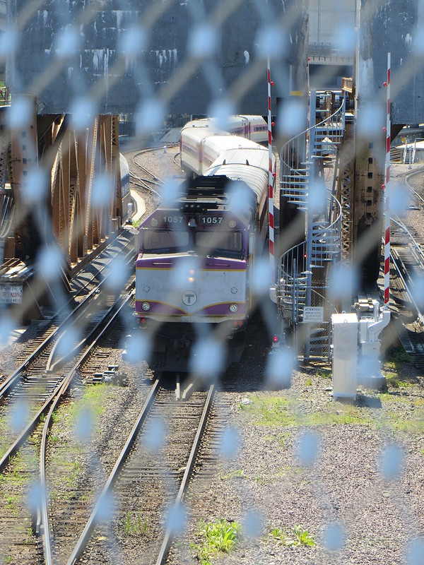
DSH -- this is a place where you can (if you wait long enough -- as I have done it a couple of times) take a single picture with:

1) airplane apporaching Logan over
2) cars driving on Levret Circle Ramp over
3) trains crossing to North Station over
4) boats on Charles

Now we can snake into it people or bikes on the new bridge

Add, depending on vantage point...
5) Orange Line emerging above-ground underneath 93.
6) 7-day-a-week freight trains at Boston Sand & Gravel, Pan Am's largest customer inside 495.

...and Green Line trolleys on the Lechmere Viaduct if facing the opposite direction, plus sound carrying from Red Line trains rumbling over the Longfellow. That bridge is going to be one of the best railfanning spots in the entire country.
 
Open "by June" was the last, best estimate of opening. Is it now looking more like June 1st, June 15th, June 25th, or the dreaded June 45th?
I hate to quote myself here, but now that it is June 29th, how's it looking for opening by, say, July 3rd?
 
Both cities are playing with fire every day they leave it closed. I see people crossing it, jumping fences, all the time. Construction equipment is all packed up. They're just letting the grass grow now. There really should be an announcement.
 
This bridge has been ready for a while. Not sure what the holdup is. Also in the neighborhood they are moving dirt around on the undeveloped side of the NorthPoint central park. Today they are taking soil samples from one of the dirt mounds. Construction of the first apartment building is supposed to start later this year.
 
Add, depending on vantage point...
5) Orange Line emerging above-ground underneath 93.
6) 7-day-a-week freight trains at Boston Sand & Gravel, Pan Am's largest customer inside 495.

...and Green Line trolleys on the Lechmere Viaduct if facing the opposite direction, plus sound carrying from Red Line trains rumbling over the Longfellow. That bridge is going to be one of the best railfanning spots in the entire country.

F-Line -- I managed a couple of times to get my list onto one photo standing near to the MOS

If you can put all that in one picture and you'd have the iconic photo of the Northpoint park area
 
F-Line -- I managed a couple of times to get my list onto one photo standing near to the MOS

If you can put all that in one picture and you'd have the iconic photo of the Northpoint park area

I haven't been walking around the area so not sure if the OL is visible in one shot...might be a little more northwesterly to catch a good glimpse, which would exclude capturing the Duck Boats in the same frame (solution: panoramic camera!). But end-of-track on the BS&G freight siding is right at the foot of the drawbridge and Pan Am occasionally transports oversize consists that do cram cars all the way to end-of-track. So it is probably possible to catch the freights in the same frame as all else. I don't know when that train runs...probably mid-morning or early afternoon during commuter rail off-peak/midday MBCR shift changes (those are the usual priority schedule slots when dispatch lets Pan Am and CSX freights crawl around BET). But it is a 7-day-a-weeker...even when BS&G is closed on Sundays, because they drop a load of sand for start of the workweek.
 
Well I was a bad boy this morning and followed a couple of cyclists over the bridge. It is still not offically open, but the gates are ajar. Couple of interesting things I noticed while walking around the basin. Under the south side of the Zakim a new park has been created and you can walk out along the North Station platform/tracks to the railway bridges. On the Charlestown side the new park has two Coyote decoys in residence. Question; is the B&M Signal Tower still in use? The west wall is being proped up by two telephone poles.
This is the 10:15 train to Rockport.

Charles River Park Bridge 7/1
 
Unfortunately you can no longer bike from the east entrance of the TD Garden all the way around under the Zakim to Lovejoy Wharf right now. There's a chain-link gate or fence in the way. It might be possible to walk around it on foot, but definitely not on a bike. I hope this is a temporary construction fence.
 
Unfortunately you can no longer bike from the east entrance of the TD Garden all the way around under the Zakim to Lovejoy Wharf right now. There's a chain-link gate or fence in the way. It might be possible to walk around it on foot, but definitely not on a bike. I hope this is a temporary construction fence.
Ron,
I got to it via Beverly St., on the east side of the bridge. Just before the locks you take a left through the State Police parking lot and then under the bridge.
I noticed the fence yesterday and it looks like they have erected a scaffold on the northeast corner of the Garden. The contractor is Shamut.
 
Yep, I approached the fence from both directions. Not quite sure what construction activity it is protecting. I don't think any contract has been let yet for a South Bank bridge or one that crosses the river alongside the tracks.
 
I tried to get there via Charles River dam last week. I was about to slip through the gate when some contractor in a pickup truck drove up to the gate and gave me a dirty look and then drove in and got to work landscaping at the base of the bridge, under the Zakim. So that foiled my plans. He also adjusted the fake coyotes, so as to keep the birds cautious, I guess, since if they're always in the same spot they won't believe it.

Saddened by my failure to get to the bridge, I then tried to go under the North Washington Bridge on the walkway that Ron said was blocked -- welp, it's blocked alright. And the parking attendant said I would have to go around the block, but had no explanation as to why it was blocked. You could still go under the bridge from the other side, but you couldn't use it a thru route. Hmm.

Urb -- last Sunday the Bridge was open on both ends -- lots of people were parking near Northpoint walking over the bridge along the Harbor Walk and on to see the Constitution and the Eagle

I walked over the tracks shot some train pix and looked at the Millers River restoration.

That gate was locked although I suspect you could get through on foot if you were determined. I also saw the strange concrete landscape under the Zakim and then crossed the lawn and saw the fake coyotes and quite a few real dogs -- gotta assume that the contractor charged with moving the coyotes has to hose them down as well.

There is a path from the Charlestown Bridge down through Paul Revere Landing Park that takes you to the "concrete canyon park" and on to the Pedestrian Bridge. the concrete canyon does however feature: some strange lighting towers; excelent views both ways

Definitely got the feeling that there is still some weeks of landscape work to finish that side of the "lost half mile" of the Charles Bank --guessing official opening in August?

PS: has anyone noticed the "faux Rowes Wharf " arch at the Marriot in Charlestown -- actually quite photogenic -- you can shoot through the arch across the marina and see Old North in the backround
 
Where did you find this date? Will there be any sort of ceremony?
 
Definitely got the feeling that there is still some weeks of landscape work to finish that side of the "lost half mile" of the Charles Bank --guessing official opening in August?

PS: has anyone noticed the "faux Rowes Wharf " arch at the Marriot in Charlestown -- actually quite photogenic -- you can shoot through the arch across the marina and see Old North in the backround

Sunday 7/8/12 Update:

The path at the bridge was blocked on both sides though it was accessible for pedestrians with quite a few making the unofficaial trek. Some of us helped a bike ride get his bike over the top of the fence on the Cambridge side and we later met a bike while approaching the Charlestown side who had made it over the top himself

On the Charlestown side the bridge was ineffectively blocked though you had to squeeze through a smallish aperature

Note the Millers River path looked to be be blocked but the fence could be moved just by bumping it - -the Millers River path is educational with various historic maps and even bizarre numnbers carved into the path (turn out to be illustrations of the original depth soundings)

The cayotes have been moved to keep the Geese honest

Everyone is speculating that the opening is a most two weeks away

Photogs should note the opportunity to shoot up through the diamond spae apertures in the Zakim
 
It's official now: the ribbon-cutting ceremony will be this Friday, July 13 at 2 pm. I just got an e-mail from the DCR with this information.
 

Back
Top