Ron Newman
Senior Member
- Joined
- May 30, 2006
- Messages
- 8,395
- Reaction score
- 13
Now that I've seen that graphic again, I think it's just as well that these got delayed until after Spaulding is vacated and demolished.
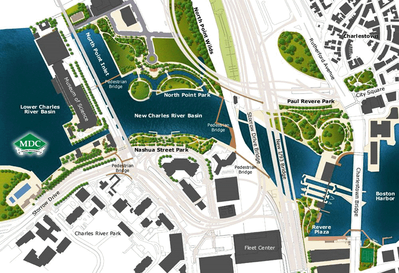
There were plans for several additional bridges that have yet to be realized...[including]... the planned pedestrian bridge spanning the inlet between the North Point Park and MOS
I don't understand why the bridge from North Point Park to Nashua St Park is so awkward. I also don't understand how it's going to work unless a) the grade is ridiculous, b) there's lots of stairs, or c) it has it's own lifting span/draw. They should just make it flush along the track leads and attach a walkway onto the existing draw somehow. That's the only way I can see it ever happening.
It looks to me like they were somehow going to re-use the piers (from a removed rail drawspan) that are already in the river's channel at that point, and it looks like they picture it being a draw bridge (as Ron Newman remembers).
The North Point Inlet Bridge and the bridge over the tracks at NS (on the NS side) seem very hard to justify from any view but the most Disney-fied urban amusement park urbanist view. Or worse, they function in many ways like an urban freeway system for walking...an expensive bypass for people who would otherwise be enlivening other thoroughfares.
The North Point Inlet Bridge raises the question: do leisurely strolls need to take the shortest routes possible? .
I'd agree it needs better connectivity, but I think the Museum/Causeway bridge would play the same destructive role that freeways and skywalks play: they deaden street life and split the audience for services that cater to pedestrians, and ultimately make places sterile and uninviting.I think these additional bridges are absolutely needed for this park. It's a very nice little park, but it's extremely isolated and a huge pain in the ass to get to. The more connections it has, the more accessible it is, the more successful it will be.
I'd agree it needs better connectivity, but I think the Museum/Causeway bridge would play the same destructive role that freeways and skywalks play: they deaden street life and split the audience for services that cater to pedestrians, and ultimately make places sterile and uninviting.
For the same amount of money as a bridge, you could probably make access more pleasant and increase usage of the park by improving street-level amenities between the Lechmere T (current & future), the Museum of Science and the EF building(s). Picture, for example. an arcade covered with vines, renovating the old MDC stable/garage, or even food trucks.
I was up close in personal there an hour ago; that sucker will be open by Evacuation Day
With E-Day just around the corner, I'm hoping you're right...how is it looking here in the 2nd week of March?
Any news? Its painful to have such unseasonably warm days and to picture the bridge not in use.
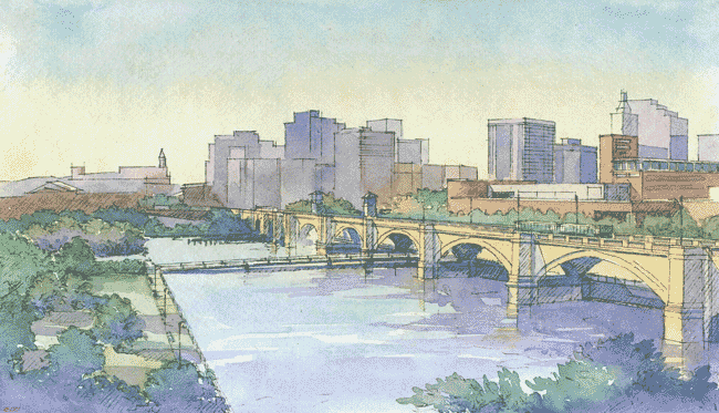
Charles River Skatepark, long delayed, now set to open in 2013
This story from the Boston.com quotes Renata von Tscharner, the president of the Charles River Conservancy as saying
1) The bridge will be open by June
2) The skate park will break ground in March and be done 9 months later ("by 2013")
The Charles River Skatepark, a proposed 40,000 square foot skatepark under the shadows of loop ramps to the Leonard P. Zakim Bridge, has faced a number of setbacks and changes over the past decade, but could be ready to open by the end of next year.
“We plan to start preloading the ground this spring
and complete the drawings and permitting for a construction starting date in March 2013.
The construction takes 9 months, which brings us to an opening date of December 2013,”
Renata von Tscharner, president of the Charles River Conservancy, said in an e-mail.